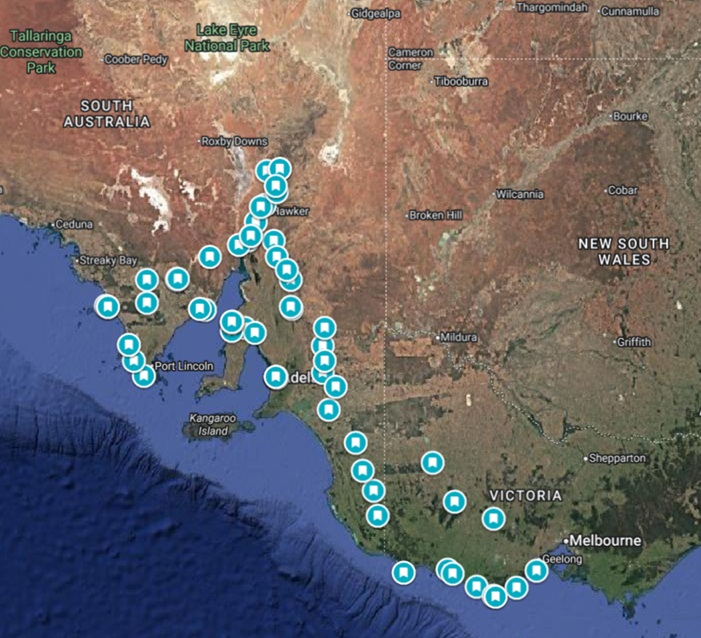
The Easter 2025 Ride was a two-week motorcycle journey from Melbourne across South Australia and back, blending comfortable open-road touring with stretches of red dirt, backcountry detours, and classic coastal highways.
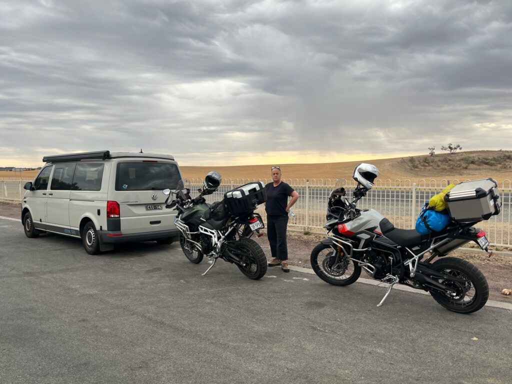
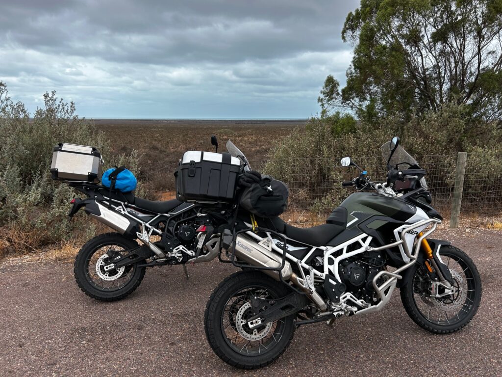
Each riding their Triumph Tiger 900, Chris and Janette carried a balance of on-bike and off-bike gear, along with tents and lightweight camping equipment for nights under the stars. For the opening days they travelled in company with close friends Mary-Louise (Lou) and Dave, who accompanied the ride in their VW Campervan through to Adelaide, before the Tigers continued further west into the Eyre Peninsula and then to the Flinders Ranges.
The route showcased the full range of southern Australia’s landscapes — the granitic peaks of the Grampians, the broad wheat country of the Wimmera, the wind-carved cliffs and coves of the Eyre Peninsula, the red-dirt tracks of the Flinders, and finally the ocean curves of the Great Ocean Road — a compact loop of freedom, wide skies, and long horizons.
Duration: ~14 Days
Trip Type: Motorcycle Touring & Light Adventure — Paved and Unpaved Roads
Accommodation: Mix of pubs, motels, and camping
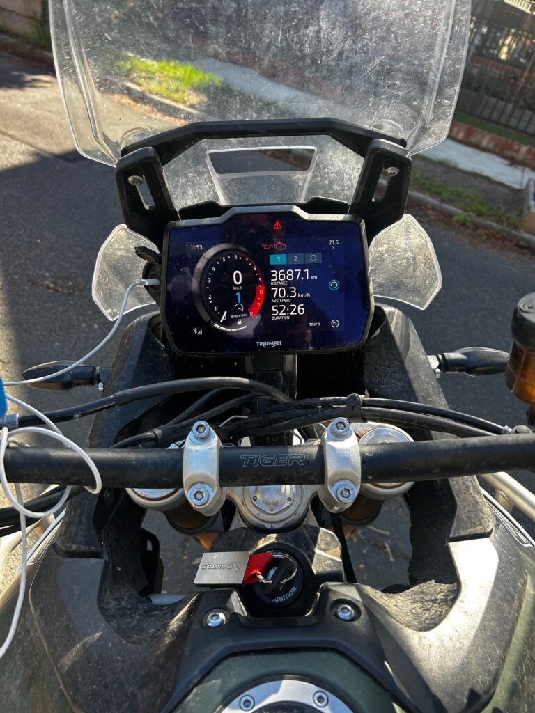
Route Distance: Approx. 3,700 km
🏍️ Day 1 — Melbourne to Dimboola
Route: Melbourne → Beaufort → Halls Gap → Horsham → Dimboola
Distance: ~375 km
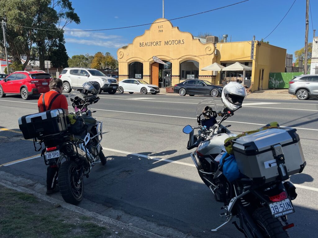
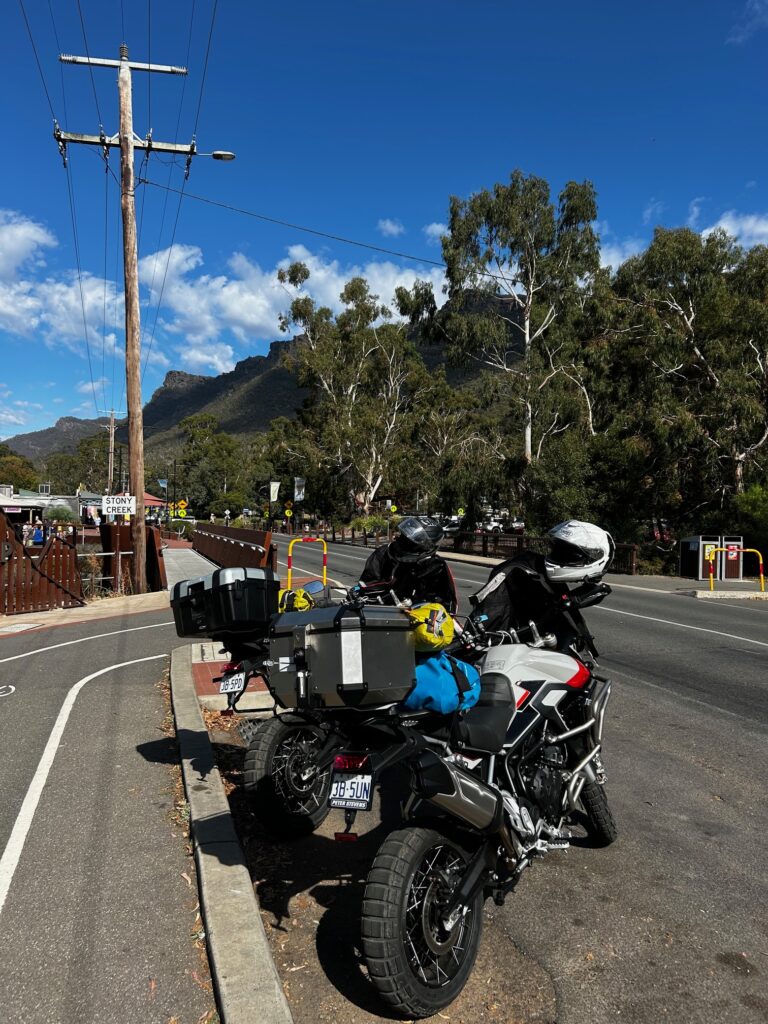
Leaving Melbourne on Good Friday, the road west along the Western Highway opened beneath clear skies — a crisp start to the two-week adventure. Morning coffee at Beaufort set the rhythm before the Tigers rolled into Halls Gap, where the famous bakery lunch beside the river made for a perfect midday stop — good pies, a soft breeze, and a few noisy cockatoos for company.
From Halls Gap, the road climbed onto the C222 ridge across the Grampians, a spectacular run where fresh green shoots pushed through recent bushfire regrowth. Twisting and rolling over the range, the scent of eucalyptus and charred timber hung in the air before dropping down to Horsham, rejoining the highway for the final leg to Dimboola.
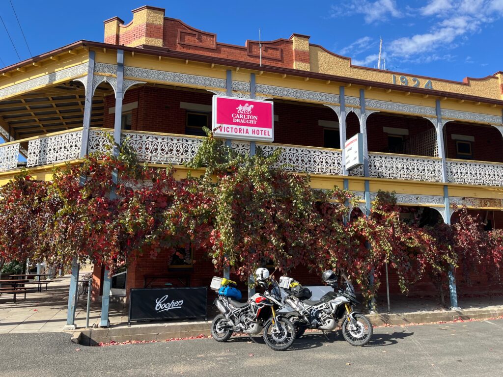
That night’s stop was at the Victoria Hotel, a classic country pub with a friendly bar crowd and perfect timing to catch the Good Friday AFL clash — North Melbourne vs Carlton. North went down heavily, but spirits stayed high. Travelling with Lou and Dave, at least as far as Adelaide, added good company and a few laughs — Lou even had the chance to visit the childhood home of Essendon FC legend Tim Watson, ticking off a personal highlight.
Overnight: Victoria Hotel, Dimboola
Meals: Beaufort coffee • Halls Gap bakery lunch • Pub dinner at Victoria Hotel
Highlights: Grampians ridge ride • Halls Gap bakery lunch • Bushfire recovery landscapes • Victoria Hotel pub night
🏍️ Day 2 — Dimboola to Adelaide
Route: Dimboola → Nhill → Bordertown → Keith → Murray Bridge → Adelaide
Distance: ~370 km
After breakfast at the Victoria Hotel in Dimboola, we rolled out under a overcast sky, stopping briefly at the Pink Lake just outside town — a shimmering patch of colour offset against the wide, flat horizon. From there the Tigers purred westward through Nhill, the landscape flattening into wheat country, and we topped up fuel at Bordertown before pushing on along the Western Highway toward Keith.
That’s when things turned tense. The intercoms lit up — Janette’s tent and CamelBak had torn loose from the back of her bike after the luggage straps failed, and in the process the flailing gear shattered her chain guard. She hadn’t even noticed until we regrouped with Lou and Dave at Keith for coffee. It was one of those moments that hits hard only in hindsight: a few minutes of bad luck that could have been far worse on such a busy highway, running at speeds over 110 km/h. The next few hundred kilometres were spent quietly processing the “what-if”, as the rain began to gather ahead.
Past Murray Bridge, a dust storm loomed, merging into sheets of heavy rain as we crossed the Adelaide Hills and descended toward the city. Visibility dropped to almost nothing at times — a proper test of patience and focus after a long day’s ride. By late afternoon, we were drenched but relieved to roll into Adelaide, pulling up gratefully at the InterContinental Hotel (booked on points!) for a dry room and a warm shower.
The evening brought welcome company: our son Ben, Janette’s mum, and Chris’s mum and dad had all come across for Easter, and Lou and Dave joined for drinks and dinner. Across the river, the Adelaide crowd roared for the Easter Saturday game, the city lights reflecting on wet streets. It was a comforting close to a challenging day — one that left us both grateful, tired, and still quietly replaying the near-miss in our minds.
Overnight: InterContinental Hotel, Adelaide
Drinks / Meals Breakfast at Victoria Hotel, Dimboola • Coffee stop in Keith • Dinner with family in Adelaide
Highlights: Pink Lake stop • Tent & gear loss incident • Heavy rain and dust storm • Adelaide family reunion
🏍️ Day 3 — Adelaide to Wallaroo
Route: Adelaide → Port Wakefield → Paskeville → Moonta Bay → Wallaroo
Distance: ~190 km
Easter Sunday began with bags packed and bikes loaded, ready for the next leg north. Before checking out, we joined the family for breakfast at Peter Rabbit Café, a tucked-away spot in the heart of Adelaide that somehow manages to stay open — and lively — even on Easter Sunday. The coffee and conversation were warm, the goodbyes lingering a little longer than usual before we rolled out again into overcast sky and then into the rain, bound for Port Wakefield.
The ride north along the A1 started under steady drizzle and was quickly complicated by a strong westerly crosswind, forcing a constant lean just to hold a straight line. Beyond Port Wakefield the landscape began to shift — the outback edge starting to show its face in the flat scrub and pale, open skies. Turning onto the B85 through Paskeville, we veered off onto backcountry dirt roads toward Moonta Bay, the red clay glistening from the earlier rain and a few mud patches keeping the pace honest.
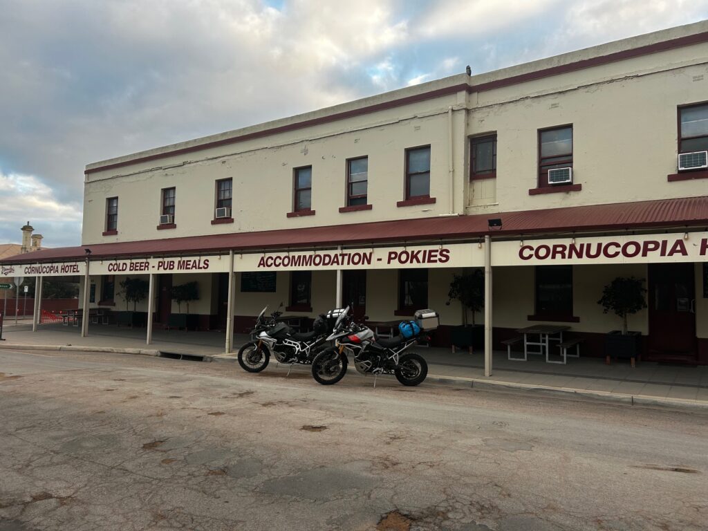
By mid-afternoon we reached Wallaroo, the air salty and cool off the Spencer Gulf. A cold Coopers Ale at the Marina Alehouse marked the perfect finish to the day’s ride before checking into the Cornucopia Hotel, our stop for the night. The accommodation was basic but spot-on — clean, dry, and perfectly located. Dinner was a highlight: a proper veal schnitzel, the kind that fills the plate and spills over the edges. Not your typical Victorian chicken version, but a real Austrian-style classic — crisp, golden, and exactly how schnitzels should be served.
Overnight: Cornucopia Hotel, Wallaroo
Drinks / Meals: Breakfast at Peter Rabbit Café (Adelaide) • Beer at Coopers Alehouse, Wallaroo Marina • Dinner at Cornucopia Hotel
Highlights: Easter Sunday breakfast • Strong crosswinds • First taste of the outback • Wallaroo Marina beer stop • Classic Austrian-style veal schnitzel
🏍️ Day 4 — Wallaroo to Port Lincoln (Sleaford)
Route: Wallaroo → Ferry to Lucky Bay → Cowell → Port Lincoln → Sleaford
Distance: ~300 km (including ferry crossing)
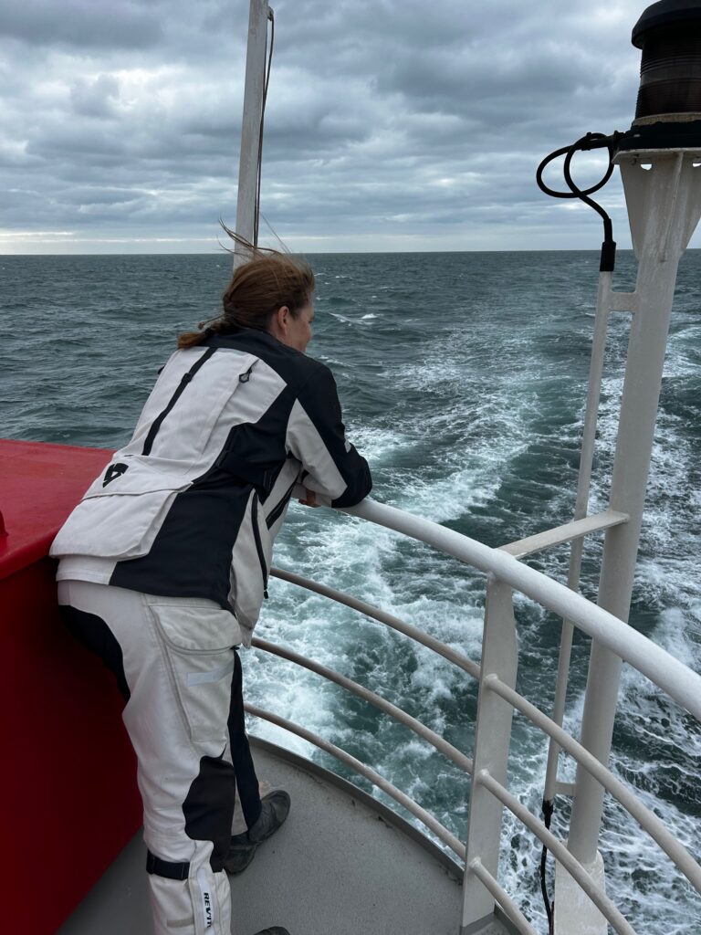
Easter Monday began early, again with an overcast and threatening sky, with a ride down to the Wallaroo ferry terminal, ready to board the 9:00 a.m. crossing of the Spencer Gulf to Lucky Bay. The weather hadn’t quite improved — a stubborn south-westerly had stirred up the Gulf — and what followed was a rocky, hour-and-a-half passage across choppy grey water. The bikes were well strapped down, and chatting with locals onboard who assured us they’d “seen it worse” offered some comfort, though not much stability.
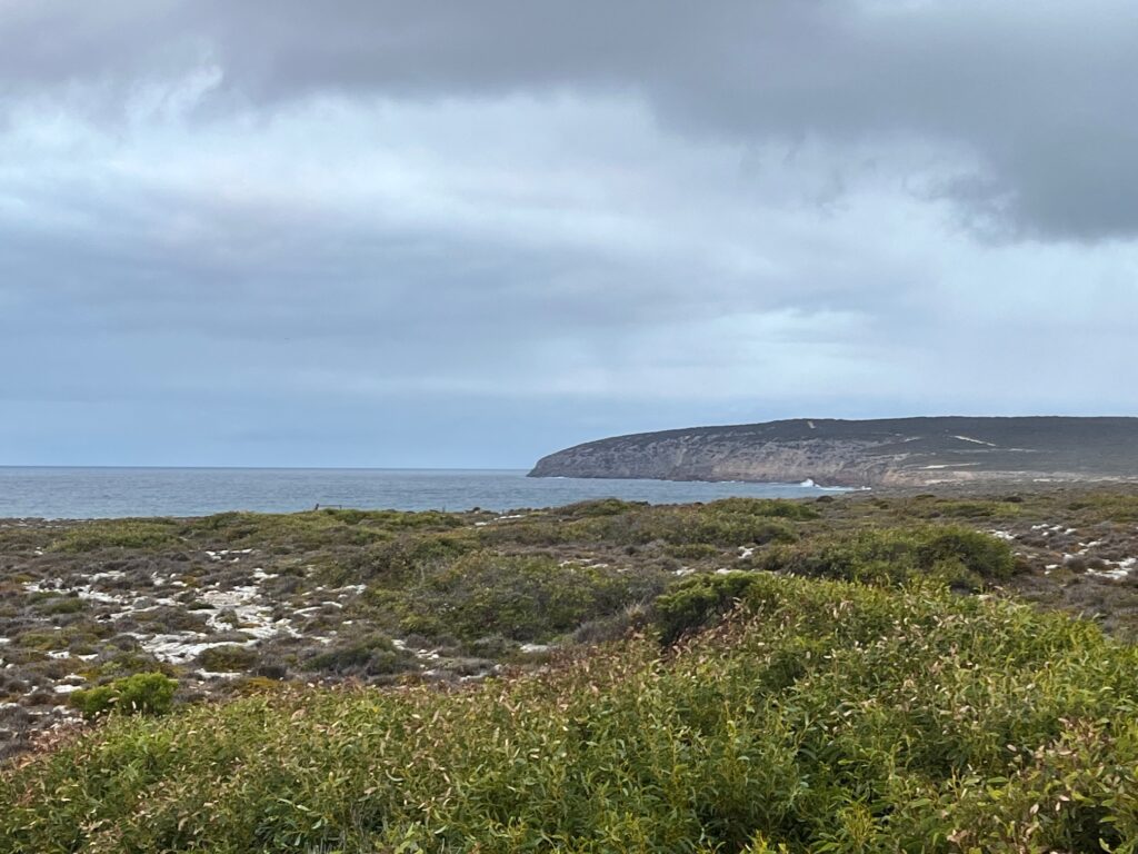
We rolled off the ferry at Lucky Bay and headed straight toward Cowell for coffee and supplies, the short inland stretch marked by impressive silo art and long, quiet roads. From Cowell, we rejoined the B100, the Eyre Peninsula’s coastal route, sweeping south toward Port Lincoln. The landscape opened up beautifully — sea and sky to one side, undulating farmland and low hills to the other — a rhythm of wide corners and soft, rolling views that make this part of South Australia such fine riding country.
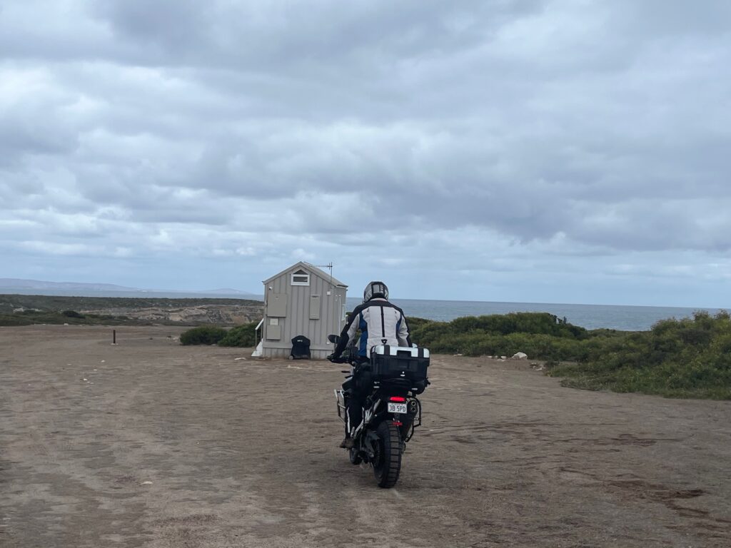
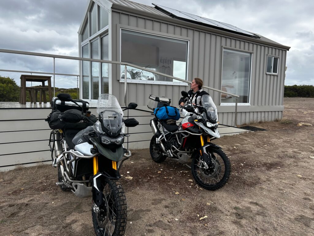
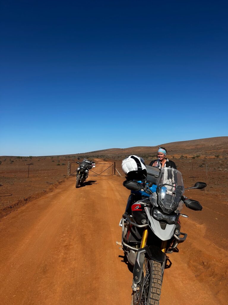
We reached Port Lincoln early afternoon, stopped for lunch and a second coffee, then stocked up with provisions for the night before heading out along the southern edge of the peninsula to Sleaford, inside the Port Lincoln Conservation Park. Our accommodation — Eyre Way, a cluster of three remote micro-cabins — was reached by a sequence of farm gates, sandy tracks, and open paddocks, the kind of approach that makes you wonder if you’re in the right place until the view suddenly opens up to the sea.
Our cabin sat alone above the bay, perfectly framed against the late-afternoon light. Dinner was steak and red wine cooked simply and enjoyed from the deck, overlooking the Great Southern Ocean — the waves breaking softly in the distance. It wasn’t a cheap stay, but it was spectacular — private, peaceful, and one of those rare finds that make the whole day’s ride worthwhile
Overnight: Eyre Way micro-cabin, Sleaford (Port Lincoln Conservation Park)
Drinks / Meals: Coffee and supplies in Cowell • Lunch in Port Lincoln • Dinner and wine at cabin overlooking the ocean
Highlights: Spencer Gulf ferry crossing • Silo art near Cowell • Open coastal landscapes • Remote stay in Port Lincoln Conservation Park • Dinner overlooking the Southern Ocean
🏍️ Day 5 — Sleaford to Elliston
Route: Sleaford → Port Lincoln → Coffin Bay → Greenly Beach → Sheringa → Elliston
Distance: ~300 km
After waking to the quiet and sea air of Sleaford, we reluctantly packed up and made our way out of the Eyre Way micro-cabin, retracing our sandy tracks back to the road and up to Port Lincoln. The first stop was Boston Bean Coffee Company, where we needed to drop off the cabin key — and, as it turned out, meet one of the day’s more memorable characters.
An elderly lady, probably in her late seventies or early eighties, pulled up on her own small motorcycle and struck up a chat about the Triumph Tigers. She’d ridden all over the world in her younger years — once owning a Tiger herself — and had gradually “downsized through the engine sizes” over the decades, now riding a humble postie bike. Her enthusiasm was infectious and quietly inspiring; proof that the love of riding never really fades, only adapts.
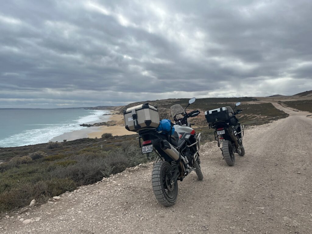
Two coffees consumed, we headed west along the B100 toward Coffin Bay, where the next stop was the Beachcomber General Store for a light lunch and, inevitably, oysters. Even for a non-oyster devotee, the Thai-spiced variety went down surprisingly well — fresh, sharp, and perfectly coastal. From there we continued along Airport Lane and rejoined the B100, before taking a long dirt-road detour to Greenly Beach. The ride in was loose and gravelly but well worth it — the view opened onto a remote bay, wild surf, and the sense of absolute isolation that defines the Eyre Peninsula’s western edge.
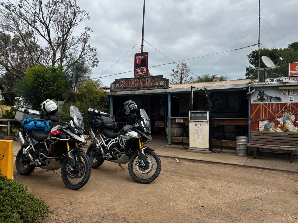
Back on the main road, we turned north toward Elliston, pausing at Sheringa, home of the wonderfully eccentric Sheringa Roadhouse — a combination curiosity shop, café, and local museum, run by a friendly, talkative woman who poured cold drinks and shared stories about life “not far from Nowhere Else Road,” as the sign out front proudly declared.
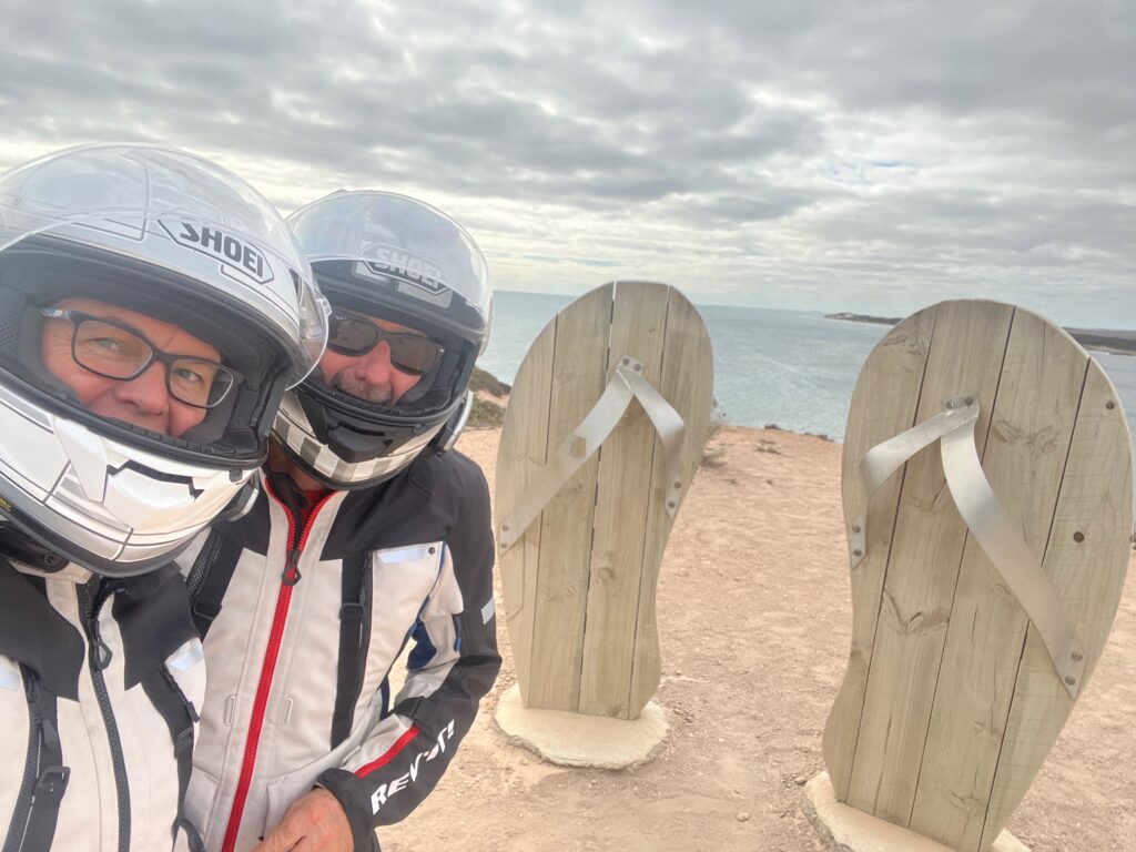
Rolling into Elliston by late afternoon, we explored the Elliston Cliff Tourist Drive, a winding track of compacted dirt and coastal outlooks lined with local sculptures and surf-viewing spots. A few surfers were out, dots in the swell below — brave souls in what’s undoubtedly shark territory. We finished the day with a quiet drink at the Elliston Hotel, then stocked up at the general store before settling into the Waterloo Bay Tourist Park, another self-catering night and a fittingly relaxed end to a day full of encounters, detours, and small stories.
Overnight: Waterloo Bay Tourist Park, Elliston
Meals: Coffee at Boston Bean (Port Lincoln) • Oysters at Beachcomber (Coffin Bay) • Drinks at Elliston Hotel • Self-catered dinner
Highlights: Boston Bean coffee stop • Meeting an 80-year-old motorcyclist • Coffin Bay oysters • Dirt-road detour to Greenly Beach • Quirky Sheringa Roadhouse • Elliston Cliff Tourist Drive
🏍️ Day 6 — Elliston to Quorn
The initial plan for the day was modest — a short 180 km ride from Elliston to Kimba, following the Eyre Highway (A1) to get a sense of the early Nullarbor Plain. Kimba marks the halfway point across Australia, which had a certain appeal as a milestone. But as often happens on the road, plans shifted. With the lure of the Flinders Ranges ahead, we decided to push on past Kimba to Quorn, turning the day into a longer, more ambitious ride of nearly 400 km.
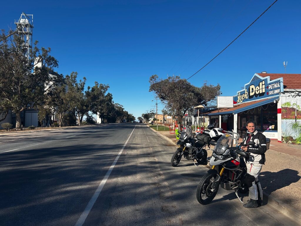
We left Elliston under a cool, overcast sky, heading inland on the B91 to the small grain town of Lock, where we stopped for a coffee. Lock’s a classic wheatbelt community, centred around an old railway line that once connected the region’s grain to the ports. Over coffee we met a friendly local — a lifelong resident and self-professed Pepsi Max drinker, not a pub-goer — who shared stories of how Lock had struggled when the rail line shut down. The town’s pub had closed, and its sense of community along with it. He told us that Kimba was now being considered for a revived railway link, which he hoped might breathe life back into the district and rekindle the social heart that country towns like Lock once thrived on.
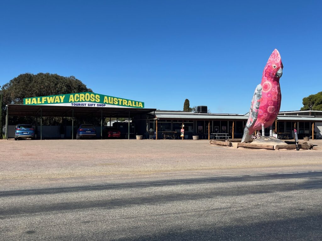
From Lock we rode east along the B90, joining the Eyre Highway near Kyancutta, and on into Kimba for lunch and fuel. The town proudly advertises itself as “Halfway Across Australia”, marked by a large galah sculpture and a warm community spirit. Lunch was at a collective-style café run by a group of local women who had transformed an old shed into a coffee shop and craft co-op, showcasing the region’s art, produce, and handmade goods — another small town keeping itself alive through ingenuity and pride.
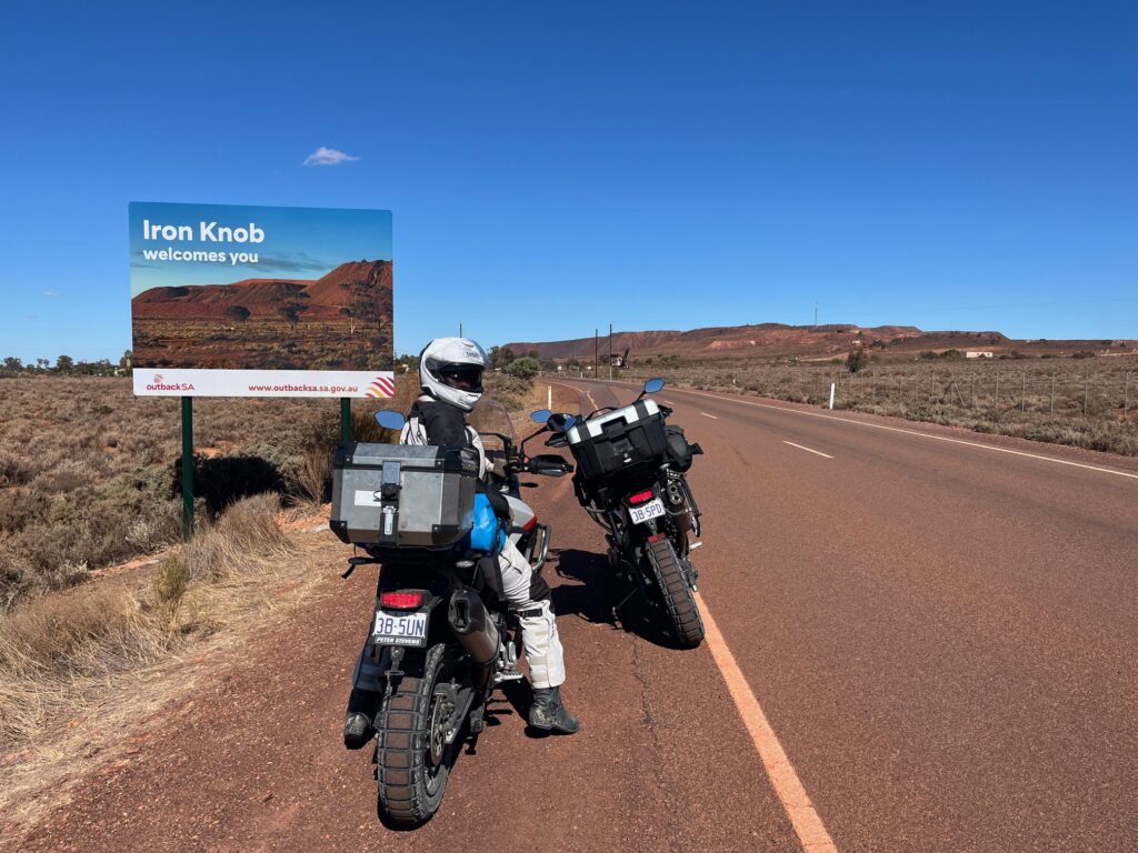
Pushing on from Kimba, and the more we moved into the classic outback landscape and the scenery, and sky began to change. The greens and golds of the farmlands gave way to the red copper hues of the outback, the air dry and vast. The sky overhead, which had been overcast for the past few days, now provided a stark blue contrast against the red dirt. Passing through Iron Knob, one of Australia’s earliest mining towns, we rode through a landscape etched by history and geology — iron-rich soil, sparse vegetation, and a raw openness that signals entry into the South Australian interior.
We reached Port Augusta for a short rest and refuel before turning north onto the B83, climbing gently toward Quorn, at the southern edge of the Flinders Ranges. The light softened as the hills rose on the horizon, the day’s red dust giving way to cool evening air.
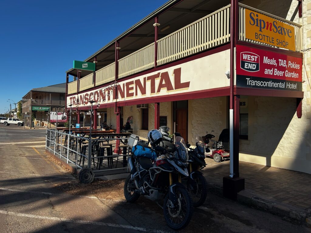
We checked in at the Transcontinental Hotel, a beautifully aged country pub that once stood as a key stop on the Trans-Australian Railway. Quorn thrived during the railway era and again during World War II, when troops travelling north to Darwin passed through on the Old Ghan line. Over a drink at the nearby Flinders Gin distillery, we caught the last half-hour before closing — and discovered a local gin so good it’s now a staple in our home bar.
Overnight: Transcontinental Hotel, Quorn
Drinks / Meals: Coffee at Lock • Lunch at Kimba craft café • Dinner and drinks in Quorn
Highlights: Rural town encounters • Lock railway history • Kimba halfway marker • Outback colours of Iron Knob • Flinders Gin discovery at Quorn
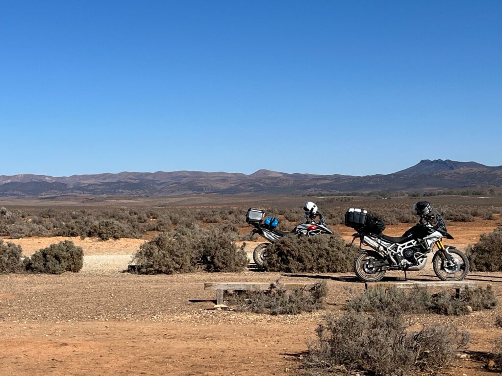
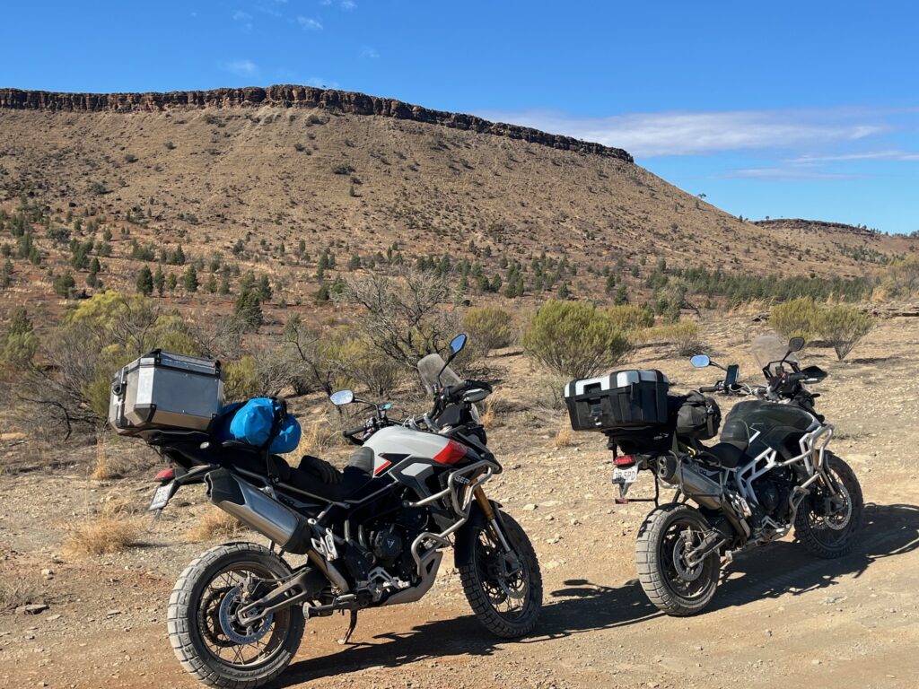
🏍️ Day 7 — Quorn to Blinman
Route: Quorn → Simmonston → Barndioota → Hookina → Parachilna → Parachilna Gorge → Blinman
Distance: ~230 km
We woke early in Quorn, checked out of the Transcontinental Hotel, and had breakfast at a small café just around the corner — a friendly local spot buzzing with motorcyclists from Adelaide making the most of the Anzac Day long weekend. A few stories were exchanged about the region; they were heading back south, while we were pointing the Tigers north toward Parachilna and deeper into the Flinders Ranges.
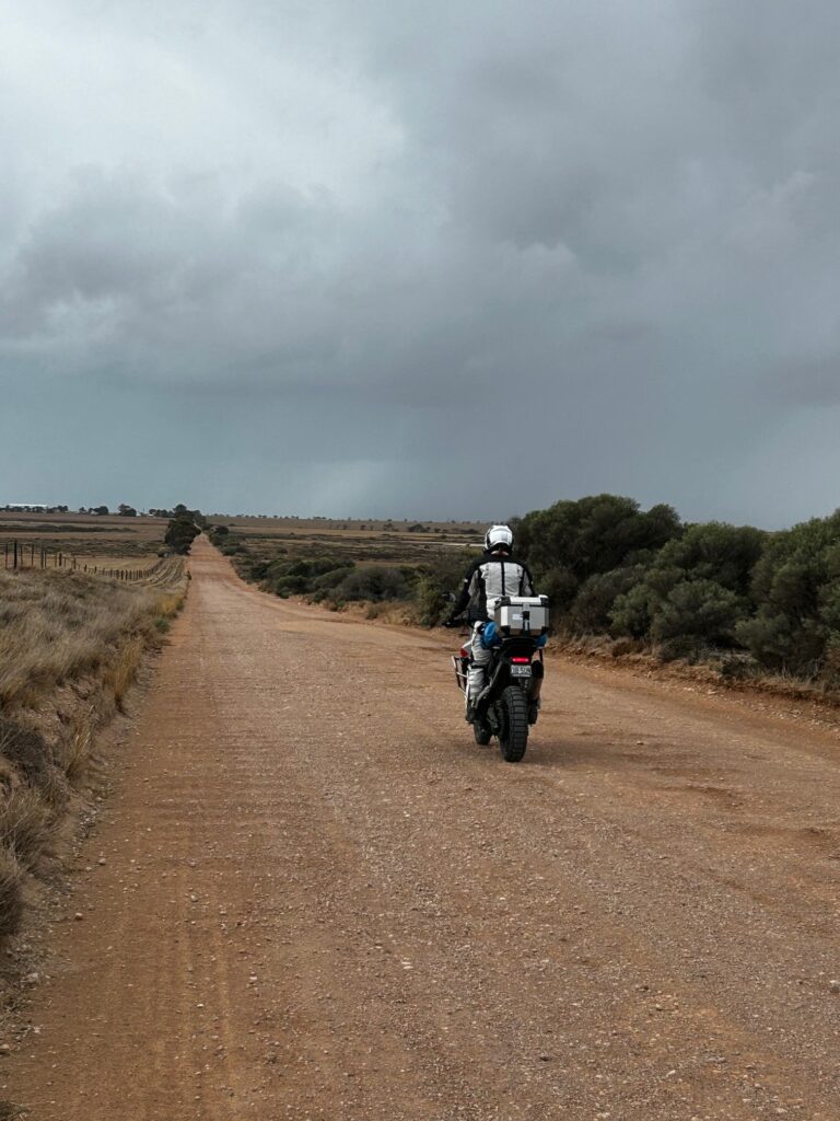
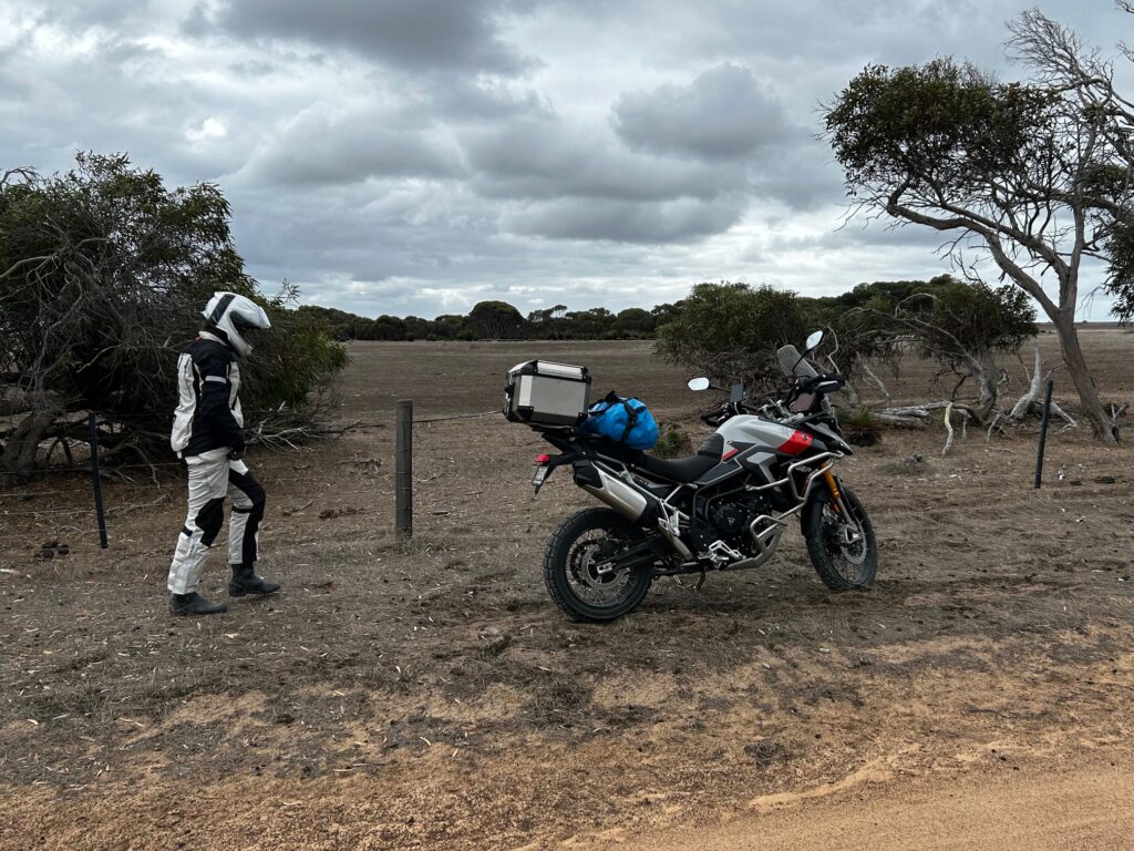
After breakfast, we filled the tanks and headed out along the Outback Highway (B83) before turning off onto Simmonston Road, where the tarmac gave way to red dirt. The day had cleared beautifully — blue skies, mid to high 20s, perfect riding weather, but warm enough to make sure we carried plenty of water for the off-road sections ahead.
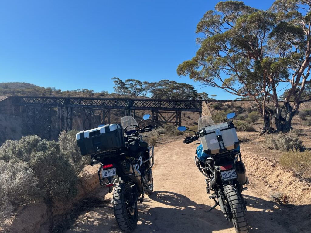
The route led us to Simmonston, a ghost of a town that never was — two pubs and a bank built in anticipation of the Ghan Railway, which never came. The weathered sign describes it simply as “the town that never was,” a fitting summary of this windblown, half-forgotten place.
From there, the ride turned properly off-road, cutting through wide farm paddocks and following rough station tracks. We passed Barndioota and the old Hookina Cemetery, small but moving markers of life in a landscape that seems almost empty. The Bobby Creek Road wound north, running roughly parallel to the Flinders Ranges Way but far quieter, eventually rejoining the highway north of Hawker.
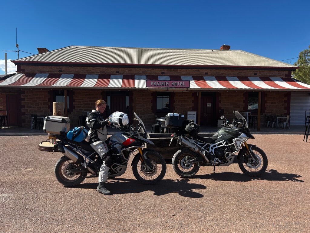
We turned left again onto the Outback Highway, continuing to Parachilna for lunch. The Prairie Hotel there is a Flinders icon — equal parts pub, gallery, and outback curiosity — located beside the old Parachilna Railway, once part of the original Ghan line. A cold beer from the adjoining brewery and a hearty meal set the tone for the afternoon.
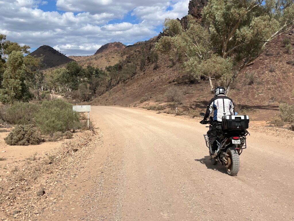
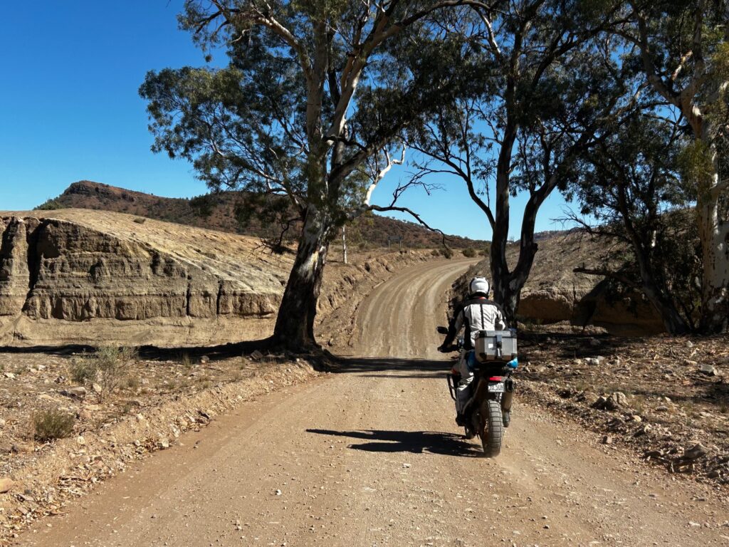
From Parachilna, we crossed directly over the highway onto Parachilna Gorge Road, a winding dirt track that cuts through one of the most spectacular gorges in South Australia. The red cliffs rose close on either side, the air cooled, and the road curved gently east through creek beds and stands of gums. Passing Angorichina Village, we followed the gorge toward Blinman, the northernmost town in the Flinders Ranges.
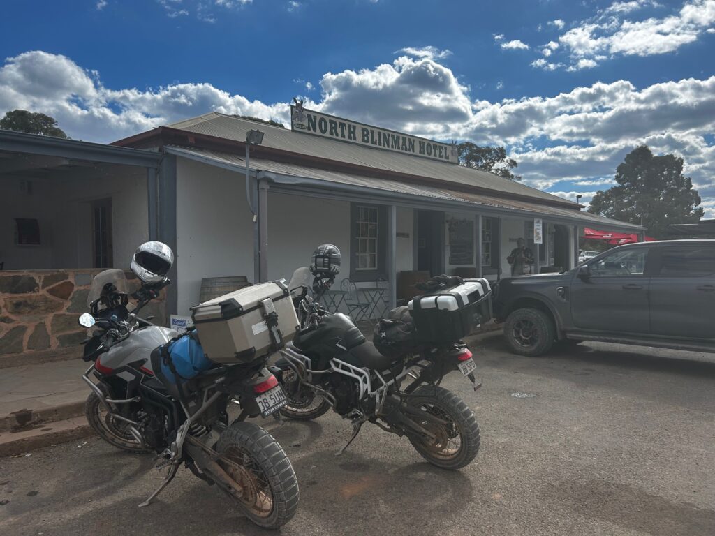
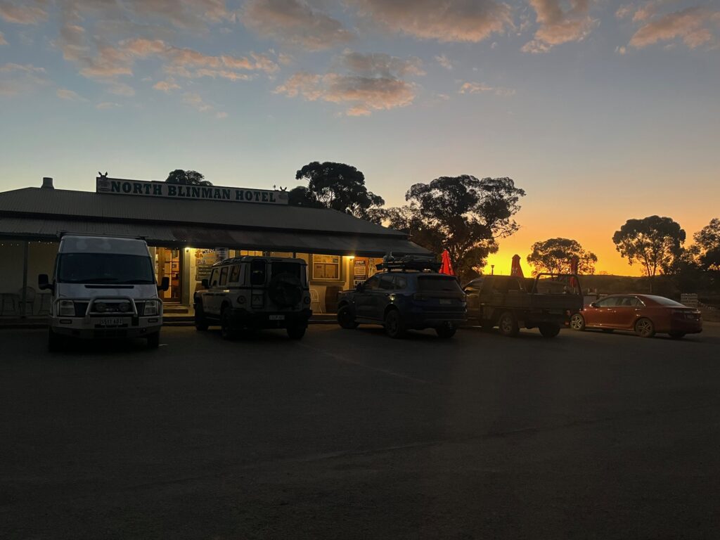
Our stop for the next two nights was the Blinman Hotel, a classic stone pub at the centre of town. It was Friday night, and the bar filled quickly as locals from stations up to 200 km away rolled in for dinner, drinks, and conversation — the weekly social ritual of the outback. The energy was warm and genuine; a gathering that made you appreciate the small-town heartbeat that keeps these remote communities alive.
Overnight: Blinman Hotel, Blinman
Drinks / Meals: Breakfast café in Quorn • Lunch and beer at Prairie Hotel, Parachilna • Dinner at Blinman Hotel
Highlights: Off-road adventure • “Town that never was” at Simmonston • Red-dirt farm tracks • Historic ruins and Hookina Cemetery • Parachilna Pub & brewery lunch • Spectacular ride through Parachilna Gorge • Arrival in Blinman
🏍️ Day 8 — Blinman and Surrounds
Route: Local exploration around Blinman
Distance: Minimal riding
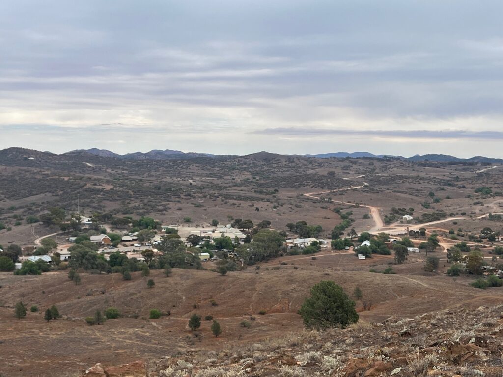
After several long days in the saddle, Day 8 was a leisurely rest and explore day around Blinman, the northernmost settlement in the Flinders Ranges. We woke late, wandered down to the local bakery for breakfast and coffee, and watched the town slowly come to life under another clear blue sky.
Blinman is surrounded by the remnants of its mining past, with old shafts, ruins, and stone cottages scattered across the hillsides. We spent the morning exploring some of these historic copper mine sites before hiking up the hill overlooking the town. At its summit stands a war memorial honouring the local soldiers who fell in the Great War. Considering the terrain, it’s remarkable to imagine how the stones and plaques were hauled up there by hand — a true feat of determination in such rugged country.
In the afternoon, we visited the old Blinman cemetery, a small but poignant place that tells the hard story of early mining life. Many headstones bear the names of infants and young families, reminders of the harshness of life in the outback during those years — isolation, heat, disease, and the daily struggle to survive. It’s sobering and quietly moving.
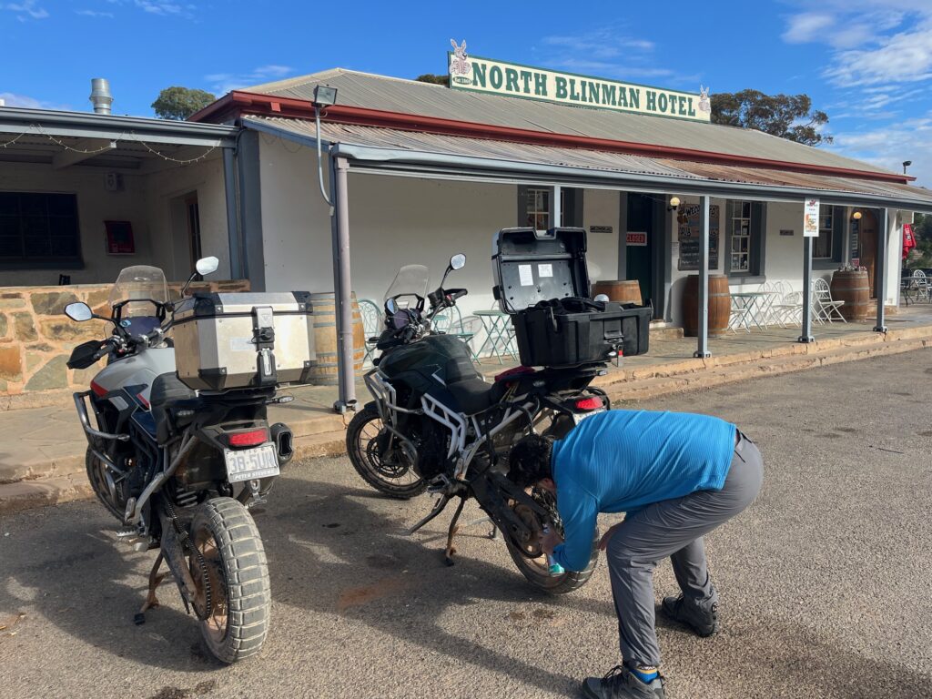
Back in town, the rest of the day was spent doing some basic bike maintenance — cleaning chains, checking tyre pressures, and brushing away the accumulated red dust from the previous day’s off-road adventures. With the bikes tended to and the sun dropping behind the ridge, it was time for another quiet evening at the Blinman Hotel, ready for the journey south to Wilpena Pound the following morning.
Overnight: Blinman Hotel, Blinman
Drinks / Meals: Breakfast and coffee at Blinman bakery • Dinner at Blinman Hotel
Highlights: Blinman Mines • Hilltop War Memorial • Historic cemetery • Bike maintenance and recovery day
🏍️ Day 9 /10 — Blinman to Wilpena Pound (2 Nights)
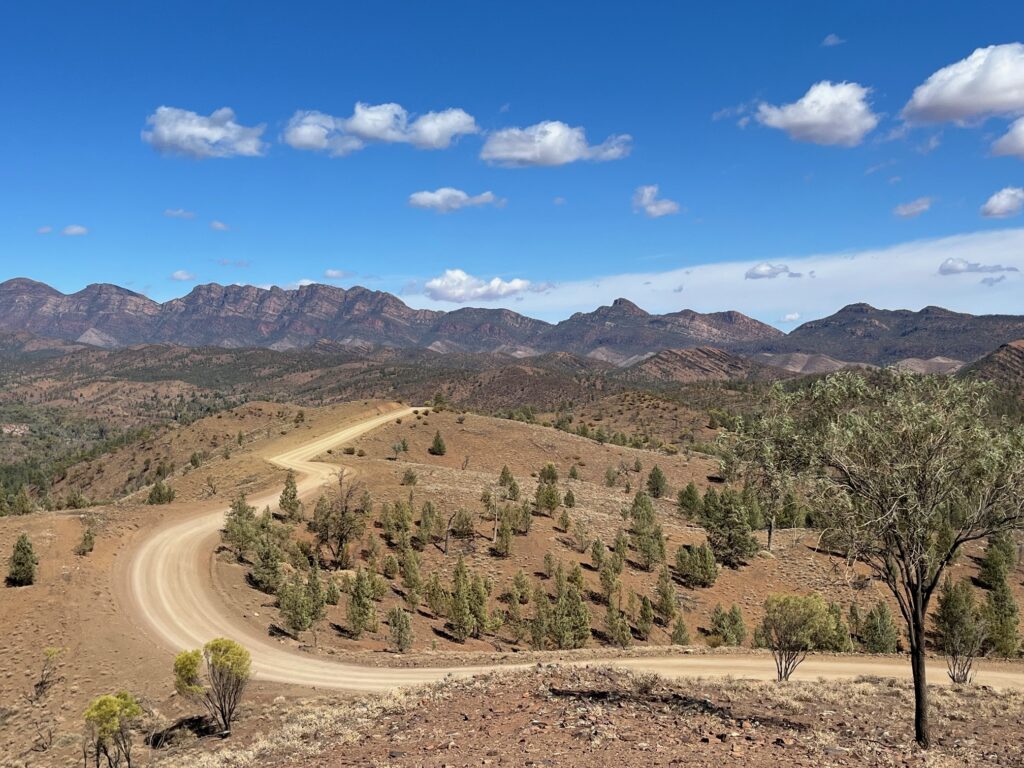
Route: Blinman → Brachina Gorge → Razorback Lookout → Wilpena Pound
Distance: ~120 km
Highlights: Off-road riding through the Flinders • Brachina Gorge lookout • Creek crossings • Great Wall of China formation • Razorback climb • Arrival at Ikara Safari Camp
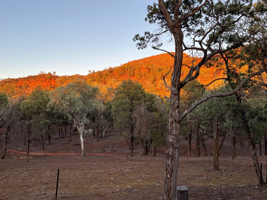
Day 9 we left Blinman and continued south through the heart of the Flinders Ranges toward Wilpena Pound. It wasn’t a long day in distance, but it was one of the most rewarding rides of the trip — a day defined by clear blue skies, red dirt, and endless mountain ridges.
We set off down the Flinders Outback Highway, taking every chance to branch onto the dirt backroads. The first detour led us toward Brachina Gorge and the Brachina Lookout, the track weaving through riverbeds and low scrub, punctuated by several creek crossings. With temperatures sitting in the mid-20s, it was perfect riding weather — warm enough to remind us to carry plenty of water, but not oppressive.
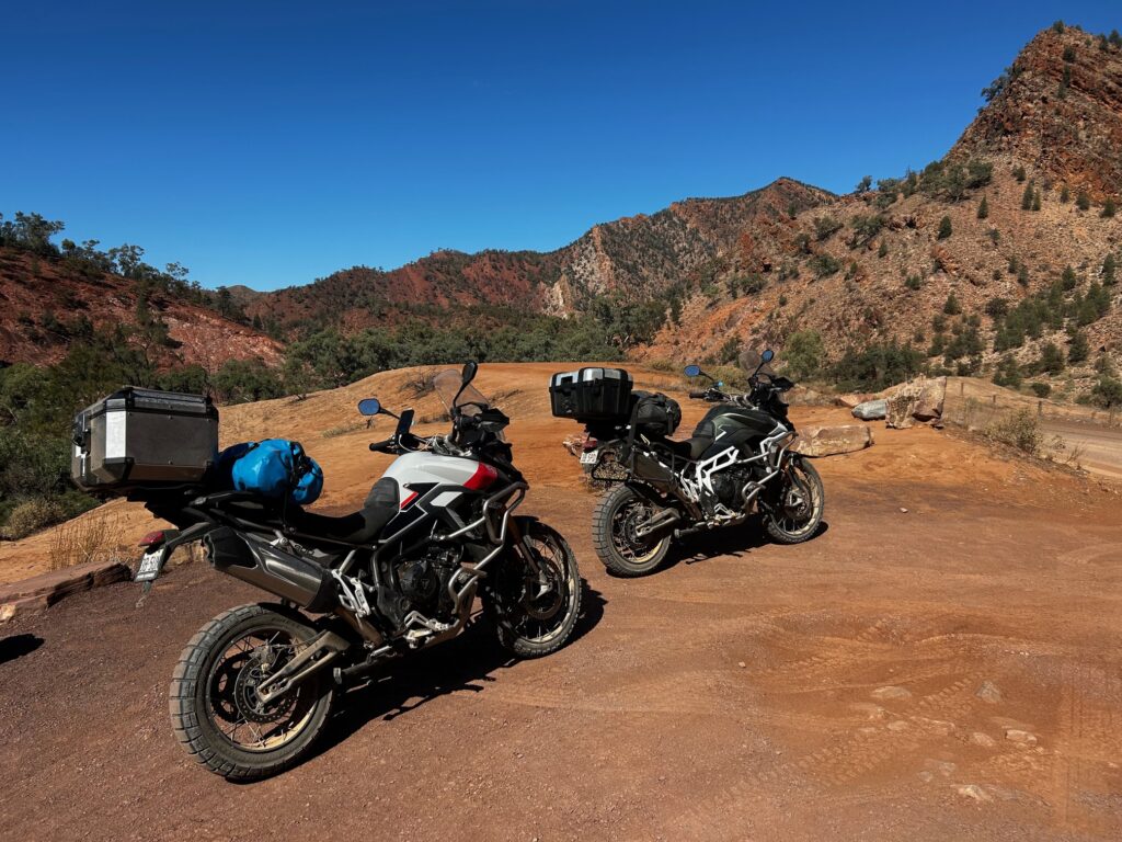
Along the way we passed the striking rock formation known as the Great Wall of China — a jagged, layered ridge line capped with what truly resembles a wall, standing proud against the deep blue sky. From Brachina, we looped back to the main track and continued south to the Razorback Lookout, another dirt-road climb rising sharply above the plains. It’s a steep, loose ascent, one that demands commitment on the bike — stopping halfway isn’t really an option. But the reward at the top is immense: a panoramic sweep across the Flinders Ranges, Wilpena Pound visible in the distance, the light catching every fold of the ancient rock.
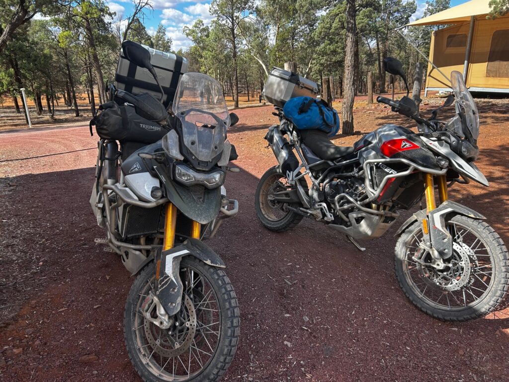
From Razorback, we descended back to the Flinders Ranges Way and cruised the final stretch into Ikara Safari Camp, our home for the next two nights. The afternoon light turned the landscape golden as we settled in — another spectacular day in the Ranges, and one that captured everything that makes this region unforgettable.
After a week of near-constant movement, Day 10 was deliberately slow — a day to rest and explore Wilpena Pound on foot. We woke late at the Ikara Safari Camp, enjoying the cool stillness of the morning before setting out on a hike along Wilpena Creek toward the Wangara Lookout.
The track wound gently through native bushland, alive with kangaroos, emus, and birdlife, the quintessential Flinders Ranges experience. The hike — roughly 7 kilometres return — offered spectacular views into the natural amphitheatre of Wilpena Pound, its ridgelines catching the morning sun. Back at the resort and visitor centre, we stocked up on a few essentials and spent the afternoon simply relaxing and recovering — catching up on notes, cleaning gear, and enjoying the slower rhythm of the day. Later, a cold beer at the resort bar made for a perfect mid-afternoon break before we returned to the Safari Camp for a quiet evening and an early night.
Tomorrow would be a long day — leaving the Flinders Ranges behind and heading southeast toward the Murray River and the township of Morgan.
Highlights: Off-road riding through the Flinders • Brachina Gorge lookout • Creek crossings • Great Wall of China formation • Razorback climb • Wangara Lookout hike • Kangaroos and emus • Relaxed recovery day
Overnight: Ikara Safari Camp, Wilpena Pound
Drinks / Meals: Self Catering • Lunch after hike • Beer and dinner at resort
🏍️ Day 11 — Wilpena Pound to Morgan
Route: Wilpena Pound → Hawker → Orroroo → Peterborough → Burra → Morgan
Distance: ~371 km
Day 11 promised to be a long one — a 371 km ride from Wilpena Pound to Morgan, one of the key bends along the Murray River, where the great river turns from an east–west to a north–south flow on its way from the Snowy Mountains to the Murray Mouth in South Australia.
We left Ikara Safari Camp early under another crisp morning sky, following the Flinders Ranges Way south toward Hawker, before joining the R.M. Williams Way near Orroroo. The weather was ideal for riding — mid-twenties, slightly overcast, with a soft cloud cover that filtered the sun and added depth to the colours of the ranges and plains. The desert tones began to give way to patches of farmland, yet the red soil and distant ridges still framed every horizon. It was spectacular country — open, empty, and quietly alive.
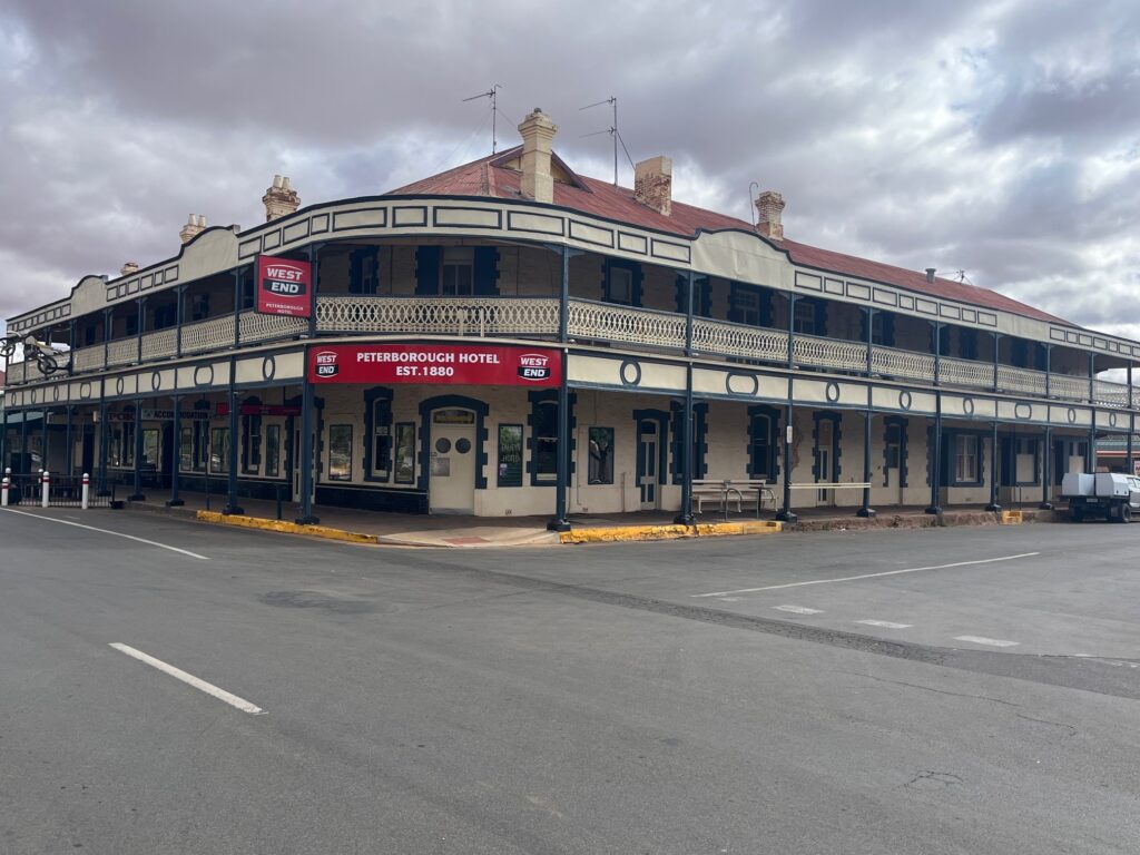
We passed through Orroroo, a small but welcoming service town surrounded by wheat and sheep paddocks, then continued to Peterborough — once a major railway junction and still a key stop for the Indian Pacific on its run between Sydney and Perth. Peterborough wears its rail heritage proudly; the grand old railway hotel still anchors the main street, a reminder of busier days when steam and steel were the lifeblood of the town.
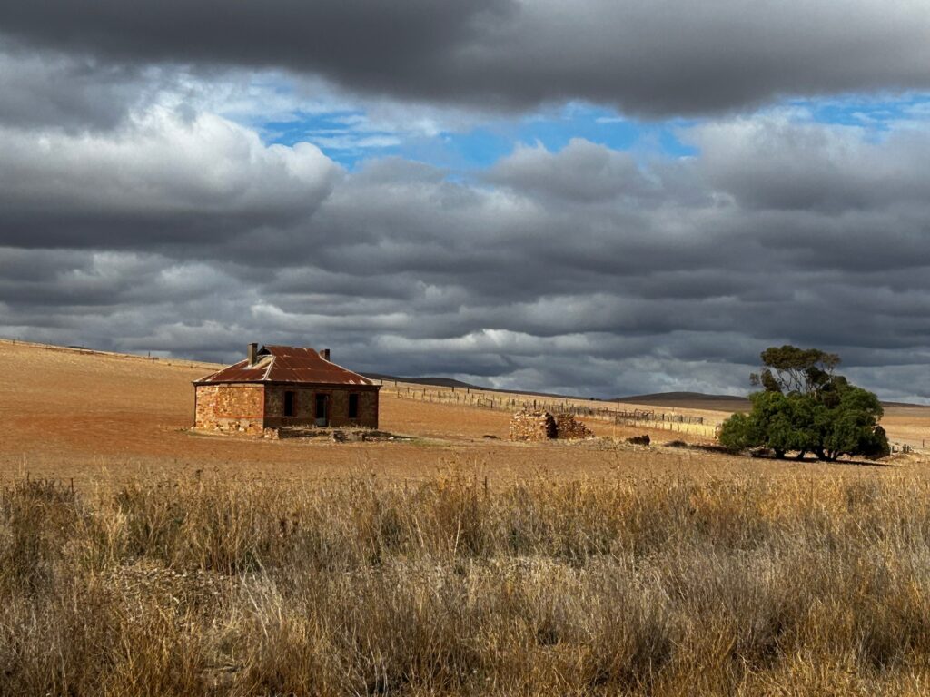
Continuing south toward Burra, the landscape broadened again, the hills low and rolling. Just outside of Burra we stopped at one of Australia’s most recognisable landmarks: the Midnight Oil “Diesel and Dust” house. The weathered farmhouse, immortalised on the album cover, stands solitary against the ochre earth and pale sky — a perfect embodiment of the outback spirit captured in Australian rock history. We took the time for a few photos before pressing on.
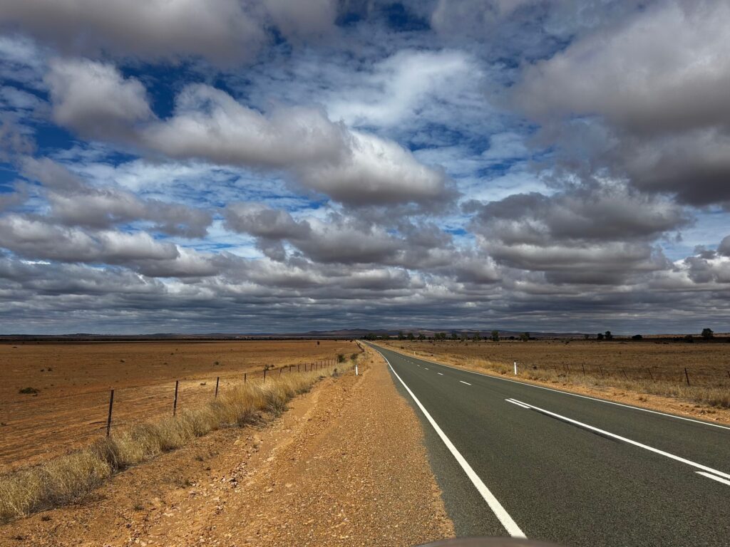
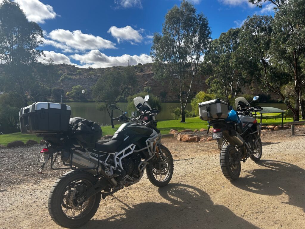
From there, the B64 carried us through golden fields and open plains toward Morgan, the blue shimmer of the Murray River finally reappearing after more than a week inland. It felt fitting — a long day’s ride ending at one of Australia’s greatest waterways.
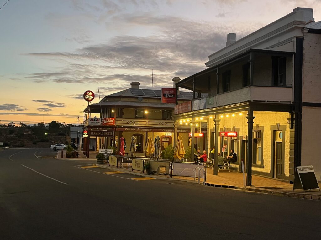
Morgan was once a bustling riverboat port, linking the Murray’s paddle steamers to Port Adelaide by rail, but today it’s a quiet, timeless town of wide streets, stone buildings, and calm river bends. We checked into the Terminus (Colonial) Hotel, took a short walk down to the riverbank to stretch our legs, and watched the late-afternoon light fade across the water.
A big day, but a good one — a ride that carried us from the edge of the outback to the heart of the Murray.
Overnight: Terminus (Colonial) Hotel, Morgan
Drinks / Meals: Breakfast at Ikara Safari Camp • Lunch in Peterborough • Dinner and drinks at the Terminus Hotel, Morgan – a chance for one of our last real schnitzel.
Highlights: Long day in the saddle • Mid-20s temperatures with cloud cover • Desert to farmland transition • Historic railway towns • Midnight Oil “Diesel and Dust” house outside Burra • Riverboat heritage at Morgan • Murray River bend
🏍️ Day 12 — Morgan to Penola
Route: Morgan → Blanchetown → Nildottie → Forster → Walker Flat → Purnong (punt crossing) → Koroonda → Coonalpyn → Keith → Naracoorte → Penola
Distance: ~410 km
Day 12 promised another long day in the saddle, covering more than 400 kilometres as we made our way from Morgan down into the Coonawarra wine region. The goal was to reach Penola, drawn by the thought of a comfortable pub, a good meal, and perhaps a glass of local red.
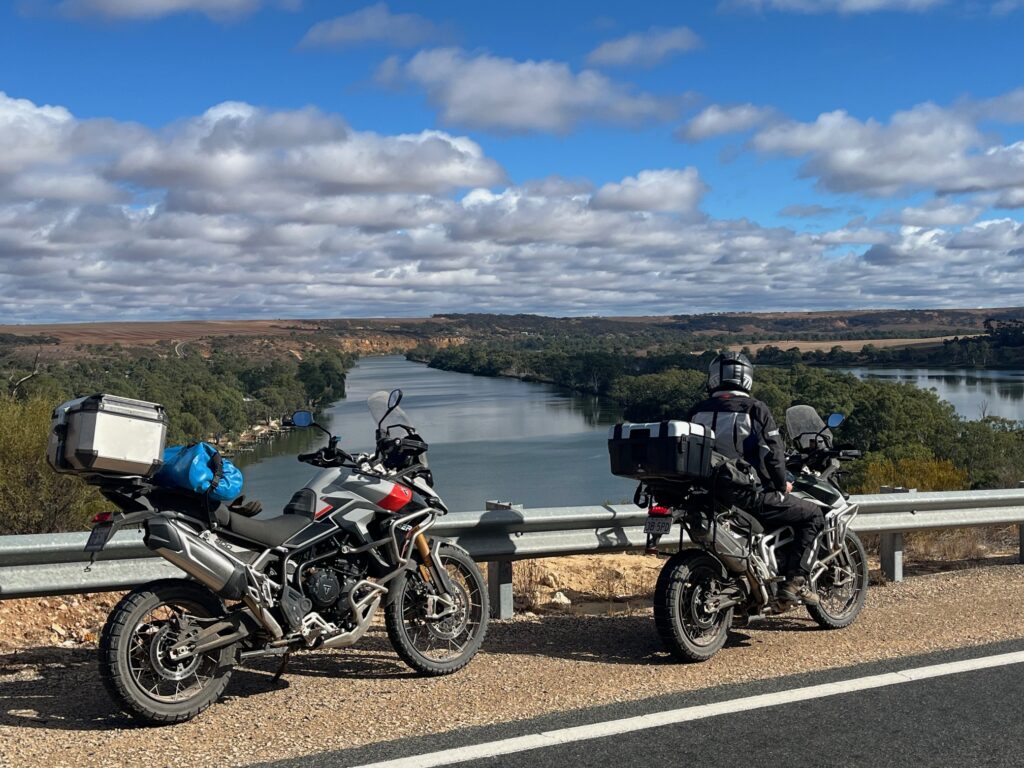
We left Morgan early, tracking the Murray River south through a string of small riverside towns — Blanchetown, Nildottie, Forster, and Walker Flat — before reaching Purnong, where we stopped for our first coffee of the day. The Murray here has carved a deep gorge, a stark contrast to the flat, meandering river further north. Red cliffs rise sharply from the water, and the valley widens into sweeping bends — a magnificent stretch of river to ride beside.
At Purnong, we rolled the bikes onto the free punt that ferries locals and travellers across the Murray — one of those small, uniquely Australian experiences that makes a journey memorable. From there, we rejoined the southern roads toward Coonalpyn, linking back onto the A8 Western Highway — the same route we’d followed weeks earlier near the start of the trip.
With the open highway under our wheels again, we cruised at a steady 110 km/h, covering ground quickly until reaching Keith. The weather stayed pleasant — mid-20s with high cloud cover, ideal riding conditions.
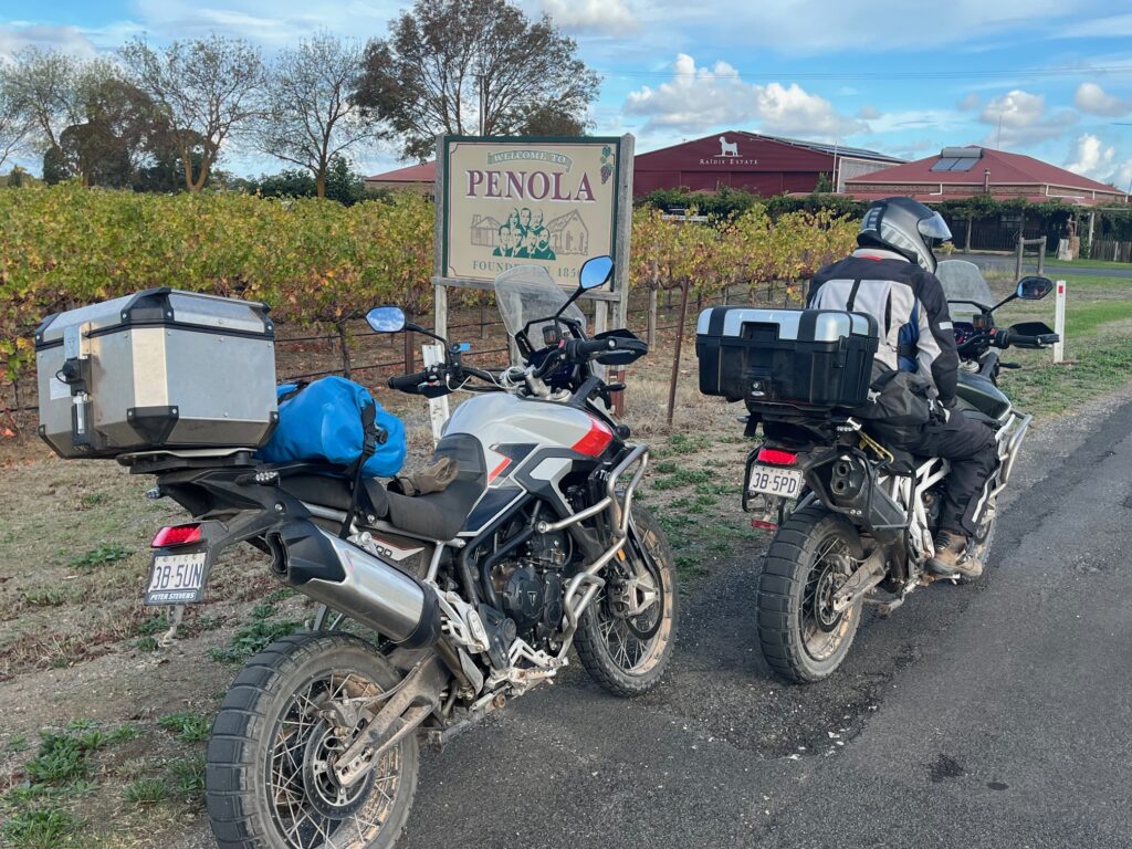
From Keith, we turned south onto the A66 Riddoch Highway, rolling through Padthaway and into the Coonawarra, one of Australia’s best-known wine regions. The scenery shifted again — neat rows of vines stretching to the horizon, cellar doors and old stone buildings marking the heart of South Australia’s wine country. Passing through Naracoorte, we pushed on for the final short leg to Penola, arriving in the late afternoon.
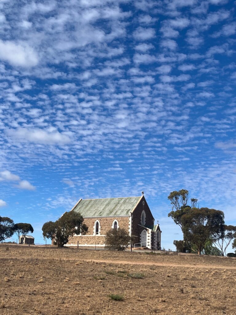
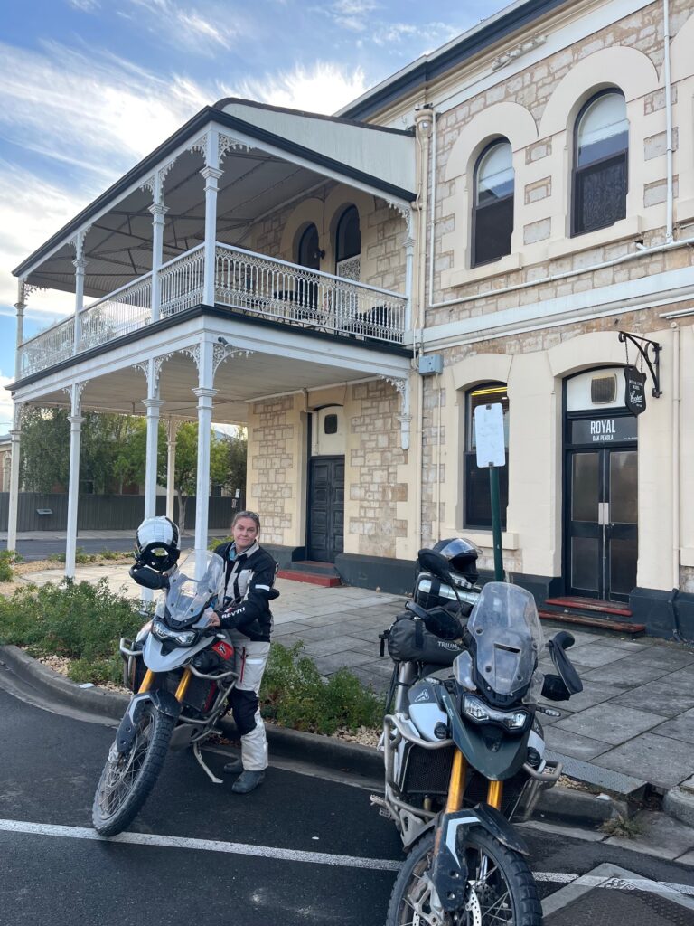
We checked into the Royal Oak Hotel, a welcoming old pub with the kind of relaxed warmth that makes a long day disappear quickly. Over dinner, we chatted with a few local teachers enjoying a glass of Coonawarra wine and sharing stories about the town’s history. Penola holds a special place in Australian heritage as the home of Saint Mary MacKillop, the country’s only canonised saint, who founded her first school here.
It was a fine way to end the day — good food, local wine, and friendly conversation after another long and rewarding ride.
Overnight: Royal Oak Hotel, Penola
Meals: Coffee at Purnong • Bakery lunch at Karronda • Dinner and local wine at Royal Oak Hotel
Highlights: Murray River gorge country • Free punt crossing at Purnong • Bakery stop in Keith • Coonawarra vineyards • Penola and Saint Mary MacKillop heritage • Royal Oak Hotel evening
🏍️ Day 13 — Penola to Port Campbell
Route: Penola → Mount Gambier → Nelson → Discovery Bay → Cape Bridgewater → Portland → Port Fairy → Warrnambool → Port Campbell
Distance: ~420 km
After a restful night in Penola, we headed out at a decent hour, stopping first at the Penola Bakery for a coffee and a light breakfast before rolling south on the A66 Riddoch Highway. The morning was calm, the weather holding, but overcast conditions were present for most of the day as we aimed for the Victorian border and the coast beyond.
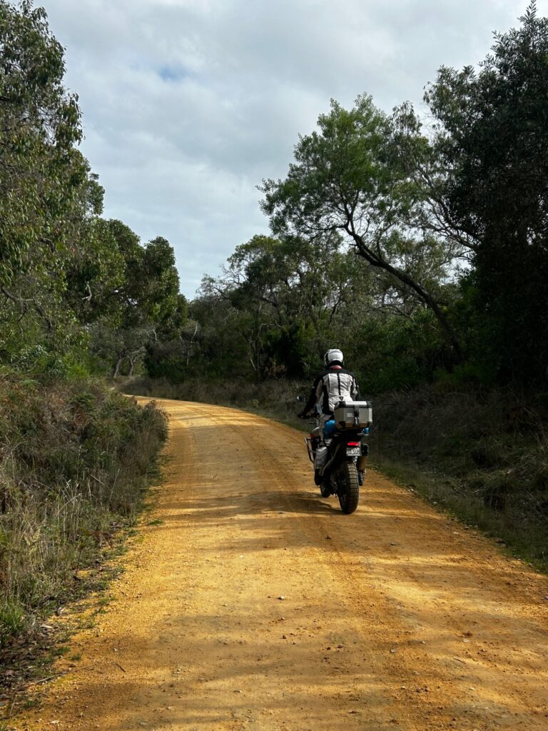
We passed through Mount Gambier, then followed the C192 toward Nelson, crossing the border and officially returning to Victoria. The Portland–Nelson Road led us through stretches of pine plantation before we turned off near Goree West onto Telegraph Road — a dirt track running quietly behind the sand dunes of Mount Richmond National Park.
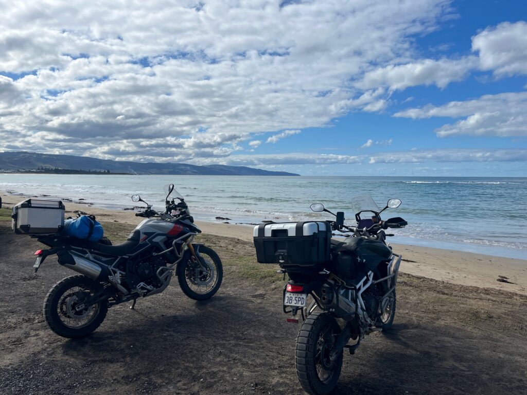
That track eventually brought us down to Discovery Bay, a wide, spectacular sweep of white sand and rolling surf — a place that holds fond memories for both of us, having visited here years ago with our kids. From there, we continued along the coast to Cape Bridgewater, where a quick stop at Shelly Beach Café and a coffee overlooking the Southern Ocean made for a perfect mid-morning pause.
Back on the bikes, we rejoined the A1 Princes Highway after a quick refuel in Portland, then pushed east through Port Fairy and on to Tower Hill, where we detoured around the loop road circling the ancient volcanic crater. The ride into Warrnambool brought us back to civilisation — but not to accommodation. Every hotel in town was booked solid.
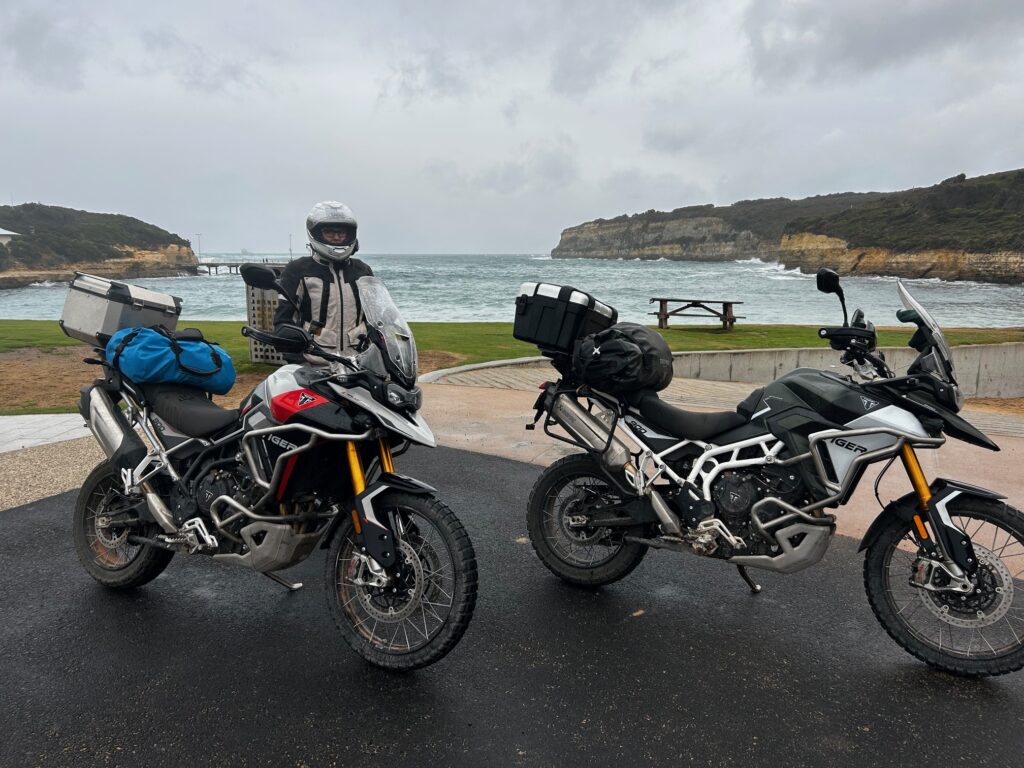
As the afternoon turned to evening, we pressed on, hoping to find a bed further along the Great Ocean Road (B100). Not long after leaving Warrnambool, the weather turned against us — heavy rain, strong crosswinds, and dropping visibility made for a challenging final stretch. By the time we rolled into Port Campbell, we were soaked, cold, and hungry, but relieved to spot the Sow & Piglets Brewery with rooms available.
It was a welcome sight — warm showers, dry gear, and a couple of craft beers in hand before walking across to the Port Campbell Hotel for dinner. A tough but memorable day: a border crossing, a taste of nostalgia, and the full force of the Southern Ocean reminding us that adventure rides don’t end quietly.
Overnight: Sow & Piglets Brewery, Port Campbell
Drinks / Meals: Breakfast at Penola Bakery • Coffee at Shelly Beach Café, Cape Bridgewater • Dinner at Port Campbell Hotel • Beers at Sow & Piglets Brewery
Highlights: Victorian border crossing • Discovery Bay and Cape Bridgewater • Scenic coastal riding • Tower Hill volcanic crater loop • Sudden weather change • Warm welcome at Sow & Piglets Brewery
🏍️ Day 14–15 — Port Campbell to Torquay, then Melbourne (Journey’s End)
Route: Port Campbell → Lavers Hill → Beech Forest → Wild Dog Creek Road → Apollo Bay → Kennett River → Wye River → Lorne → Torquay → Melbourne
Distance: ~370 km (Day 14) + return to Melbourne (Day 15)
After two weeks on the road, the final stretch began with the familiar rhythm of the Great Ocean Road — a route Jeanette and I have ridden many times before, often with friends from Melbourne and the western districts near Skipton. Even so, it never loses its magic: cliffs, surf, and sweeping corners under the open southern sky.
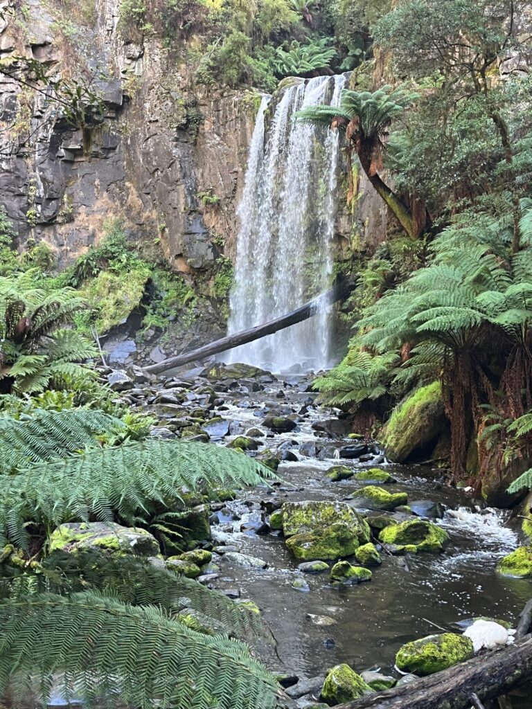
Leaving Port Campbell, we followed the Great Ocean Road east through Lavers Hill, then turned inland toward Beech Forest and the Otway Ranges. Overnight rain had made the forest tracks slick and unpredictable — patches of wet clay and slippery corners demanded careful control. We turned onto Binns Road, winding quietly through the forest canopy, past towering ferns and the distant sound of waterfalls.
We stopped briefly near Hopetoun Falls and the Redwoods a couple of the Otways’ most beautiful spots, before continuing on. With the bikes coated in red mud and both of us keen to finish safely, we kept things cautious — tippy-toeing through the Otways, content to enjoy the scenery rather than chase speed.
By mid-afternoon, we rejoined the Great Ocean Road near Apollo Bay, following it all the way through Kennett River, Wye River, and Lorne before rolling into Torquay. We checked into one of our favourite caravan parks, a familiar and comfortable spot that always feels like the end of something — a soft landing after a long ride.
The next morning (Day 15) we made the final run back to Melbourne, following the Princes Freeway north. The traffic grew heavier, the skyline familiar, and soon we were home — bikes dusty, chains stretched, minds full.
It had been a remarkable 16-day journey, covering roughly 3,700 kilometres across South Australia and Victoria. The South Australian Coast and Flinders Ranges stood out as a highlight — remote beaches, red dirt, blue skies, and open horizons — but every day brought something memorable. From the wind off the Spencer Gulf to the vineyards of Coonawarra and the wet bends of the Otways, it was a trip of contrasts, challenges, and small moments that linger.
Highly recommended — to anyone who loves riding, landscapes, and the quiet satisfaction of long days on the road.
Overnight: Torquay Caravan Park (Day 14)
Drinks / Meals: Breakfast in Port Campbell • Coffee stop at Beech Forest • Fish and Chip dinner in Torquay • Breakfast at Doc Hughes, before final ride to Melbourne
Highlights: Great Ocean Road finale • Wet clay roads through the Otways • Beauchamp Falls • Familiar coastal bends • Torquay overnight stay • 3,700 km completed
Leave a Reply