Background and Introduction
After the Danube Ride of 2018, we were always looking for the next thing — somewhere new to take the boys before they became too old and lost interest in travelling with their parents, especially when it came to bikepacking adventures. By the time Christmas 2019 rolled around, New Zealand’s South Island had made its way to the top of the list. The sheer scale and beauty of its scenery had always appealed, and when we came across a short film about the Alps to Ocean Trail, it sealed the deal. That was something we simply had to ride.
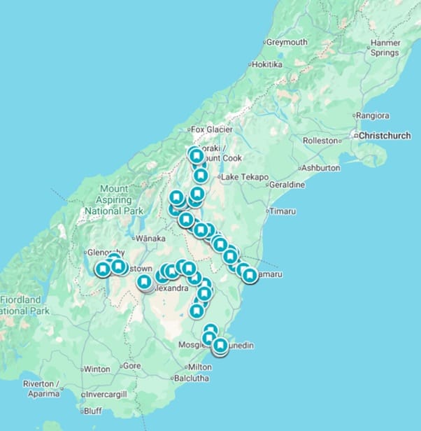
Still, it felt like a long way to go for just one trail. So, the plan evolved: if we were heading all that way, why not link a few of New Zealand’s signature routes into a single, flowing adventure? The Alps to Ocean would be the first leg, followed by the historic Otago Rail Trail, and finally, we’d finish with the lakes and rivers of the Queenstown Trail Network.
Pulling the three routes together, however, wasn’t without its logistical puzzles. With the boys in tow, we had to figure out how to get from Queenstown to Mount Cook to start the Alps to Ocean, how to bridge the gap between Oamaru and Dunedin, and then how to navigate the tricky stretch between Cromwell and the Gibbston Valley, where the Queenstown trails begin. But, as always, part of the fun lies in the planning — solving those little jigsaw pieces that make an ambitious ride like this possible and quite spectacular!
References and Research
Throughout the planning process, several key online resources became invaluable, including newzealand.com, nzcycletrail.com, and alps2ocean.com. These sites made route research, distance estimation, and identifying likely overnight stops far easier. New Zealand is superbly geared for bikepacking adventures — something we’ll continue to draw upon for future rides in Aotearoa.
And with that, our New Zealand South Island Christmas adventure was born.
1. Alps to Ocean
Getting There
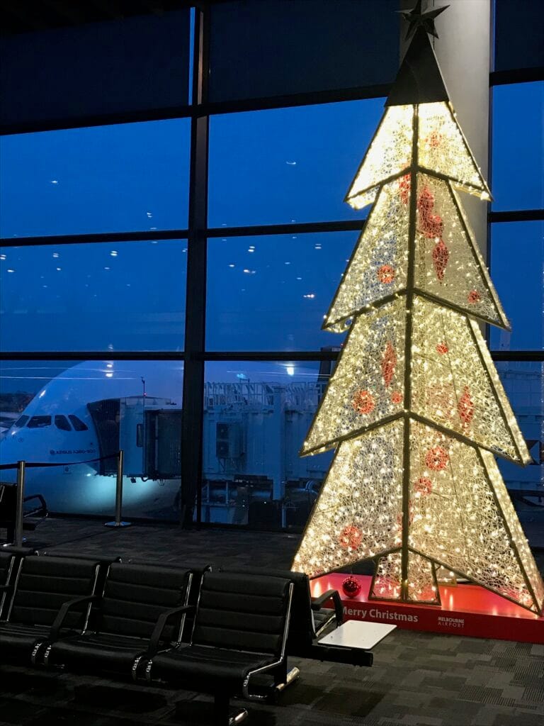
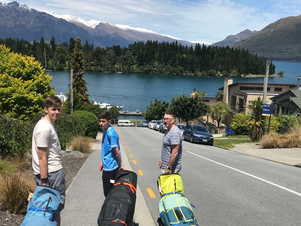
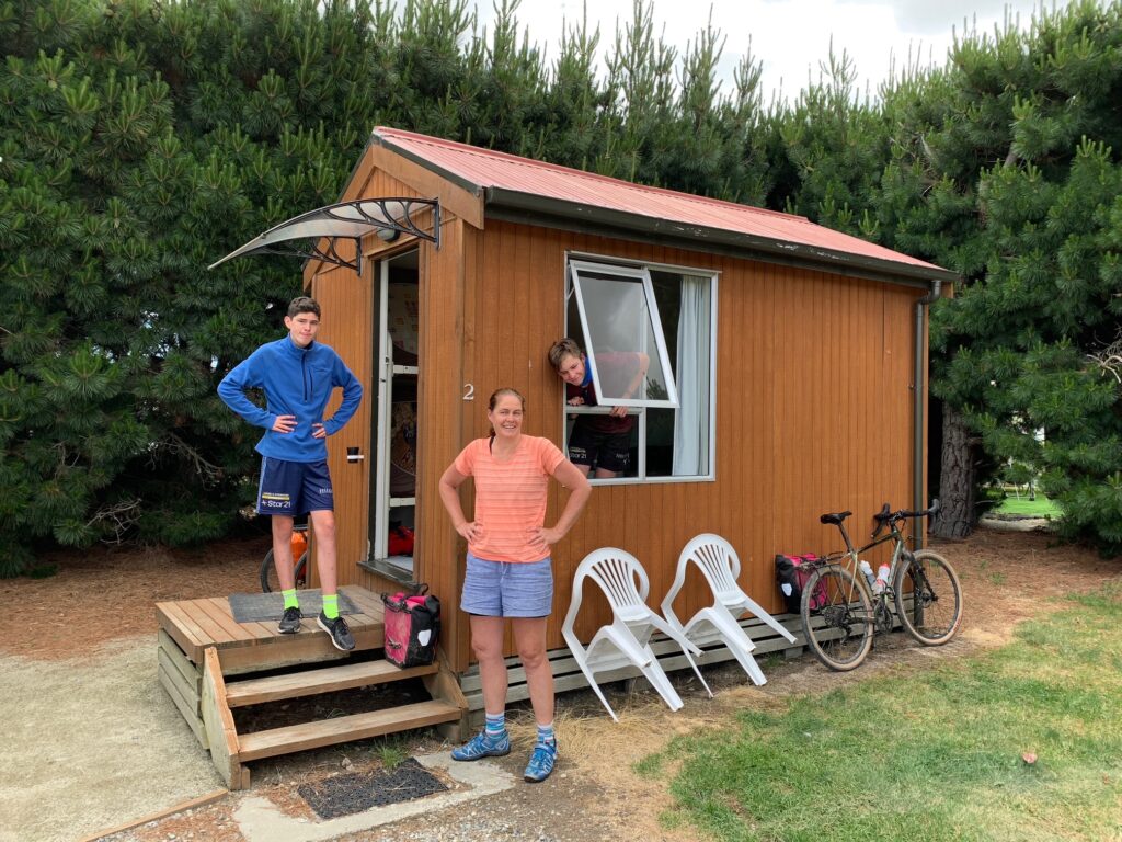
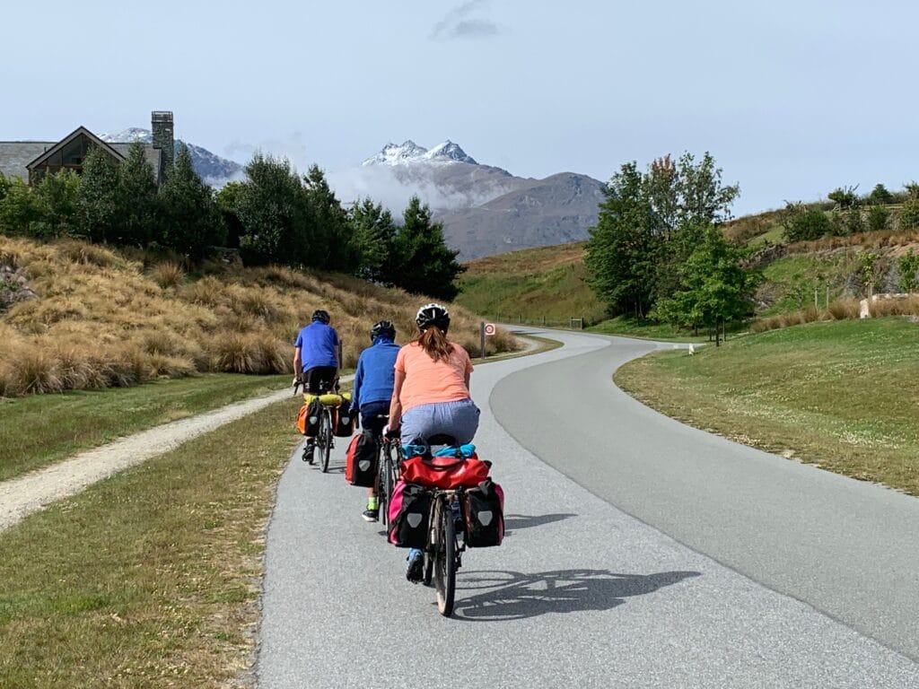
Our trip began in Melbourne, with an early morning flight to Queenstown. It was the ideal place to centre ourselves — a town that lives and breathes adventure, surrounded by mountains and energy. We spent our first night at the Queenstown Lakeview Holiday Park, setting up bikes and gear, and taking a short wander through town to stretch our legs after the flight.
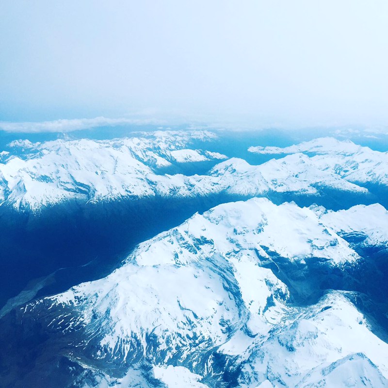
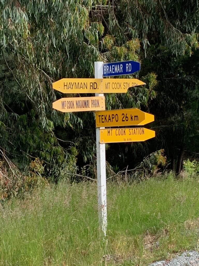
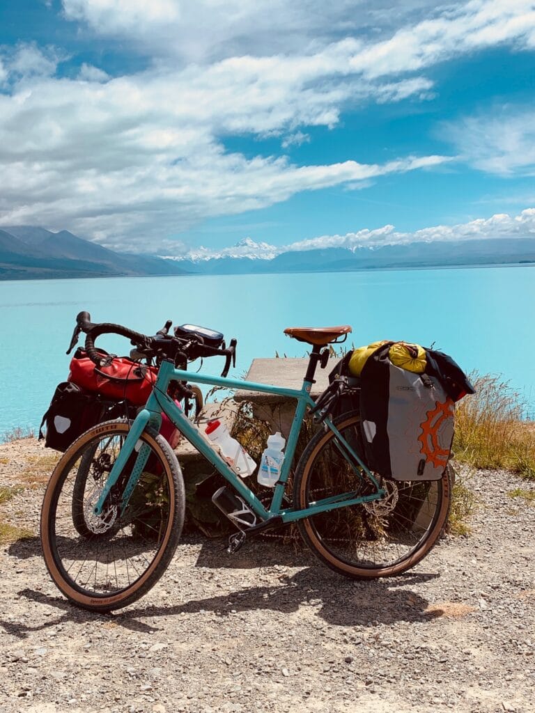
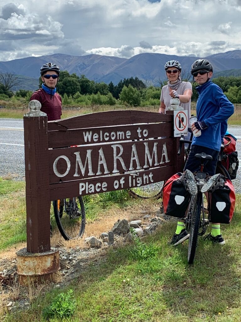
The next morning, our focus turned to reaching the start of the Alps to Ocean Trail at Mount Cook Village. We had arranged a private charter shuttle with All Mountain New Zealand, a fantastic outfit that arrived with a van big enough for four riders, four bikes, panniers, and camping gear — no small feat. The drive north took about five hours and offered a preview of the scenery we’d soon be pedalling through: out past Cromwell, through the winding beauty of Lindis Pass, and into Omarama, which we’d later revisit mid-trip. From there we continued through Twizel, then along the western edge of Lake Pukaki on Route 80, the road steadily rising as Aoraki/Mount Cook came into view.
By the time we reached Mount Cook, the sense of anticipation had built. The next morning would bring the helicopter ride across the Tasman River to the official start of the Alps to Ocean — one of those unforgettable beginnings that instantly set the tone for the journey ahead.
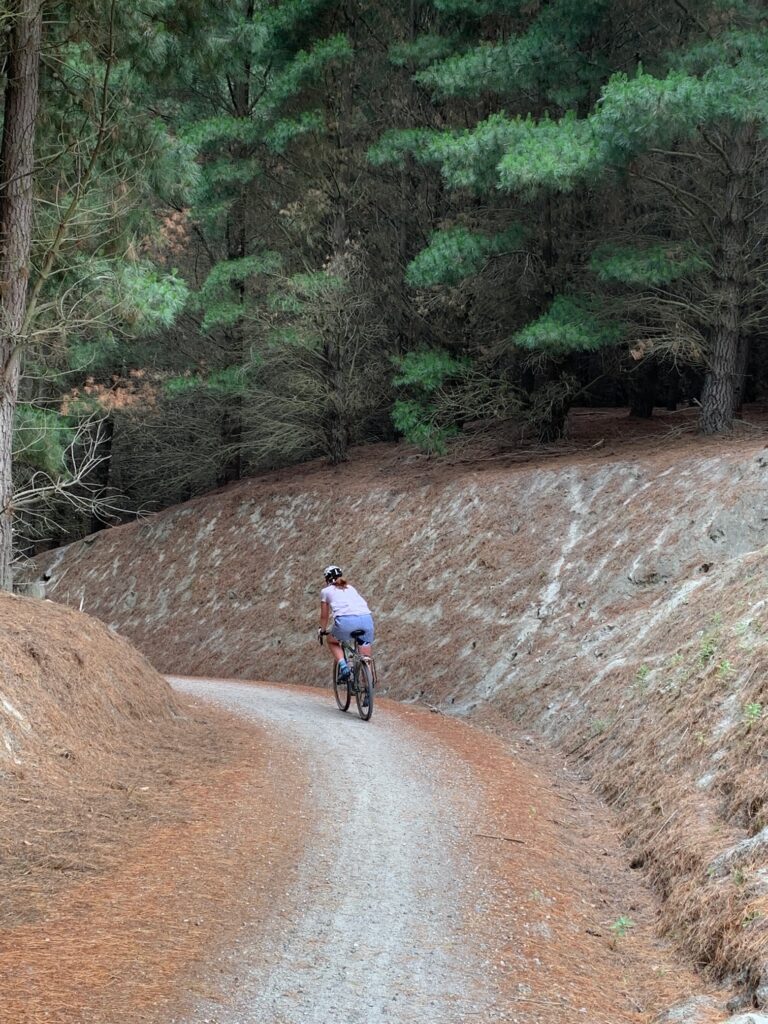
Day 1 — Aoraki / Mount Cook to Braemar Road
Distance: ≈ 35 km
Accommodation: Braemar Station – Hilltop Cottage
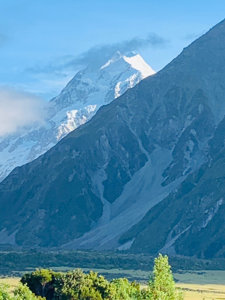
If there’s a more spectacular way to start a bike ride, I don’t know where it is. Waking up in Aoraki / Mount Cook Village, the view straight up the valley towards the mountain itself is breathtaking. We stayed at the Aoraki Mount Cook Alpine Lodge, a perfect little base to launch what would be the first leg of our three-trail South Island adventure.
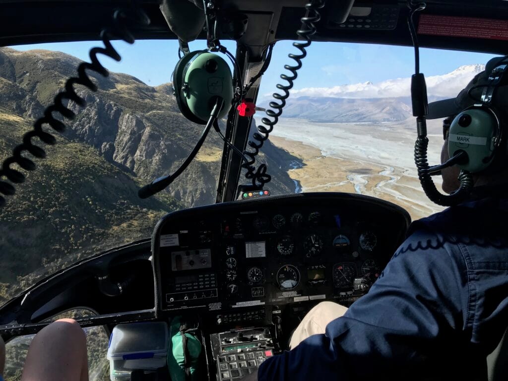
With the boys in tow, each day was planned to be manageable rather than epic — short distances, plenty of stops, and enough time to take it all in. Still, this one began in the most dramatic way imaginable. An early start took us down the Alps to Ocean Road to Mount Cook Airport, where we boarded a helicopter transfer to cross the wide, braided Tasman River that flows from the glaciers into Lake Pukaki.
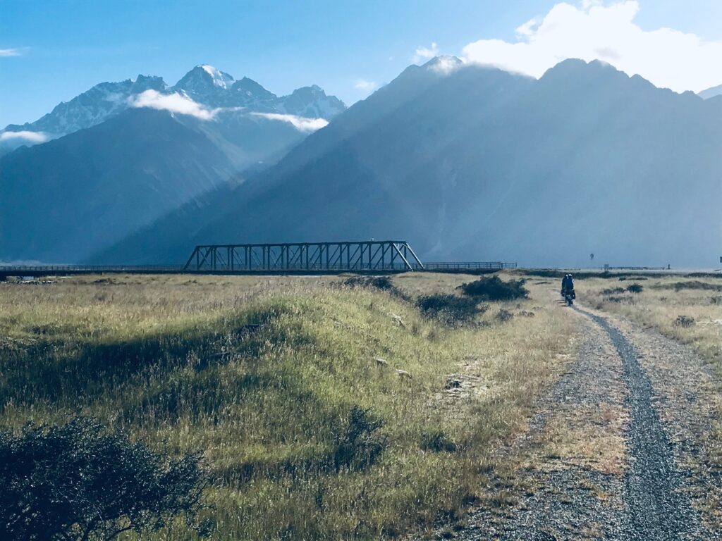
Because the helicopter couldn’t take all of us and our gear at once, the trip was done in two runs — first the bikes, then the family. Watching the bikes disappear into the distance across the valley before we followed in the second flight added a sense of anticipation. The short hop delivered us to the eastern side of the Tasman, landing near the Mount Cook Station Huts, where our bikes waited patiently on the gravel flats.
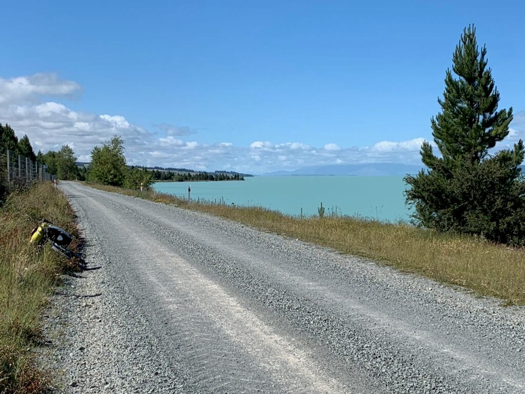
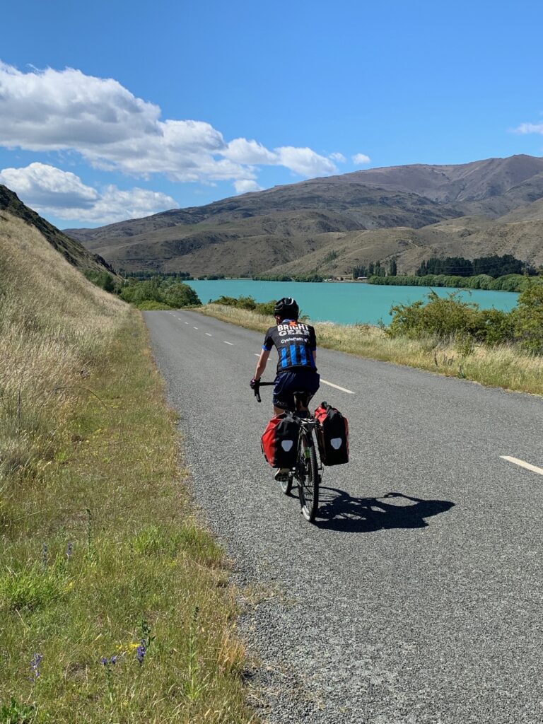
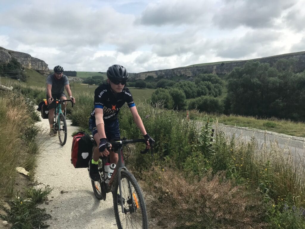
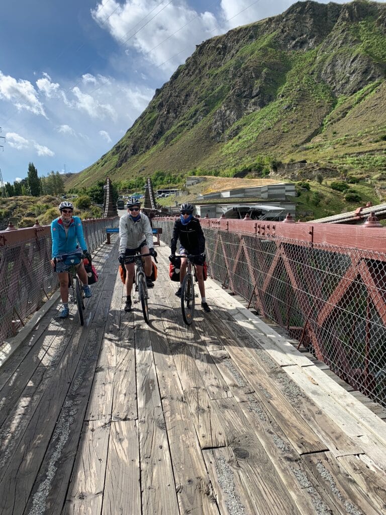
From there, the adventure truly began. The track rolled gently downhill along Braemar Road, framed by the turquoise sweep of Lake Pukaki to our right and the Southern Alps behind us. The gravel roads were wide and open — a dream to ride — until our younger son had a small spill, a confidence-shaker more than a real injury. A few dusty tears later, we were back on the bikes, spirits intact and stories already forming.
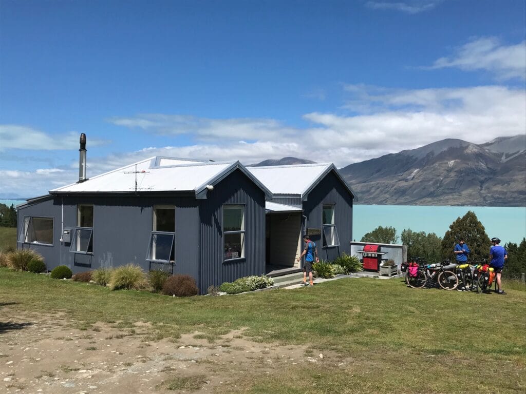
We reached Braemar Station by mid afternoon. Not cheap, but absolutely worth it — a self-contained farmhouse overlooking the lake, with mountains rising on the western horizon. It also represented a stop that kept the boys motivated, rather than broken! The station family delivered dinner and breakfast to our door — a full three-course country meal of steak, vegetables, salad, and dessert, followed by a cooked breakfast the next morning. After dinner, we stood outside as the light softened over the peaks of Mount Glenmary and the wind fell still.
A short ride by distance, but an unforgettable start to the journey. The sense of space, the air, the scale — it was everything we’d imagined when we first dreamed of riding the Alps to Ocean.
Day 2 — Braemar Road to Twizel
Distance: ≈ 42 km
Accommodation: Twizel – Mountain Chalet Motel
Dinner: Ministry of Works Bar & Grill
We woke to the soft light over Lake Pukaki, a still morning framed by the distant glint of Mount Cook. Breakfast at Braemar Station was every bit as good as the dinner the night before — hearty, home-cooked, and the perfect fuel for another day on the trail.
From Braemar Cottage, we continued along Braemar Road, keeping to the eastern side of the lake on a mix of gravel and farm track known locally as the Hayman Road or Timber Trail section. The riding was steady and open, the wind cool off the water, and the landscape vast — golden tussocks and turquoise reflections under a high-summer sun.
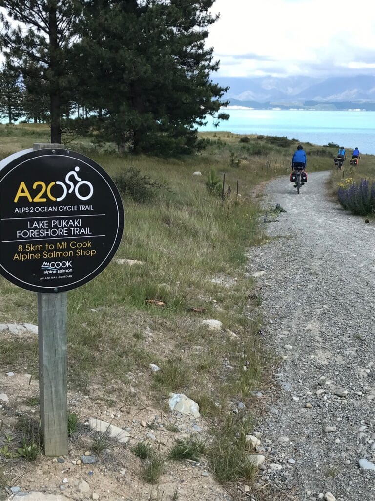
A few power stations marked our progress as we rolled south, eventually joining the Tekapo–Twizel Road. Not far from that junction sits a small gem of a stop — the Mount Cook Alpine Salmon Shop — where we paused for lunch and a well-earned rest. It became an instant favourite, especially with our younger son, who quickly claimed it as his best meal of the trip so far.
The view from here was unforgettable: looking back up the lake towards Aoraki / Mount Cook, the turquoise water glowing in the midday light, the peaks still dusted with snow even in the heat of Christmas Eve. It was one of those rare scenes that made us all pause — quiet, humbled, and grateful to be exactly where we were.
From there, the trail turned inland, running between the Pukaki River and State Highway 8 on a gentle off-road route that led us gradually into Twizel. It was Christmas Eve, and the small town carried that easy summer-holiday feeling with locals enjoying a great time of year. We checked into the Mountain Chalet Motel, showered off the dust, and walked to the Ministry of Works Bar & Grill for dinner.
Over a good meal, a beer then a glass of wine, we talked about the ride so far — the helicopter crossing, the turquoise lake, the big skies. It had been a short couple of days in kilometres, but in every other way, it already felt like a full adventure. The boys then decided to get on the pool table and begin what would be a constant theme for any pub visit during the next few weeks.
Day 3 — Twizel to Lake Ōhau
Distance: ≈ 38 km
Accommodation: Lake Middleton Campground – Camping
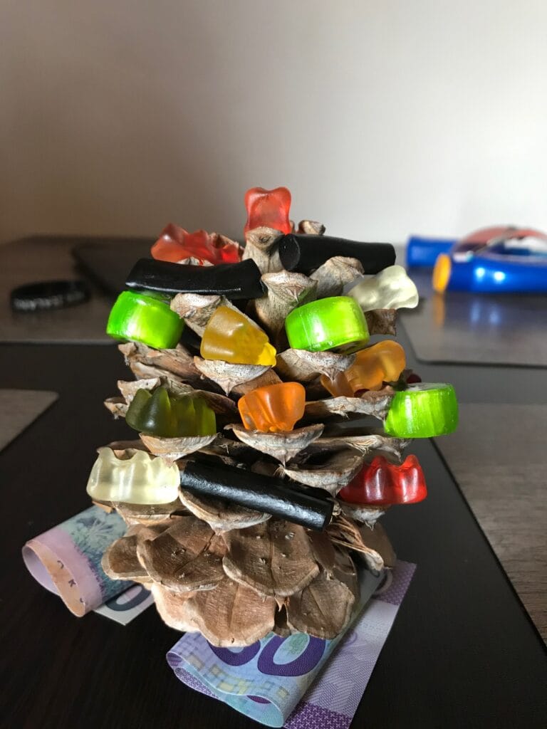
Christmas Day — though not the traditional one our boys were used to. We woke in the small town of Twizel, far from home, and set about creating a little festive spirit of our own. Our “Christmas tree” was a pine cone we’d found the day before, and the bikes were dressed with a few strands of tinsel we’d brought along. It wasn’t much, but it did the trick — a tiny reminder of Christmas morning before we packed up and rolled out.
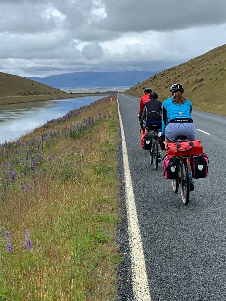
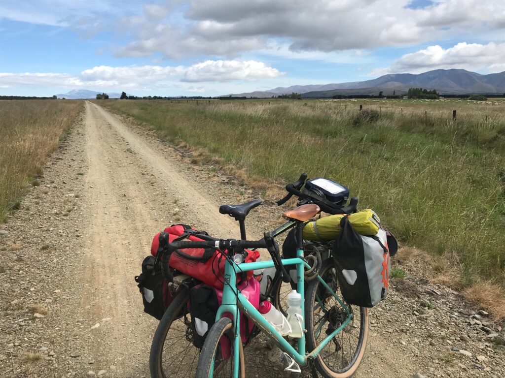
We left Twizel following the Alps to Ocean Trail, well signposted as always, heading west under the long ridge of Ben Ōhau. The morning was cool and a little overcast, a few spits of rain pushing us to pull on jackets early. The trail wound along the Ōhau Canal, its water an improbable blue, before turning toward the broad expanse of Lake Ōhau.
The riding was peaceful, the gravel roads smooth and well maintained. For much of the way we had the lake on one side and the mountains on the other — a classic South Island scene of wide open space and sharp light, even with the clouds hanging low.
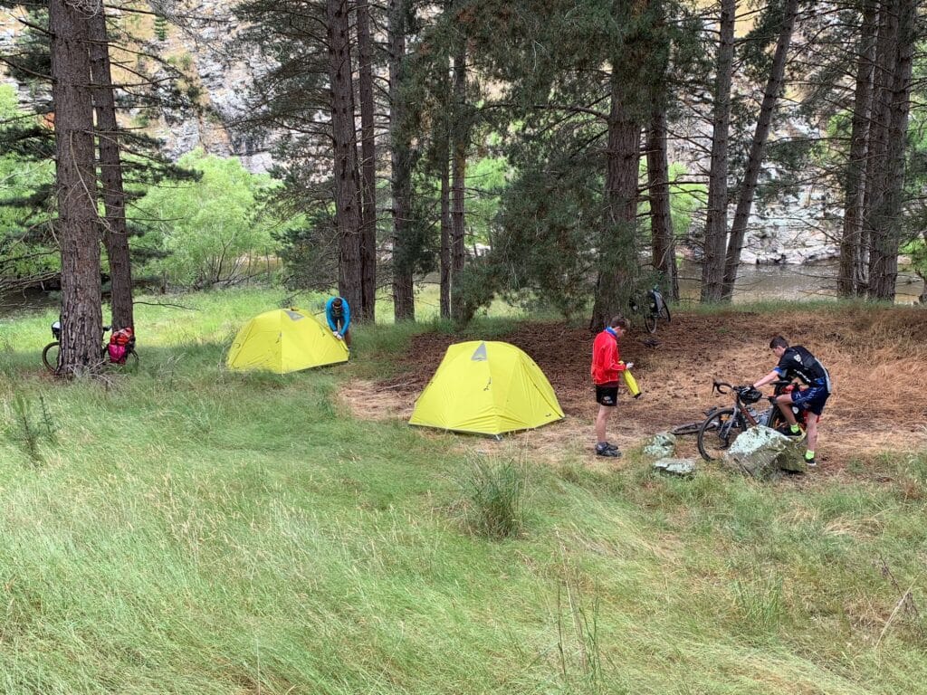
By late afternoon we reached Lake Middleton, just beside Lake Ōhau, and found our spot at the Lake Middleton Campground. The weather wasn’t kind enough for swimming, but we set up the tents, cooked our dinner, and settled in for a quiet, simple, and very different kind of Christmas night. No crowds, no noise — just the sound of wind in the grass and the soft ripple of the lake nearby.
A Christmas to remember — humble, remote, and peaceful – with the our family.
Day 4 — Lake Ōhau to Ōmarama
Distance: ≈ 45–50 km
Accommodation: Ōmarama – Sierra Motel & Apartments
Dinner: Boots and Jandals Hotel
Boxing Day — and time for a big ride. We left Lake Middleton Campground under a grey sky, the air still and cool after the overnight rain. This was to be one of the more challenging stages of the Alps to Ocean, with a long, steady climb ahead and an equally rewarding descent on the other side.
After a quick stop at Lake Ōhau Lodge, the real work began. The trail turned to a narrow gravel track that climbed steadily upward into the foothills of the Ahuriri Conservation Park, just below the Ōhau Range. The ascent stretched for roughly ten kilometres, rising about 350 metres to reach an elevation of around 900 metres above sea level. It wasn’t just a straight grind — the climb wound through river valleys, crossed small bridges, and narrowed to a track little more than a goat path in places.
The climb was relentless but spectacular, with each kilometre signposted — a blessing for both motivation and pacing. The sweeping views back down to Lake Ōhau and across to the Southern Alps were breathtaking. To further motivate the boys, we set a challenge: whoever reached the top first would claim bragging rights for the day. That small spark of competition did the trick — they took off ahead, full of energy, while we followed at a steadier rhythm.
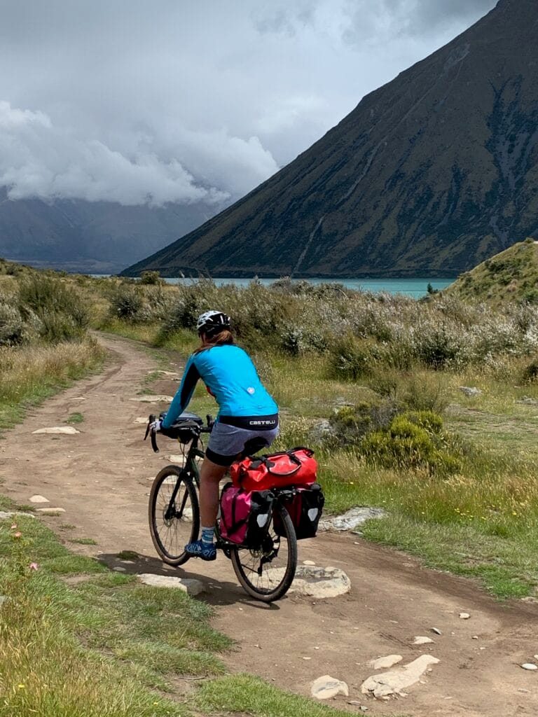
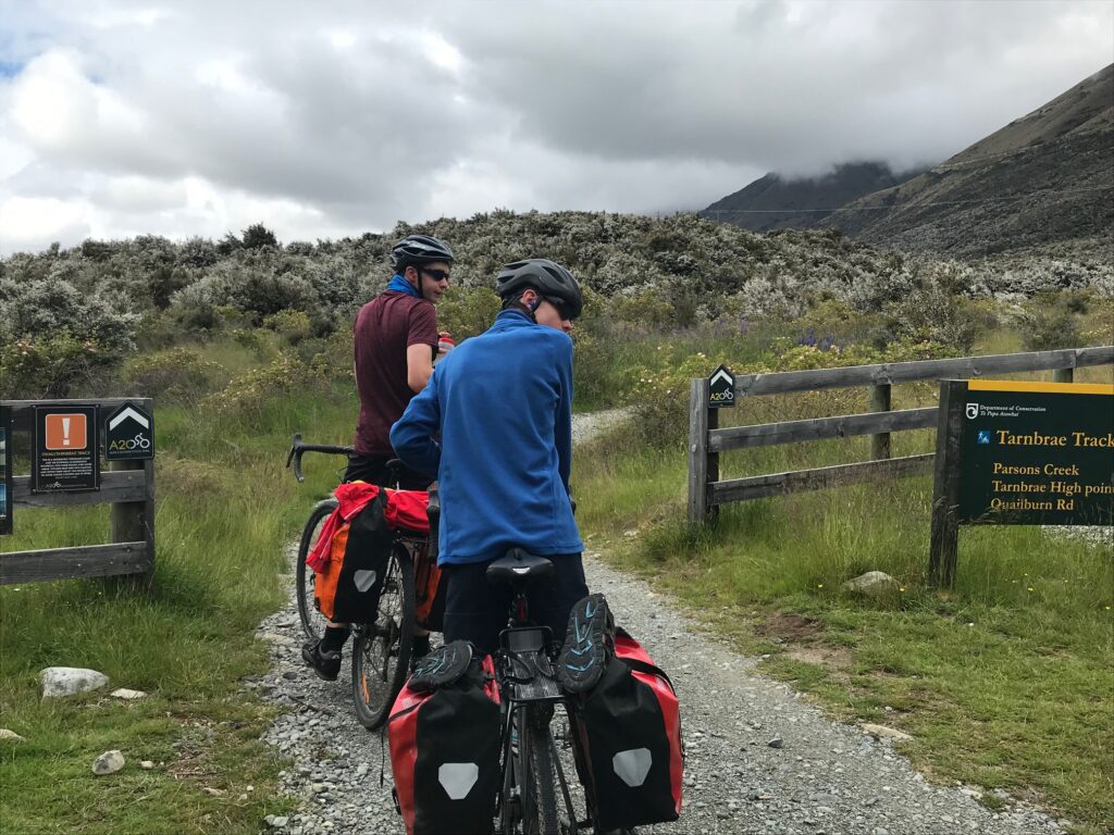
Reaching the top brought both relief and pride, the boys waiting for us with big smiles and a few triumphant shouts. The descent into the Ahuriri Valley was fast and flowing, dipping through muddy patches and water crossings, with a couple of minor “offs” and bruises among us along the way. We reached the historic Quailburn Woolshed, a perfect spot to rest and regroup. From there, we followed a long section of dirt road through the Quailburn area, rejoining the main route not far from Ōmarama.
We rolled into town late in the afternoon — dusty, muddy, and happy after a big day in the saddle. We checked into the Sierra Motel, then wandered over to the Boots and Jandals Hotel for dinner — a proper Kiwi pub meal that hit the spot. One of the day’s goals had been to soak in the Ōmarama Hot Tubs (hottubsomarama.co.nz), but by the time we arrived, they were closed for the evening.
A long climb, a long ride, and a great day all around — the perfect mix of challenge, scenery, a bit of mud and laughter, and just enough adventure to keep everyone smiling.

Day 5 — Ōmarama to Ōtematata
Distance: ≈ 25–30 km
Accommodation: Ōtematata – Frog Lodge Holiday Accommodation
Drinks: A celebratory beer at The Best Dam Pub
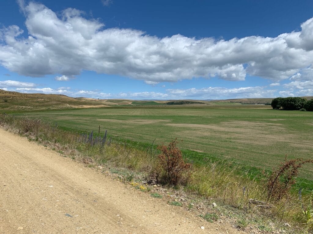
Today shaped up to be a different kind of challenge — not so much in distance, but in nerves. Leaving Ōmarama, we began on the dedicated Alps to Ocean cycle path, which wound gently through open country towards Lake Aviemore. The scenery was beautiful — rolling hills, still water, and big skies — but we knew that further ahead, the route would demand a little extra care.
At Sailors Cutting, the official trail ended, forcing us onto State Highway 83 for about 13–15 kilometres. Back in 2019, the cycle route didn’t yet continue around Lake Aviemore, so this section meant sharing the road with fast-moving traffic. With a 100 km/h speed limit, it was a nervous stretch for both Janette and myself. The boys, though, handled it brilliantly — steady, alert, and composed — riding with a confidence well beyond their years.
Once we’d cleared the highway section, the tension eased, and we could again take in the scenery around Lake Aviemore and the Waitaki Valley. The last few kilometres into Ōtematata felt relaxed, the day’s anxiety replaced by satisfaction and quiet pride in how well everyone had coped.
We rolled into town after what turned out to be a modest-distance day but one that felt much longer. A cold beer at The Best Dam Pub was the perfect reward before checking into Frog Lodge Holiday Accommodation — a quirky ex-workers’ cottage originally built for the dam crews who constructed the Aviemore and Waitaki hydro schemes. With its mix of single and bunk beds, it had the feel of an old camp or even a POW hut — but there was a pool table, and that was all the boys needed to declare it a winner.
A short ride, a nerve-testing highway stretch, and a classic end-of-day Kiwi pub made it a memorable stop on the journey south.
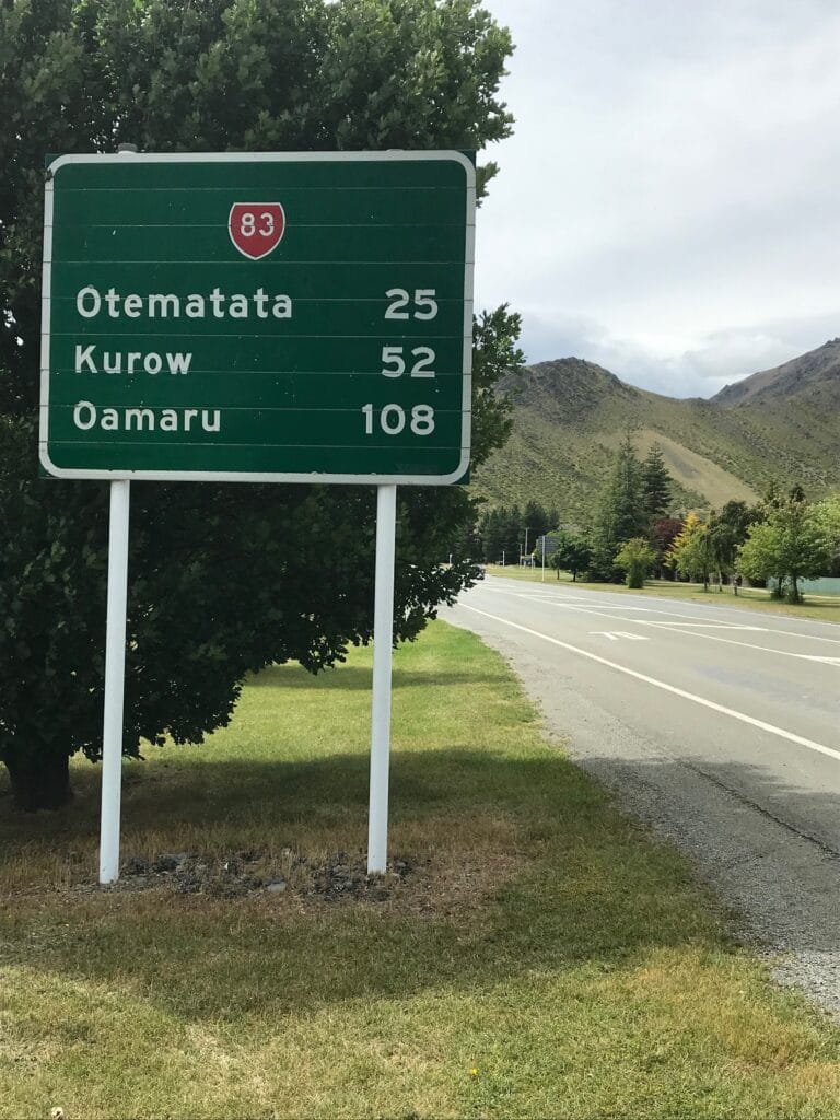
Day 6 — Ōtematata to Kurow
Distance: ≈ 45 km
Accommodation: Kurow – Kurow Motel (self-catering)
Drinks: Kurow Hotel
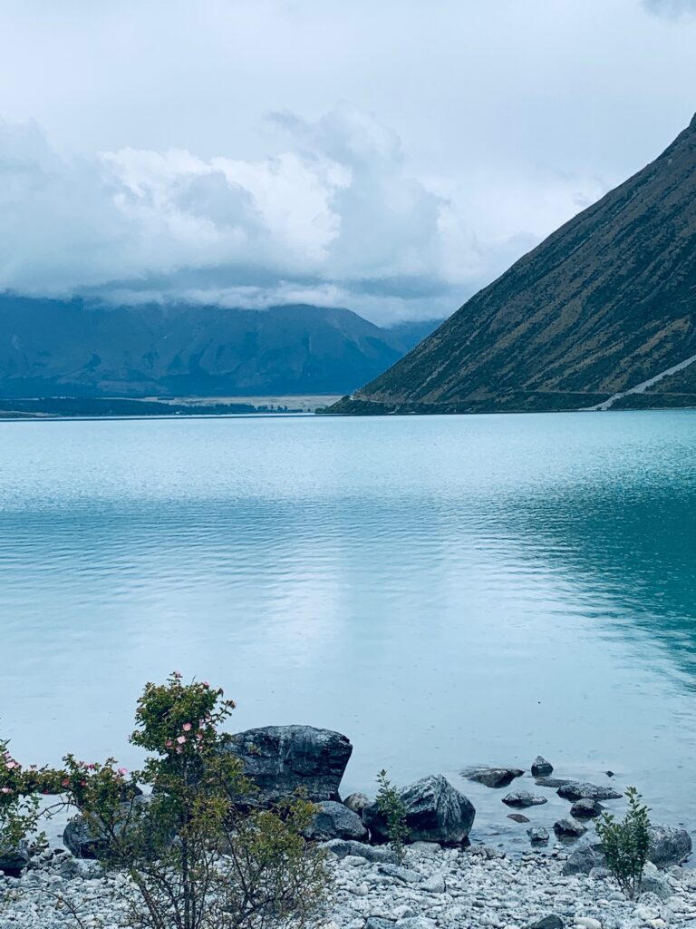
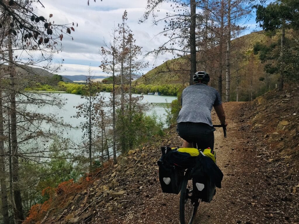
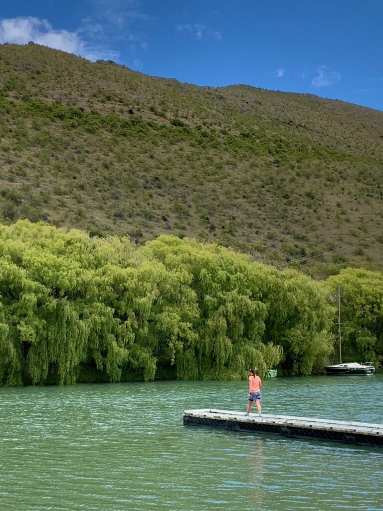
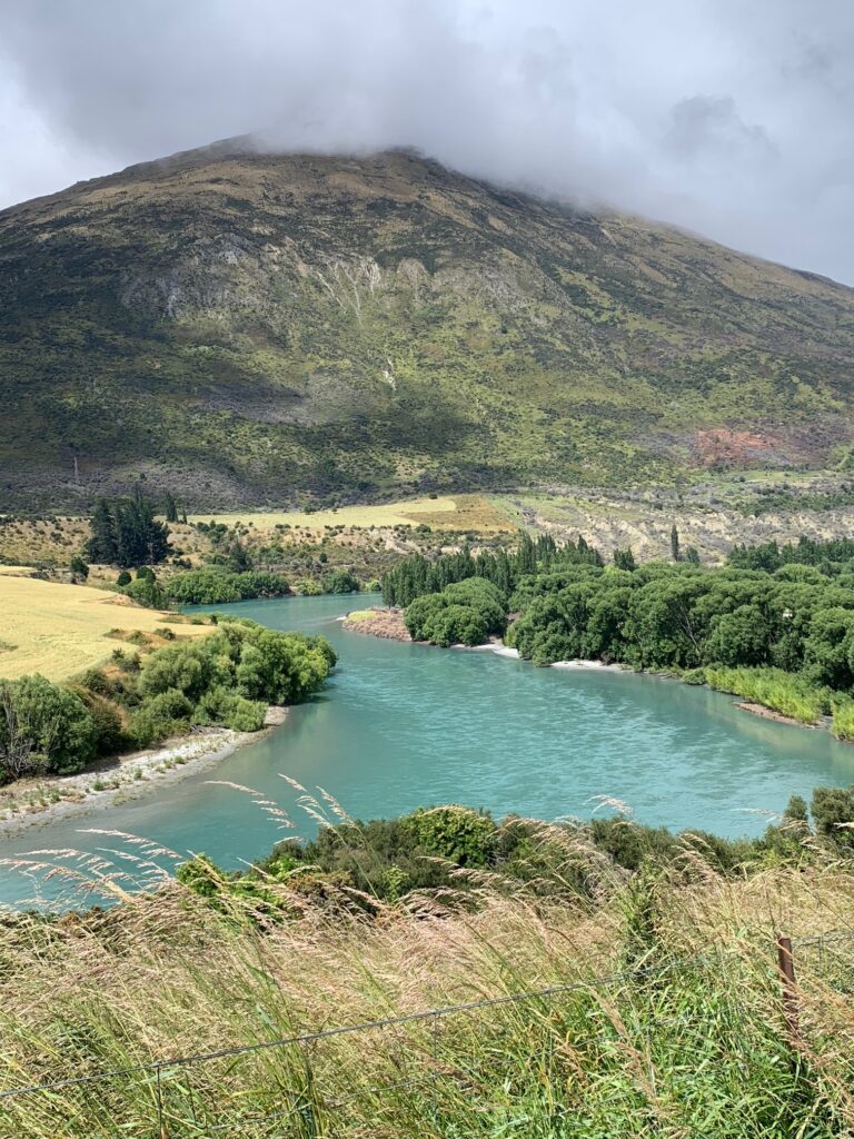
We left Ōtematata for Kurow, setting out under clear skies for what would be another solid day in the saddle. The route began by tracking a little backwards, climbing gently towards the Benmore Dam, before crossing over to the northern side of Lake Benmore. For the first stretch we rode mainly on quiet country roads, the occasional car reminding us to keep tight and steady.
From the dam we followed the road as it curved along the lake’s edge, offering wide views across the deep blue water. The surface alternated between sealed and gravel, and while there was the odd vehicle passing, it was generally peaceful riding. Beyond Benmore, the Alps to Ocean Trail picked up again along the Aviemore Dam Road, where the Waitaki River begins its long run to the coast

Partway along this section we reached the Waitangi West Campground, where we pulled up beside the Gibson Stream for a quiet lunch break. Sitting by the water, we brewed up pot noodles and tore into a few protein bars, refuelling while watching clouds drift lazily over the hills — a simple, satisfying pause in the middle of a steady day’s ride.
After lunch, we continued toward the Aviemore Dam and then the impressive Waitaki Dam, a piece of 1930s engineering history that remains one of New Zealand’s great hydro achievements (nzhistory.govt.nz).
Crossing the dam marked our approach into Kurow, a small town rich in both history and pride. It’s known as the birthplace of Richie McCaw, legendary All Blacks captain and national hero — something the locals are quick to celebrate. We pulled into the Kurow Hotel, easily spotted by its distinctive purple-and-yellow façade, and toasted the day’s ride with a well-earned beer before rolling a short distance to our accommodation at the Kurow Motel.
A 45-kilometre day with a bit of everything — dams, lakes, rivers, gravel, and a peaceful lunch beside the stream — it was a fitting close to the main riding stages of the Alps to Ocean, in a town that wore its sporting heritage and country heart proudly.

Day 7 — Kurow to Duntroon
Distance: ≈ 28–30 km
Accommodation: Duntroon Domain Camping Ground
Drinks: River-T Wines and Duntroon Hotel
A relatively short day — around thirty kilometres — as we continued our way down the Waitaki Valley towards Duntroon. We left Kurow mid-morning, the sun already warming the valley.
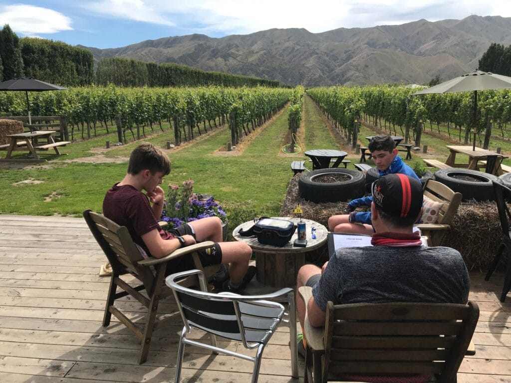
Not long into the ride, the trail veered left and dropped down toward the river near River-T Wines, a local winery set right on the route. It was too good to pass by, so we pulled in for a mid-morning break — a glass of the local wine for us, a cheese board for the boys. Sitting there in the sunshine beside the vines felt perfectly timed — the calm rhythm of a family trip that had found its stride.
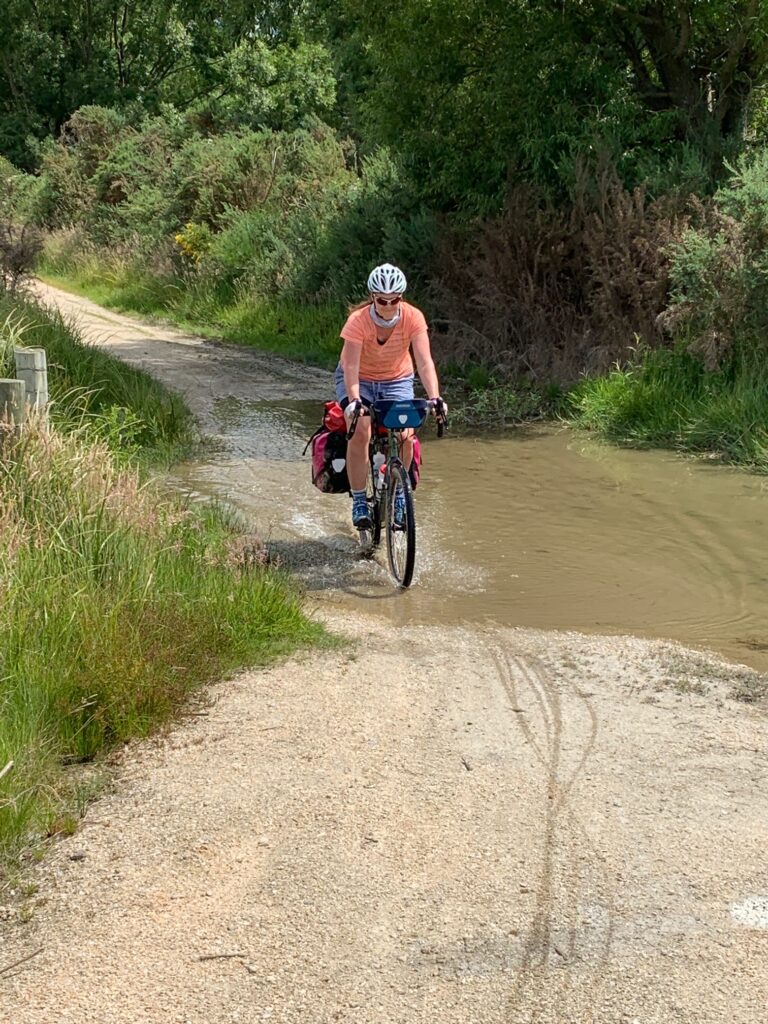
From there, we continued to follow the valley trail, weaving through open farmland and the wide river flats. A few small river crossings added some fun and splashes to the day, before we reached Waikaura, where the path briefly joined the roadside near the Takiroa Māori Rock Drawings — a fascinating roadside stop showcasing ancient rock art, a small but moving reminder of Aotearoa’s deep history and culture.
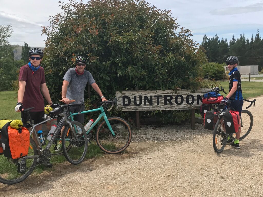
Not long after, we rolled into Duntroon, a quiet and welcoming town that marked the end of another easy-paced day. We set up camp at the Duntroon Domain Camping Ground, which turned out to be memorable for an unexpected reason: we had arrived with almost no cash, assuming everywhere would take cards. They didn’t. On a Sunday, nothing much was open — and even the Duntroon Hotel was strictly cash-only. After a quick raid of the boys’ wallets, we scraped together enough for a couple of beers and hot chips and another round of pool.
So it became a frugal but funny evening — pot noodles, chips and water, two tents under a large tree. Only 28 kilometres today, but we were resting up for the final push — a 54-kilometre day tomorrow to complete the Alps to Ocean Trail.
Day 8 — Duntroon to Ōamaru
Distance: ≈ 54–55 km
Accommodation: Ōamaru – Criterion Hotel, Bar & Eatery
Drinks: Scotts Brewing Co.
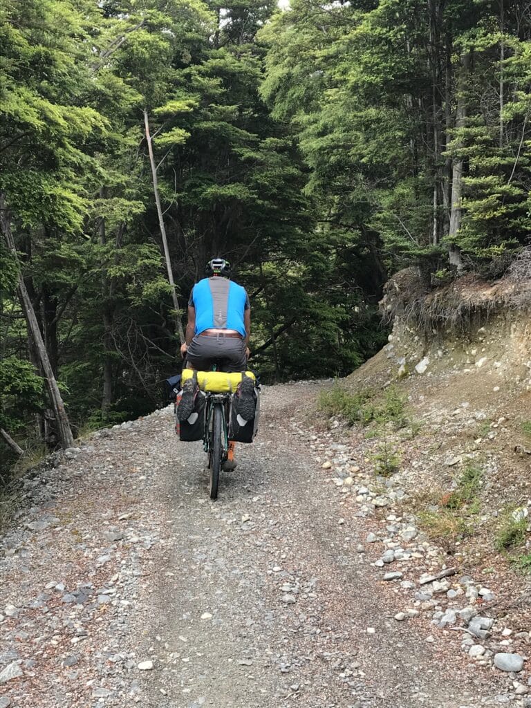
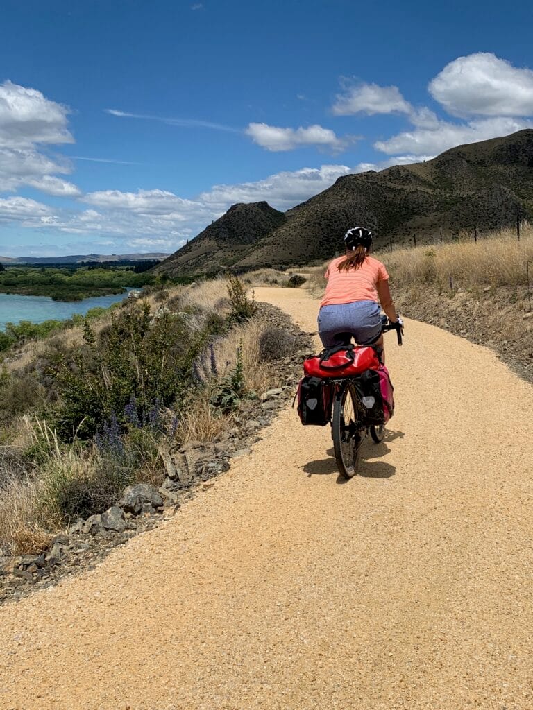
The final day of the Alps to Ocean — and the longest of our trip. We left Duntroon in the morning knowing this would be a full day in the saddle, roughly fifty-five kilometres to reach the Pacific. The trail rolled out through open farmland, alternating between off-road sections and quiet secondary roads as we tracked south through the Waitaki Valley.
Early in the ride we passed the sculpted limestone formations of Elephant Rocks, their pale shapes scattered across green paddocks. Not long after, we crossed from Canterbury into Otago — a subtle but symbolic milestone, marking our final leg across the South Island. From there, the route wound through the aptly named Zig Zag Valley, a short but playful stretch of climbing and descending on narrow country lanes through working farms.
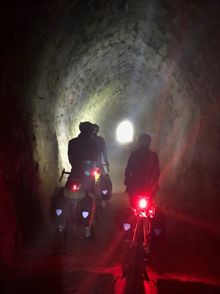
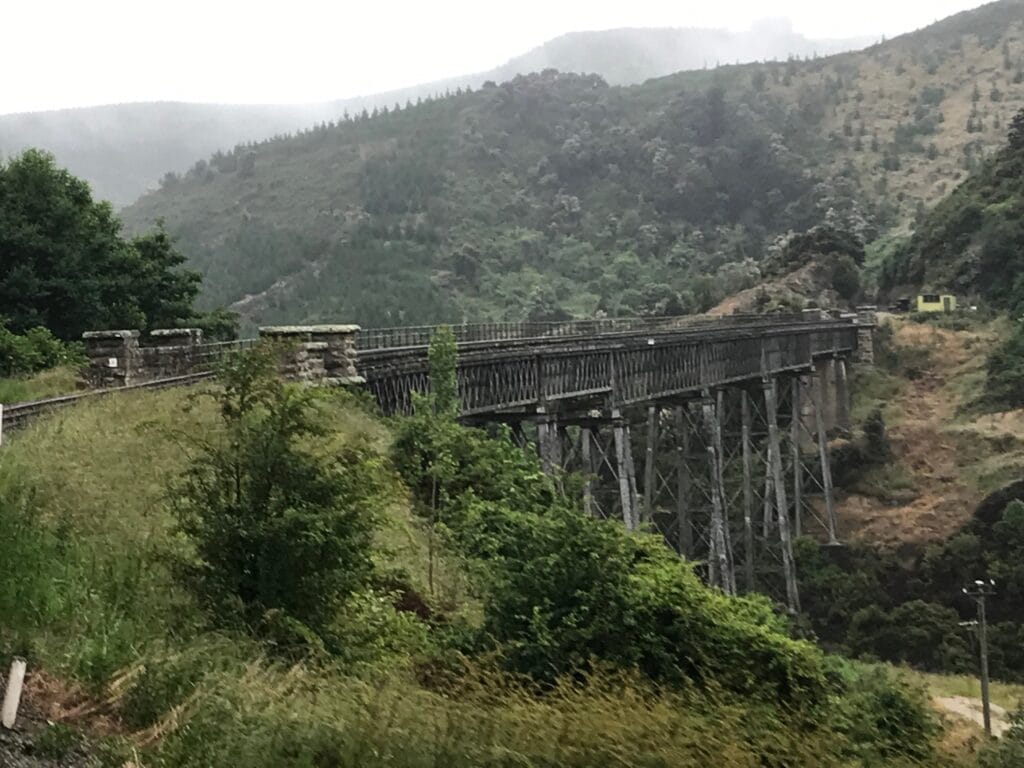
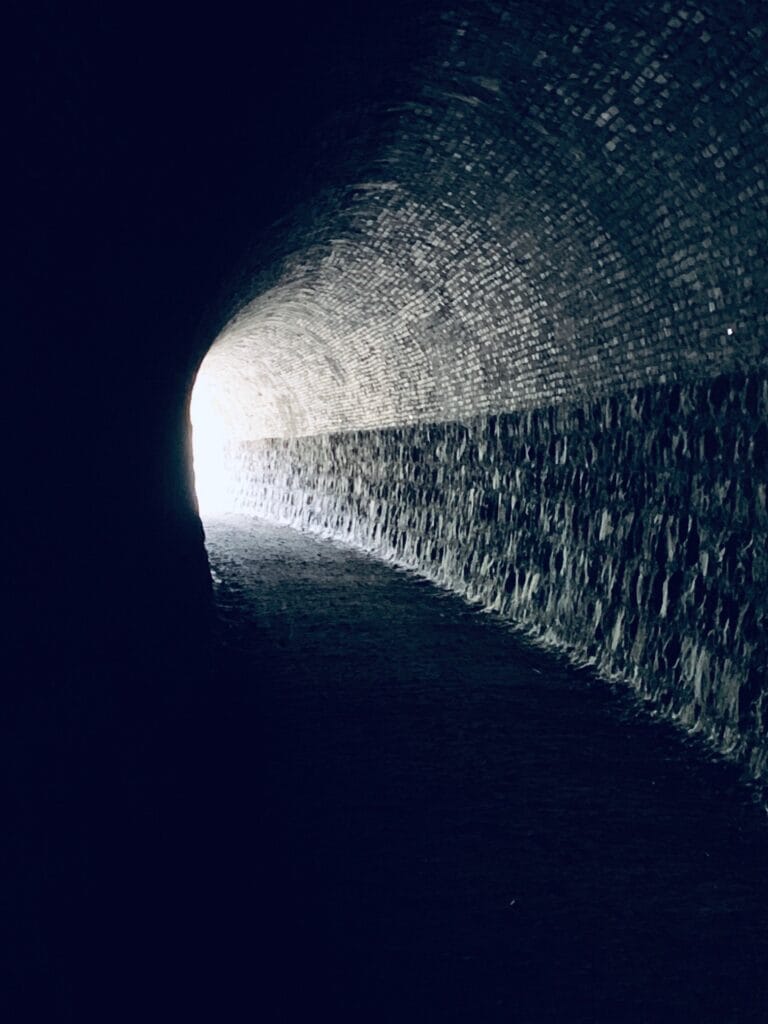
Further south, the trail joined old rail alignments, including one of the day’s highlights — the Rakis Railway Tunnel, approached along Tunnel Road. Riding through the dark, echoing tunnel was both eerie and exhilarating, and we emerged into sunlight before climbing back up to Peaks Road, where the rail line continued beneath us. The track then led us towards Windsor, through gently undulating farmland, and later along secondary roads that carried us steadily towards the coast.
By early afternoon we stopped at the Port Enfield Tavern on Western–Ngapara Road for a well-earned rest and a cold drink. Spirits were high — we knew we were closing in on the end of a long journey that had carried us from glaciers to sea. From there, we followed the old railway corridor again, passing through Enfield, Whitstone, and Weston, before entering Ōamaru via the Ōamaru Public Gardens — a beautiful, fitting final approach along the former rail line.
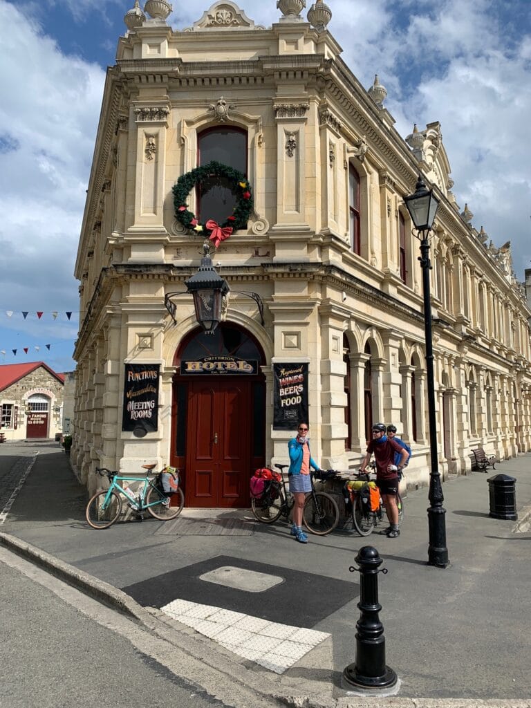
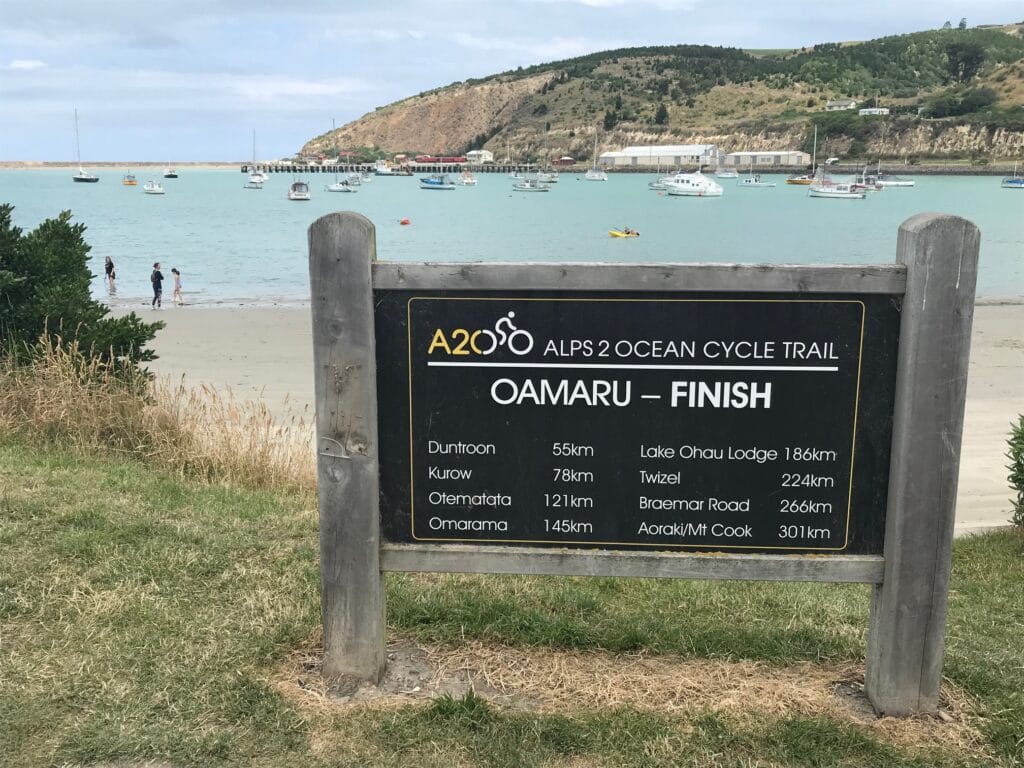
Rolling into town, we celebrated with a beer at Scotts Brewing Co., right by the harbour and official trail finish. Afterwards, Ben led us just up the road to visit the Whitestone Cheese Co., where we sampled some of the region’s famous cheeses — a perfect pairing after the local brew and a relaxed way to mark the end of our ride.
We then made our way to the Criterion Hotel, Bar & Eatery, our accommodation for the night. In a twist of Kiwi hospitality, the hotel was technically closed — the booking had been taken in error — but the owners honoured it anyway and opened the place just for us. We had the entire upstairs to ourselves: pick your own room, settle in, and enjoy the rare novelty of having a pub all to ourselves (drinks not included!).
That evening we explored Ōamaru’s Steampunk Headquarters and had dinner at The Last Post Restaurant, rounding out the trip with good food and tired smiles.
A perfect finish — fifty-five kilometres of history, rolling countryside, local flavour, and that final descent to the sea. The Alps to Ocean was complete.
Transition — Ōamaru to Dunedin (New Year’s Stopover)
With the Alps to Ocean complete, our next cycling challenge lay further south — the Otago Rail Trail. The trail begins in Middlemarch, so we had a couple of days to make our way down there and enjoy a bit of downtime in Dunedin before setting off again.
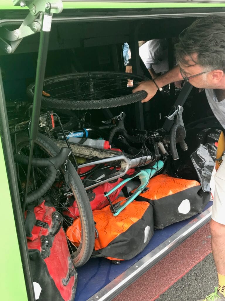
From Ōamaru, we packed the bikes and loaded everything onto an InterCity bus bound for Dunedin. The journey took just a couple of hours, and we checked into the Wains Hotel, which would be our base for New Year’s Eve and New Year’s Day.
Dunedin turned out to be a wonderful interlude — a city full of heritage buildings, steep hills, and a youthful energy. We spent the afternoon exploring what is one of New Zealand’s oldest cities, wandering around the University of Otago campus, and soaking in the mix of history and student life. Later, we made our way up to Mornington for laundry, beer, and some much-needed catch-up time, before riding electric scooters back down through the city and out to St Clair Beach. The plan had been for a swim, but the weather had other ideas — cold, windy, and more suited to hoodies than bathers.
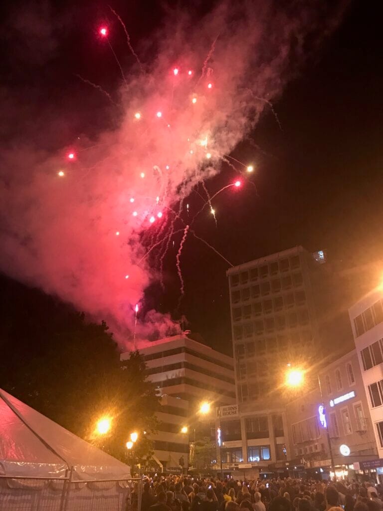
That evening, being New Year’s Eve, we joined the celebrations in The Octagon, the heart of Dunedin. As midnight approached, the crowd swelled and the fireworks began — a fittingly lively way to ring in the new decade. We thought both boys had stayed behind at the hotel, but just before midnight our youngest reappeared, having walked the 1.5 kilometres from the hotel to find us in the crowd. Not bad for an early teenager — a moment equal parts pride and surprise for us as parents!
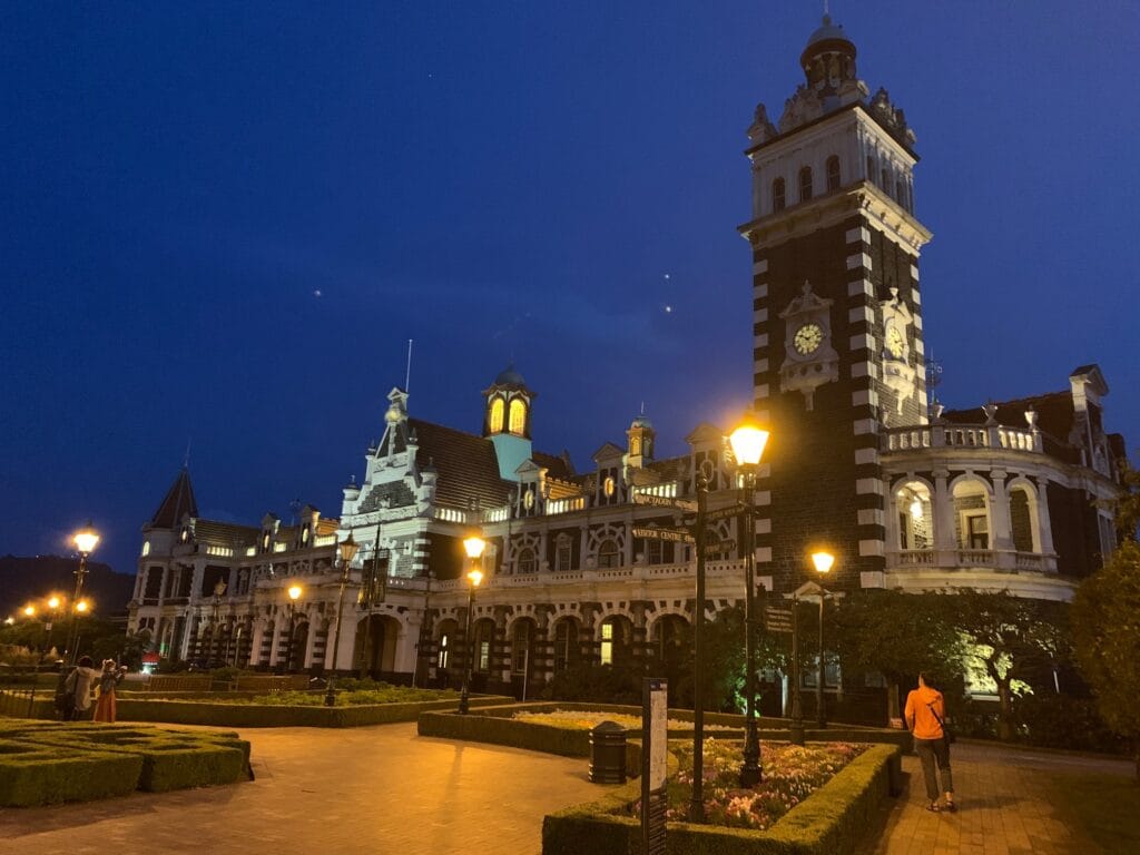
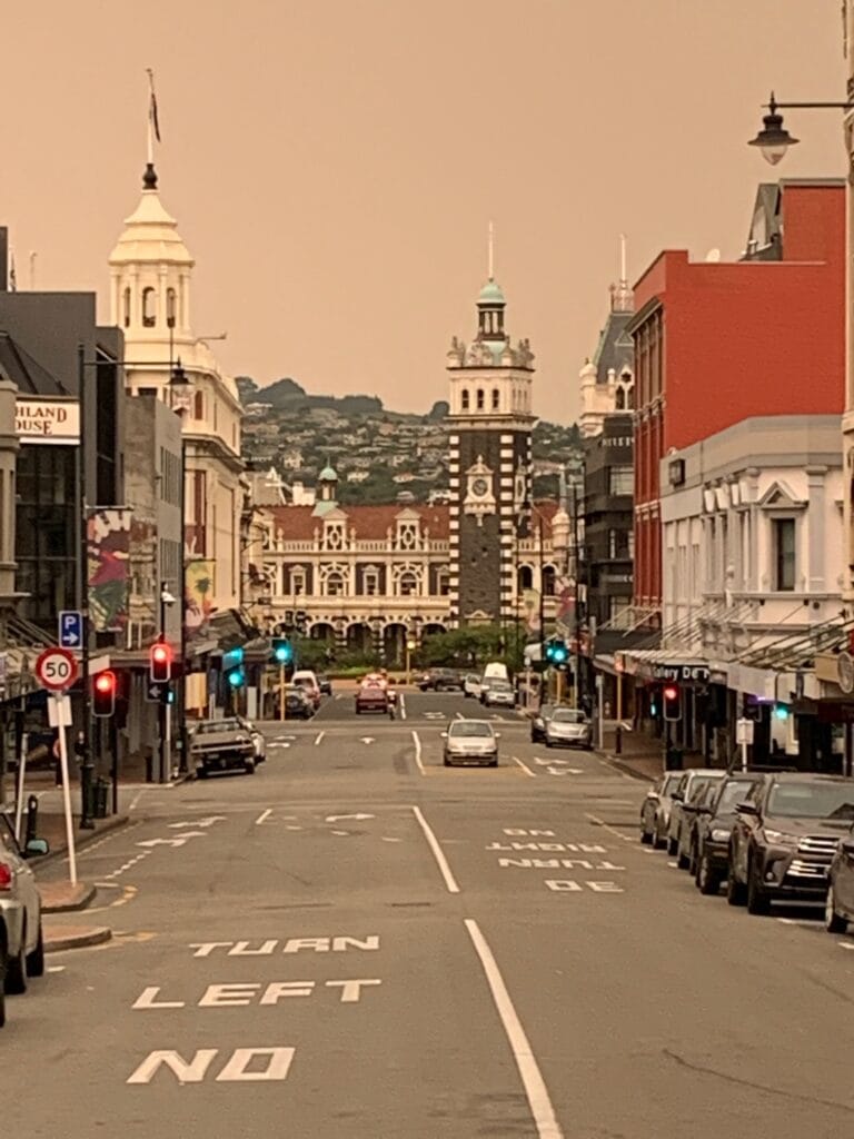
New Year’s Day was quieter. We took time to explore more of Dunedin’s streets, admired the grand railway station, and were struck by the eerie orange haze in the sky — smoke from the devastating Gippsland bushfires in Victoria, drifting over 2,000 kilometres across the Tasman Sea.
Tomorrow, we’d be back on the bikes — catching the Taieri Gorge Historical Railway to Middlemarch, the start of the Otago Rail Trail, and the next chapter of our New Zealand adventure.
Day 1 — Dunedin to Hyde
Distance: ≈ 30 km
Accommodation: Hyde – Daisybank Campsite (free camping)
We awoke to a rainy, overcast Dunedin morning — not the perfect start to a new trail, but a fitting one for New Zealand’s ever-changing weather. With the Taieri Gorge Railway scheduled to depart at 9:30 a.m., we had time for coffee and breakfast at Joe’s Garage (joes.co.nz) before heading to the station.
Bikes loaded onto the train, we settled into our seats for one of the most scenic rides in the country. The Taieri Gorge Railway wound its way out of Dunedin and into the hills, crossing high viaducts and plunging through tunnels as it climbed steadily inland. The mist clung to the valley walls, adding atmosphere to the journey and reminding us just how remote this part of Otago really is.
At Pukerangi, we unloaded the bikes and transferred them into a trailer for the short bus connection to Middlemarch, the official start of the Otago Rail Trail. After a quick lunch at the local café and a top-up on meals-in-a-bag supplies for dinner, it was time to ride.
We set out along the trail under drizzly skies, the gravel damp but rideable, and the landscape already wide and open — a different kind of beauty from the Alps to Ocean, more pastoral and rolling. The boys made their own fun along the way, trying to cover each other in mud as they navigated the puddles that lined the track — laughter echoing across the quiet plains.
Midway through the ride, we passed the Hyde Rail Disaster Memorial, a solemn reminder of New Zealand’s worst railway accident in 1943. The small monument beside the trail stood quietly against the grey sky — a moment that brought us all to a reflective pause before pedalling on.
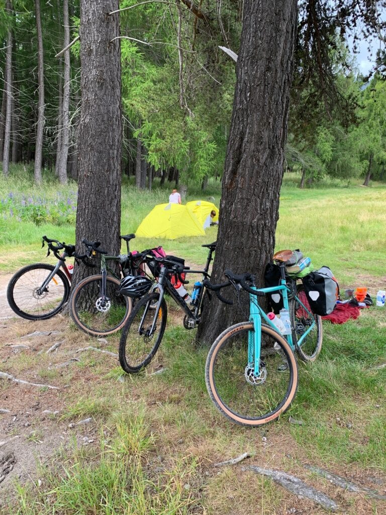
After roughly 30 kilometres, we reached our stop for the night — a free camping spot beside the Taieri River, north of Hyde. Tents up, dinner cooked, and the rain finally easing, we settled in for the night listening to the river run and the soft hum of insects in the grass.
Day 2 — Hyde to Ranfurly
Distance: ≈ 35 km
Accommodation: Ranfurly Holiday Park Motels & Cabins
Dinner: Ranfurly Hotel
After a comfortable night under canvas by the Taieri River, we took a relaxed start to the day — a mid-morning departure for what would be a relatively short ride of about 35 kilometres. The weather had finally turned our way, warm and sunny after several days of rain and grey skies, and the change lifted everyone’s spirits as we packed up and rolled north from Hyde.
The trail was in fine condition, cutting through open farmland and low hills as we followed the old rail line towards Tiroiti. Along the way we crossed the impressive Prices Creek Viaduct, one of the larger bridges on the trail, and soon after passed through the old Kokonga Station — a quiet, nostalgic spot that hinted at the railway’s heyday.
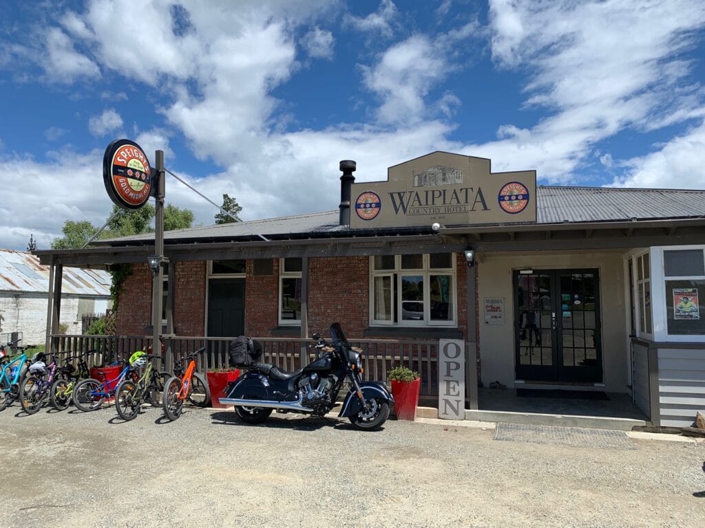
By midday we reached Waipiata, where we stopped at the Waipiata Hotel for lunch — a perfect pause in the sunshine with a cold drink and plenty of stories from the trail. From there, it was a gentle afternoon ride into Ranfurly, rolling into town early and taking time to explore its tidy main street and art deco charm.
Our accommodation for the night was at the Ranfurly Holiday Park Motels & Cabins — neat, compact, and friendly, though squeezing four of us into a single cabin may have been pushing its limits! Dinner that evening was at the nearby Ranfurly Hotel, a local institution that matched the town’s art deco character. Sadly, no pool table here — but a good meal and a relaxing night were just as welcome.
Day 3 — Ranfurly to Oturehua
Distance: ≈ 25 km
Accommodation: Crows Nest Accommodation (converted truck trailer)
Dinner: Oturehua Railway Hotel
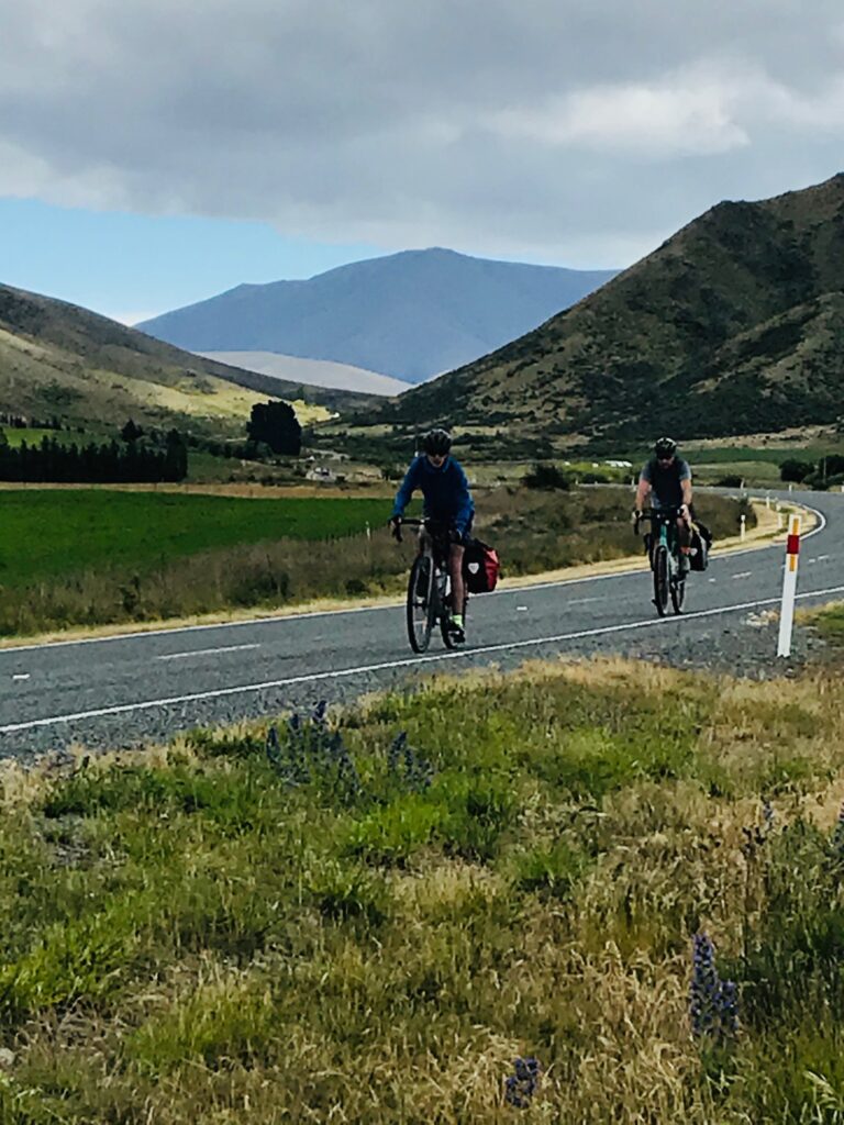
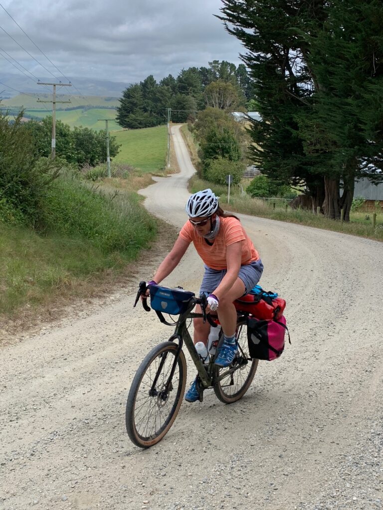
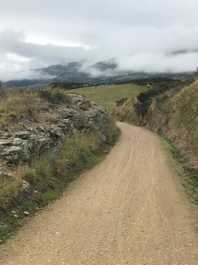
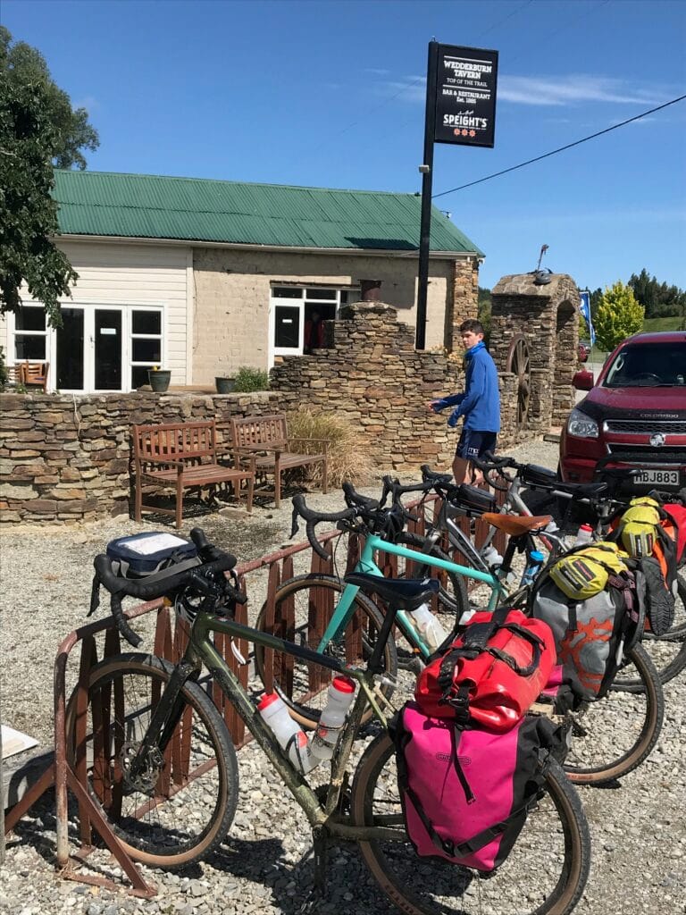
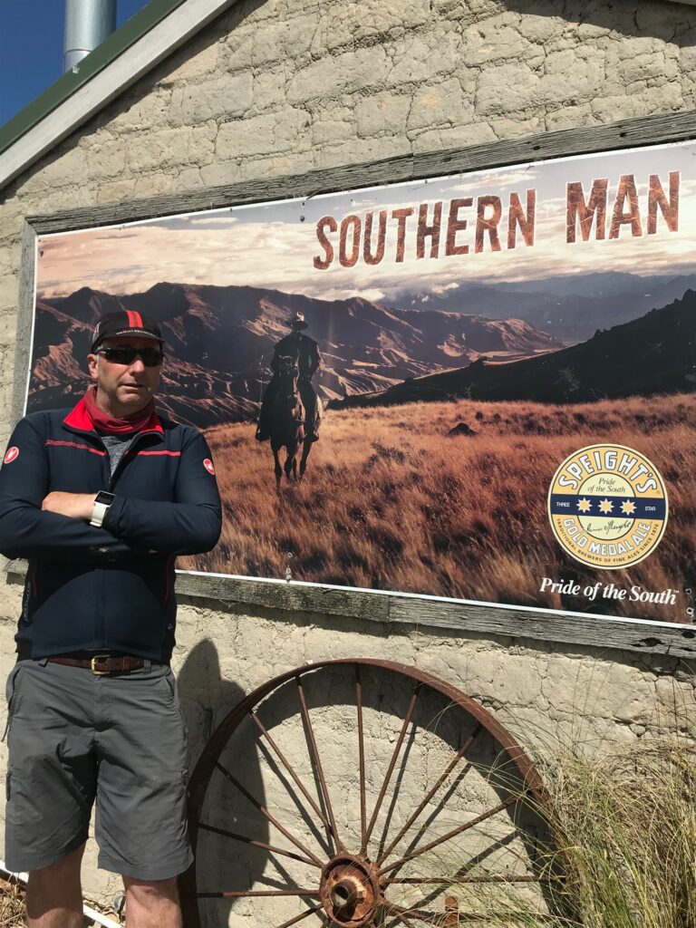
Another short day on the trail — around 25 kilometres — but a logical one, giving the boys an easier ride and setting us up nicely for the longer push towards Alexandra or Clyde in the days ahead. We left Ranfurly under wide blue skies, the weather finally settled into a proper Central Otago summer’s day — dry air, endless horizons, and the quiet rhythm of tyres on gravel.
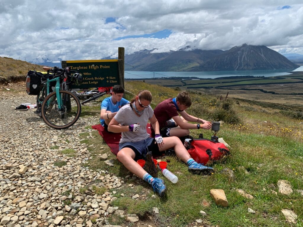
The trail led us gently through open farmland and past the tiny settlement of Wedderburn, before climbing gradually towards the highest point of the Otago Rail Trail, at 618 metres above sea level. A small sign marks the spot — and the welcome promise that it’s “all downhill from here.” While technically true, the undulating dirt roads still meant plenty of pedalling ahead!
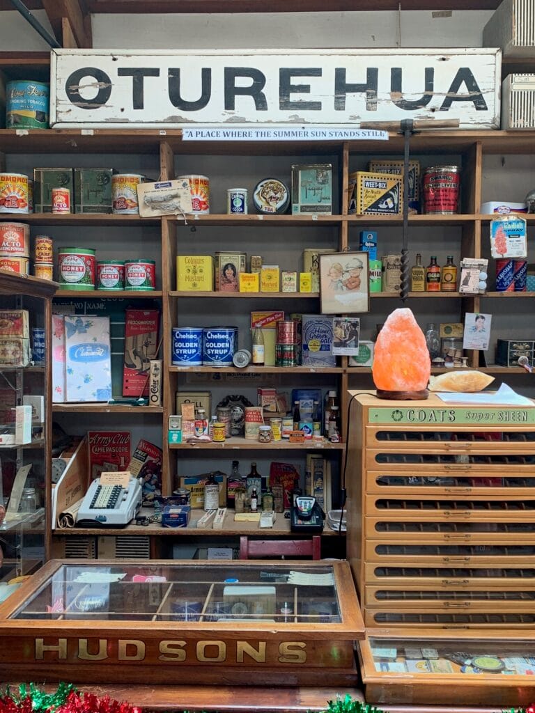
eyond the high point we reached the northernmost section of the trail before it began its slow turn southwest towards Oturehua. Rolling into town, we left the trail briefly to explore the historic T. Gilchrist & Sons General Store, established in 1902 and still filled with a mix of original fittings, old memorabilia, and modern-day treats. The boys happily stocked up on snacks while we browsed the shelves that seemed to capture more than a century of local life.
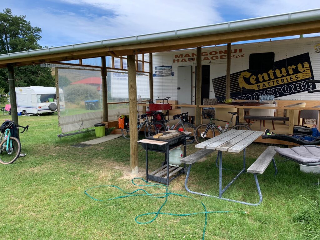
We had planned to camp again that night at Crows Nest Accommodation, but on arrival were offered an irresistible upgrade — for just a few dollars more, a converted truck trailer complete with bunks and space for all four of us. Too good to refuse, and a story we’d be telling for years to come.
Dinner was at the Oturehua Railway Hotel, a classic Central Otago pub full of character and charm. We tucked into hearty meals and sampled the region’s famous Pinot Noirs — a discovery that, to this day, remains one of our sons’ lasting favourites. The evening stretched lazily into night as we sat over drinks — beer for us, ginger beer for the boys — playing a few rounds of chess by the bar. It was one of those simple, contented evenings that stay with you long after the journey’s over.
Day 4 — Oturehua to Clyde
Distance: ≈ 65 km
Accommodation: Clyde – Antique Lodge Motel
Drinks: Victoria Store Brewery
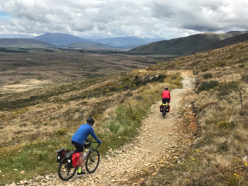
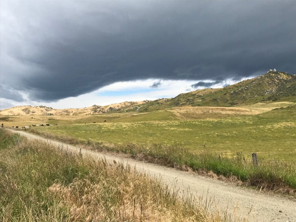
Our final day on the Otago Rail Trail — and one of the toughest. At around 65 kilometres, this would be our longest ride of the trail, and with the boys in tow we knew pacing and morale were going to be key. The early morning promised a fine day after the overcast conditions cleared, but the challenge would come not just from the distance — the rising afternoon headwind would make this a day in the saddle that the family still talks about.
Leaving Oturehua, the trail ran across wide-open plains, the landscape raw and beautiful but offering almost no shade. The sun wasn’t yet strong but climbed quickly; the gravel shimmered, and the still air of morning soon gave way to the dry heat of midday. Thankfully, the route itself was spectacular — one of the most scenic stretches of the whole trip.
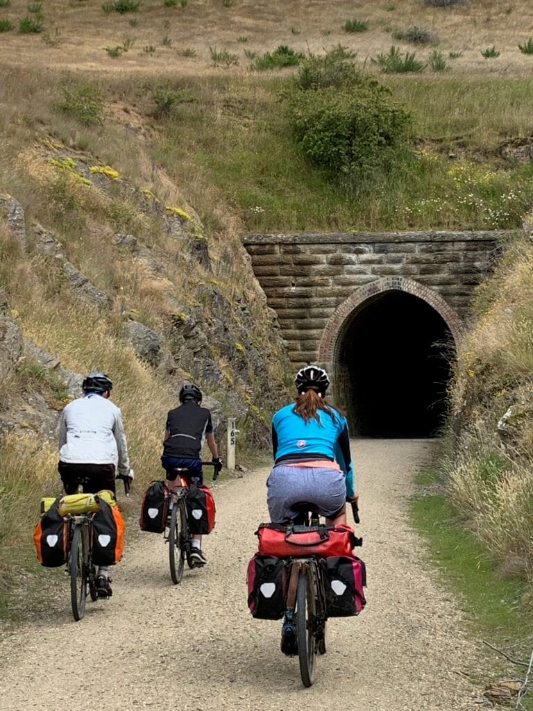
Not long after leaving town, we entered the section famous for its rail tunnels and viaducts. The two Poolburn Tunnels and the grand Poolburn Viaduct, spanning the Ida Valley far below, were absolute highlights — reminders of the incredible engineering that carved this trail through the Otago hills. From there, the track wound steadily towards Lauder, where we left the trail briefly for lunch at the Lauder Hotel — a welcome break and a chance to escape the heat for an hour.
Back on the trail, we passed through Omakau and Chatto Creek, following the course of the Manuherikia River as it dropped towards Alexandra. The scenery softened into green river flats framed by distant ridgelines, but the heat lingered and fatigue began to show.
By the time we reached Alexandra, the wind had swung north and picked up force — just in time for the final stretch to Clyde. What should have been an easy finish turned into a grinding headwind battle. The family spread out across the trail as we tried to find an acceptable cadence — our eldest pushing on ahead, me somewhere between, and Janette staying back with our youngest, who by that point had simply had enough. It was one of those long, hot, slow grinds where every kilometre seemed to take twice as long.
Eventually, we regrouped and rolled into Clyde — tired, dusty, but quietly proud. We checked into the Antique Lodge Motel, a cosy and well-earned rest, before celebrating the completion of the trail with a cold beer at the Victoria Store Brewery just up the road.
After four days and four nights on the Otago Rail Trail, the sense of accomplishment was real — a journey through history, landscapes, and shared effort. Tomorrow, we would begin the transition again, heading for Gibbston Valley and the start of the Queenstown Trails.

3. Queenstown Trails
Total Distance: ≈ 80 km (split into three distinct rides)
Accommodation:
- Arrowtown – New Orleans Hotel (2 nights)
- Queenstown – Crowne Plaza (3 nights)
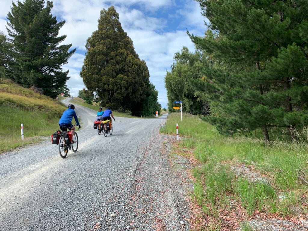
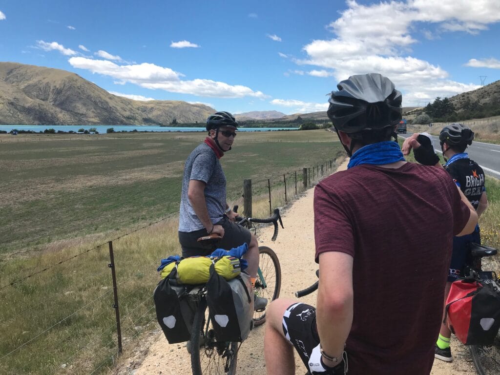
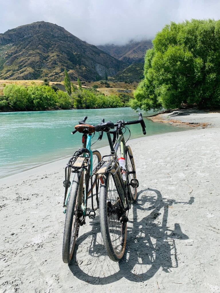
After completing the Otago Rail Trail, we shifted gears again — this time to the Queenstown Trails, a network of stunning routes weaving through the Kawarau Valley, Arrowtown, Lake Hayes, and Queenstown itself. In total, we covered around 80 kilometres, split into three distinct rides that each offered their own highlights and scenery.
Getting to the start of the trails took some careful planning. From Clyde, we organised a taxi large enough to carry four bikes and all our gear — a challenge in itself — and made the trip through Cromwell and the spectacular Kawarau Gorge. It’s a beautiful drive, but one we knew would have been unsafe for the boys on bikes given the narrow, winding roads and heavy traffic. The transfer dropped us off at Peregrine Winery in Gibbston Valley, where our Queenstown riding adventure began.
Ride 1 — Gibbston to Arrowtown
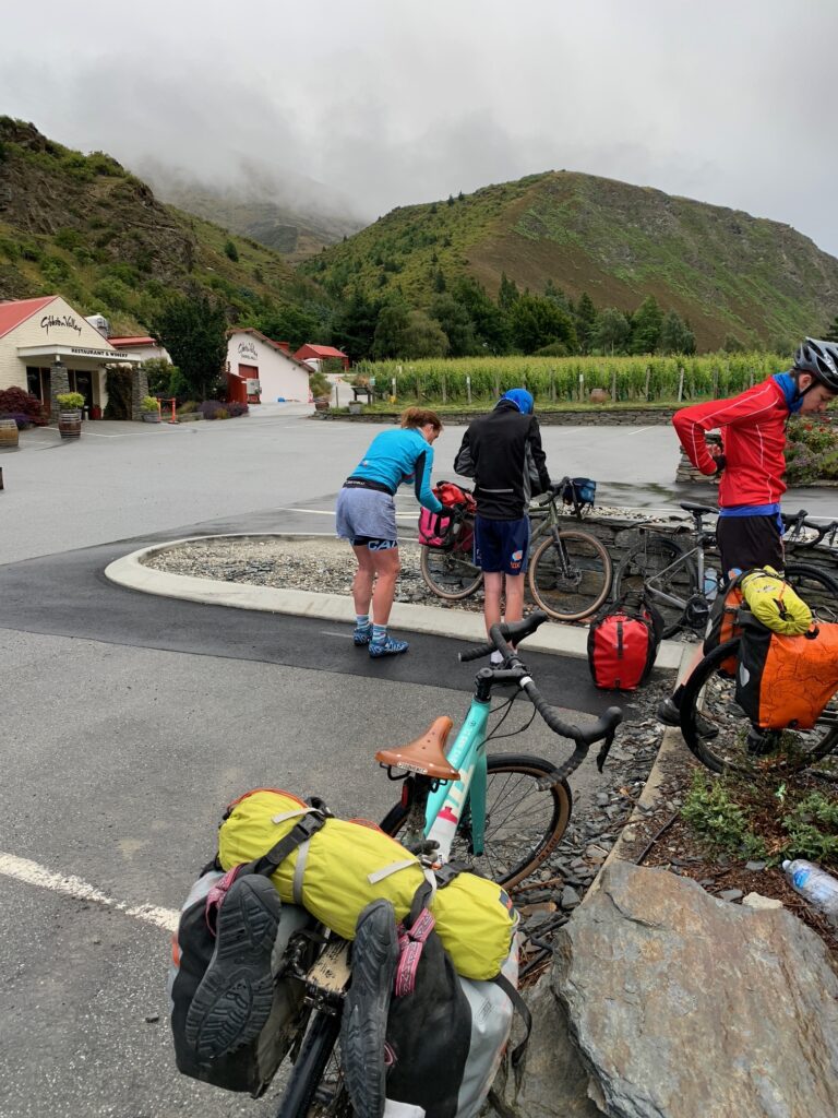
We left Clyde under overcast skies, the clouds hanging low over the hills as we loaded our bikes and gear into a taxi large enough to handle the four of us and all our panniers. The drive through Cromwell and into the Kawarau Gorge was both beautiful and tense — a narrow, winding stretch of road we were glad not to be cycling, especially with the boys.
By the time we reached our drop-off point at Peregrine Wines in Gibbston Valley, the weather had turned, and we stepped out into steady rain. After layering up in our wet-weather gear, we set off along the trail, winding our way between vineyards that shimmered under a fine mist, the rows of vines fading into the grey hills beyond.
The Kawarau Valley is a spectacular place to ride — even in the rain — and before long we reached a break in the weather just in time for a coffee stop at the Kawarau Bridge Bungy Centre, the site of the world’s first commercial bungy jump. Watching others take the plunge while we sipped hot drinks was entertainment enough.
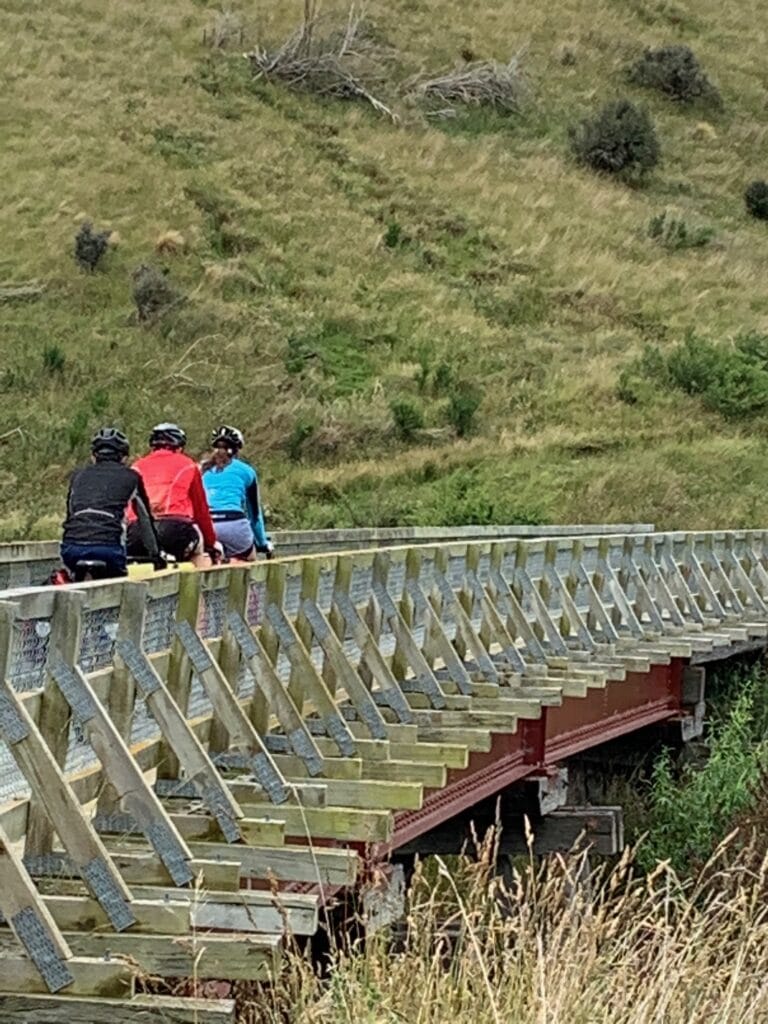
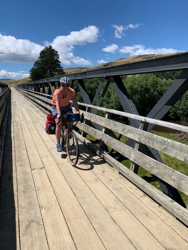
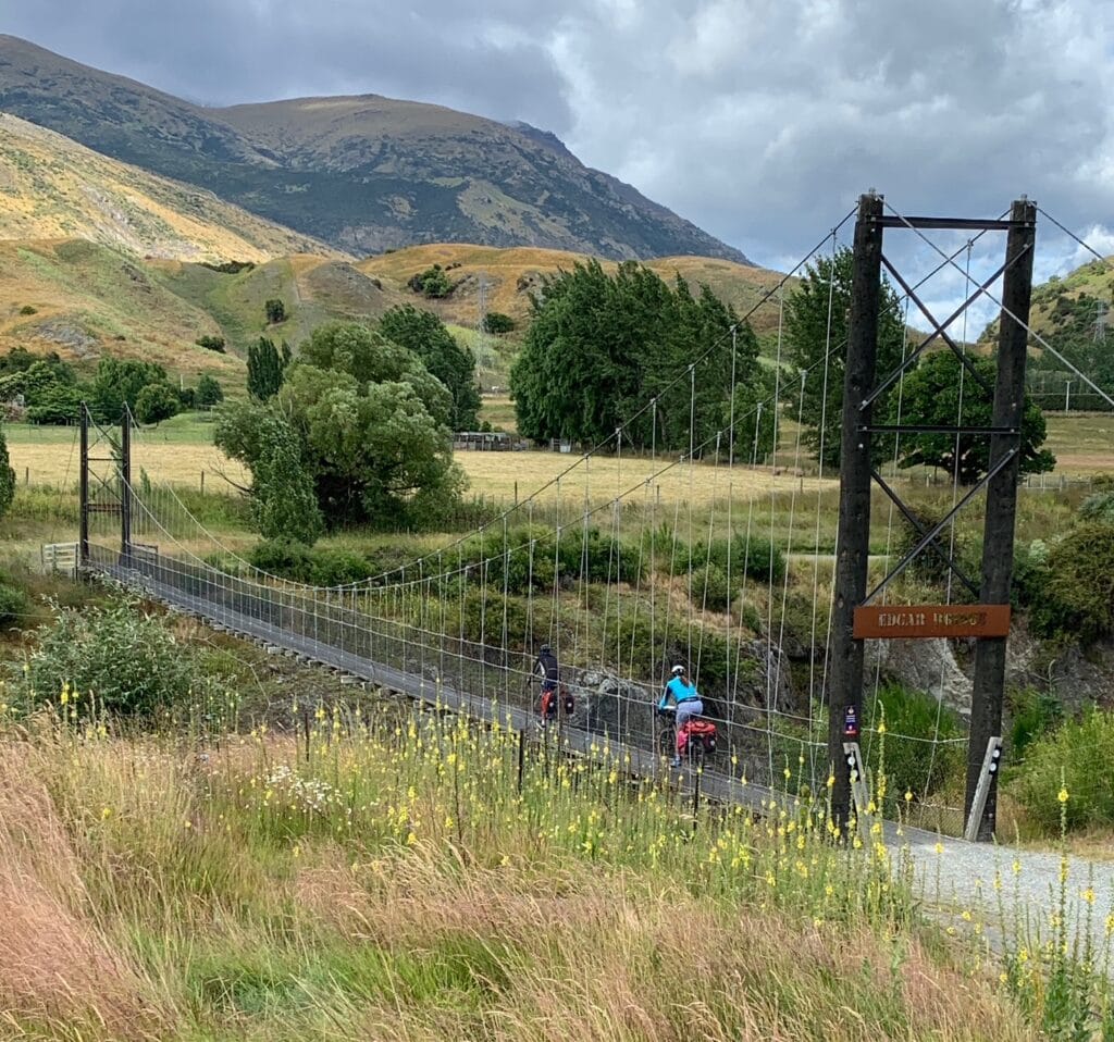
Crossing the bridge, we followed the Queenstown Trail as it climbed gently above the valley floor, offering sweeping views over the river and the terraced vineyards below. The trail also carried us across the spectacular Edgar Bridge, a graceful span suspended high over the Kawarau River — one of the highlights of the ride — before turning gradually toward Arrowtown.
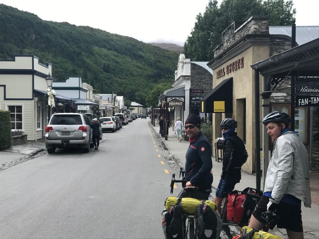
Despite the damp start, the air was fresh, the scenery breathtaking, and the sense of adventure — that familiar mix of effort and reward — fully alive again. We rolled into Arrowtown later that day, soaked but smiling, grabbed a pie from the Arrowtown Bakery and ready to settle in for two nights at the New Orleans Hotel, the perfect base for exploring the next sections of the Queenstown Trails.
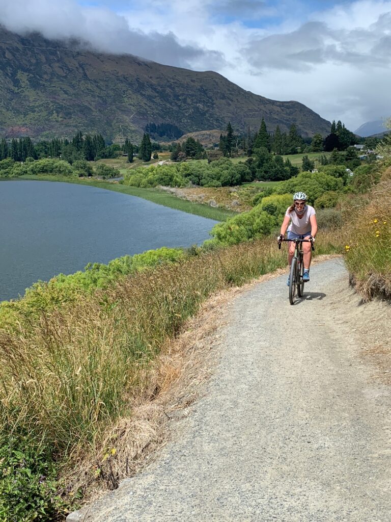
Ride 2 — Arrowtown, Lake Hayes & Kawarau River Loop
The next morning dawned clear and bright — sunny skies at last. With the boys opting for a slower start, Janette and I decided to make the most of the weather and explore the Arrowtown trail network on our own.
We retraced our route down the Arrow River Valley, following the gentle flow of the water through open countryside before beginning the climb up Mōven Hill. The views from the top were worth the effort — a patchwork of vineyards and farmland spread out below, framed by the surrounding mountain ranges.
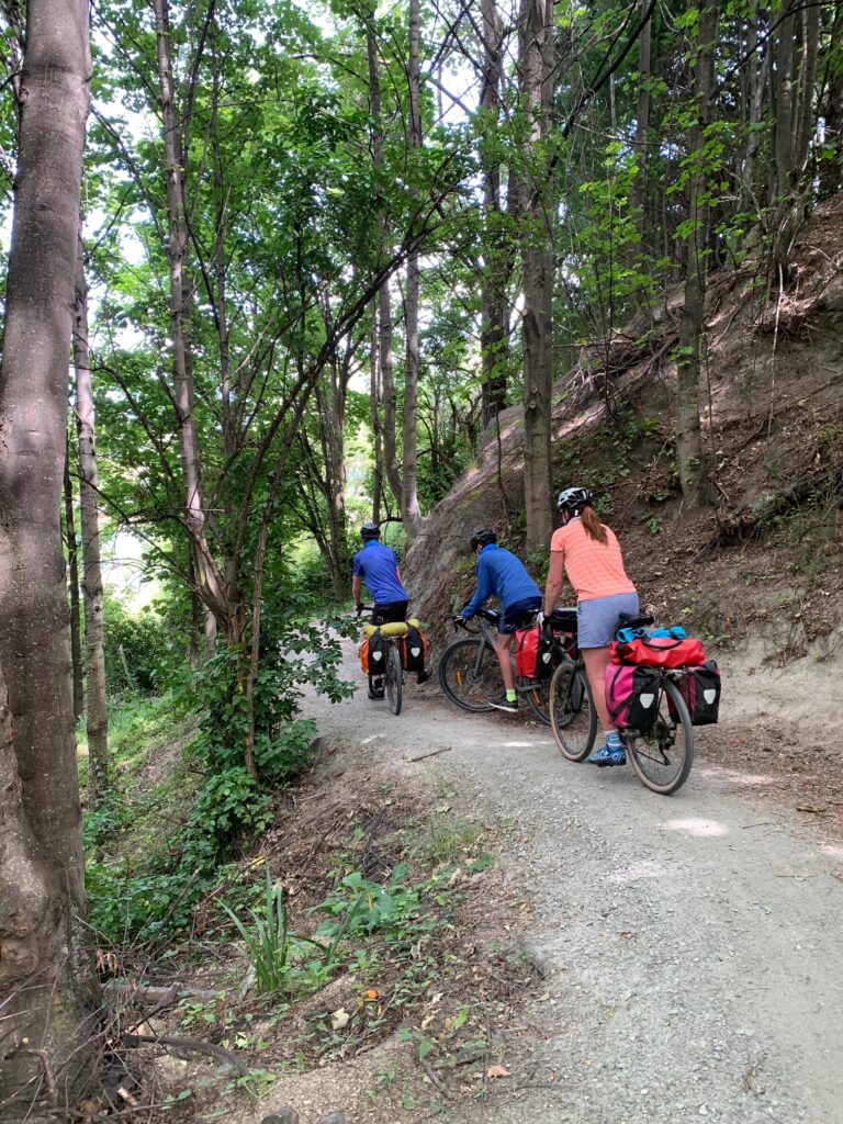
From there, the trail continued along the Kawarau River, tracing its sparkling bends before turning north towards Lake Hayes and Ayrburn. The scenery was classic Central Otago — golden grass, deep blue water, and wide skies that seemed to stretch forever. We passed the Arrowtown Golf Course, then looped back toward town along the Arrow River Bush Trail, a flowing singletrack section that wound through shaded gullies and native bush — a highlight of the ride.
It was one of those perfect mornings on the bikes: warm sun, quiet trails, and the easy rhythm of riding without a schedule. By the time we rolled back into Arrowtown, the coffee shops were filling and the day was heating up. A leisurely morning ride, full of everything that makes cycling in New Zealand so rewarding.
Ride 3 — Arrowtown to Queenstown via Shotover Country and Frankton
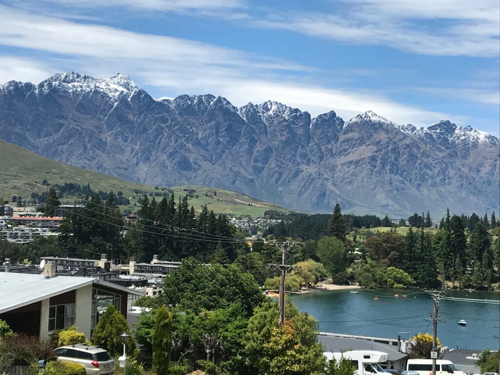
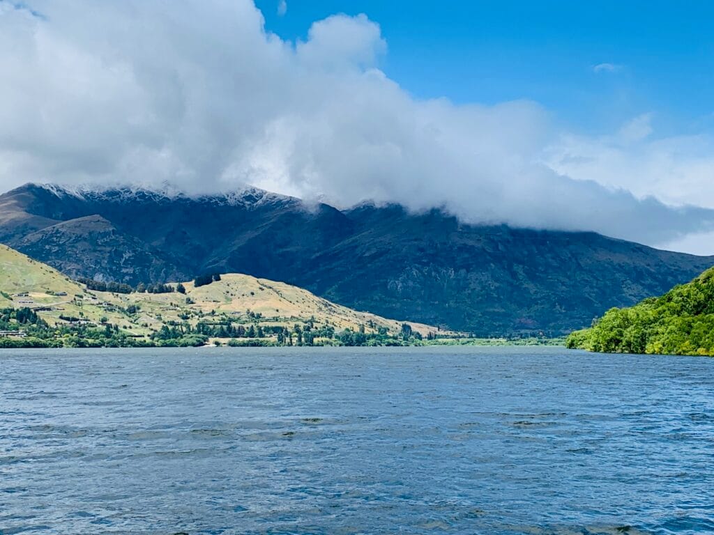
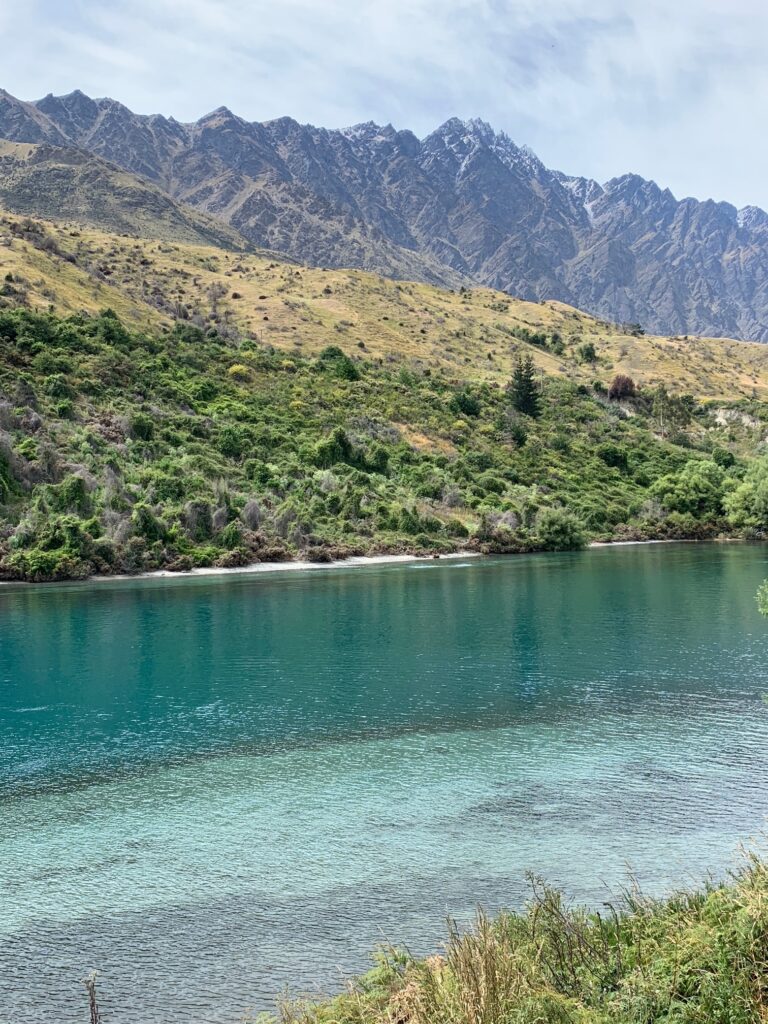
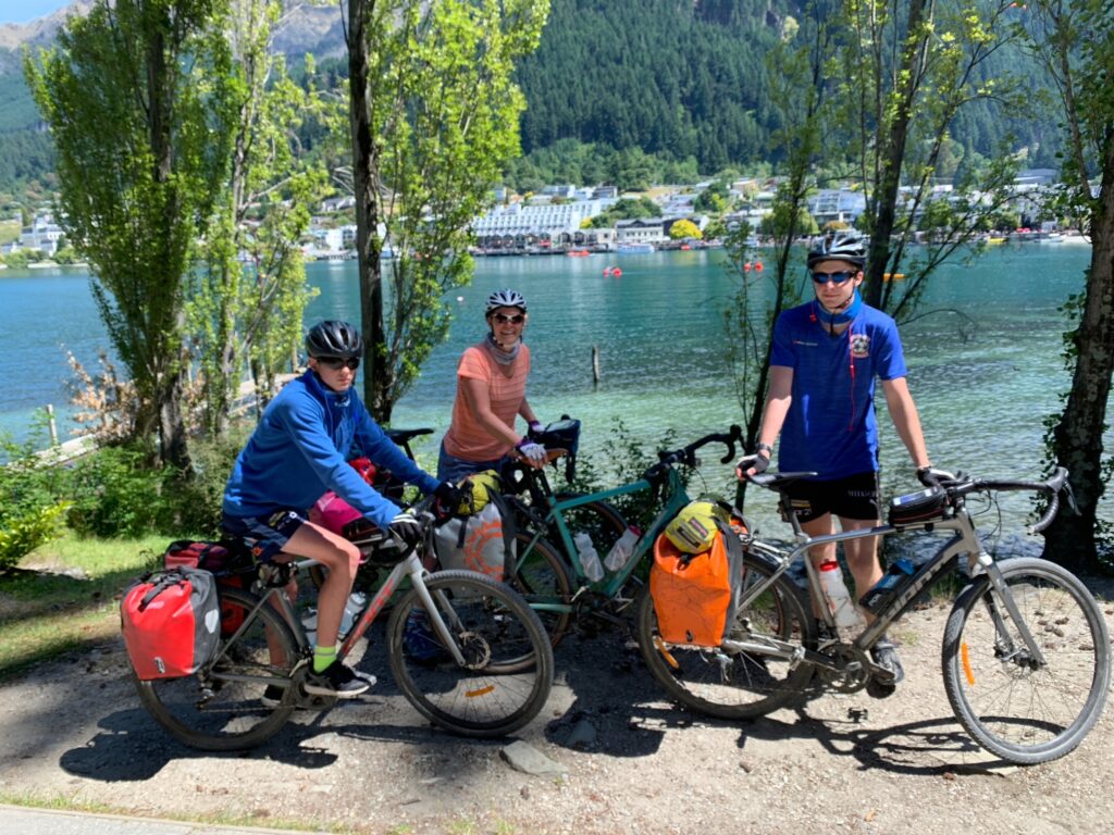
Our final leg took us from Arrowtown to Queenstown, a longer day that wound through Shotover Country, Frankton, and along the lakeside trails into Queenstown Gardens. The views across Lake Wakatipu were spectacular, with the Remarkables rising in the distance — a fitting finale to our South Island cycling journey.
We rolled into Queenstown in the late afternoon and checked into the Crowne Plaza, our base for the next three nights to do the sights properly. After so many days on the trail, it felt good to park the bikes, relax, and enjoy a bit of comfort while exploring one of New Zealand’s most famous towns.
Highlights
Learnings
The helicopter transfer across the Tasman River was an unforgettable way to start
the rugged climb through the Ahuriri Conservation Park all stood out as quintessential South Island experiences — big skies, open landscapes, and quiet satisfaction at each day’s end.
he Poolburn Tunnels and Viaduct were spectacular, while towns like Lauder, Ranfurly, and Oturehua offered warmth, history, and small-town hospitality.
Riding the Kawarau Valley wineries, the Edgar Bridge, and the Arrow River Trails showcased the region’s beauty in full.
Shared Moments & Milestones – Christmas morning in a tent, boys racing up the 900-metre climb near Ōhau, improvised dinners of pot noodles and laughter, pub pool games in small towns, and a hotel opened just for us in Ōamaru — moments that define family travel at its best.
Kids Rise to the Challenge – Whether tackling steep climbs, long days, or cash-only pubs, the boys showed independence, humour, and resilience. Setting small challenges — like “first to the top” — kept motivation high and spirits up.
Plan for Logistics — But Embrace Flexibility- Moving bikes, bags, and people between towns took planning, but it always came together
New Zealand’s Cycle Infrastructure is Exceptional:
Weather Can Change Everything – layering and preparation are everything. Wet-weather gear wasn’t optional — it was essential
The Journey Matters More Than the Distance – Every day brought its own rhythm — from 25 km to 65 km — but the memories came from what filled those kilometres: the people we met, the shared meals, and the sense of discovery that only slow travel brings.
Leave a Reply