Background and Overview
It started with a simple question:
“Where would you like to spend your birthday and have an early winter escape?”
The answer came easily.
“I’ve always wanted to go and see the Art Silos of Western Victoria — and maybe revisit some childhood netball memories of the Mildura Carnivals. And while we’re up there, perhaps see what all the fuss is about at Stefano’s.”
And so, a winter ride was born — one that would wind its way through Victoria’s broad western plains, up into the Mallee country and along the Murray River. A journey that promised open skies, quiet country towns, and long, empty roads bordered by wheat stubble and ghost gums.
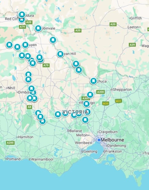
Unlike our first motorbike tour, this one came with camping gear on board, with plans to spend a night under the stars in Murray-Sunset National Park — the heart of Victoria’s far northwest and one of the state’s true outback landscapes. The rest of the route would trace the silos of Brim, Sea Lake, Patchewollock, and beyond, before cutting north to Mildura, then following the Murray east through small river towns, ending the loop in Echuca before the final ride home.
It would be a trip of country pubs, crisp winter mornings, with the Sunraysia region providing some necessary warmth, and warm fires — as required — at the end of long days in the saddle, the kind of slow travel that celebrates both the ride and the road.
Trip Summary
Duration: ~7 Days
Trip Type: Motorcycle Touring & Light Adventure — Paved and Unpaved Roads
Accommodation: Mix of pubs, guest houses (found on Booking.com), and camping grounds
Route Distance: Approx. 1,300 km
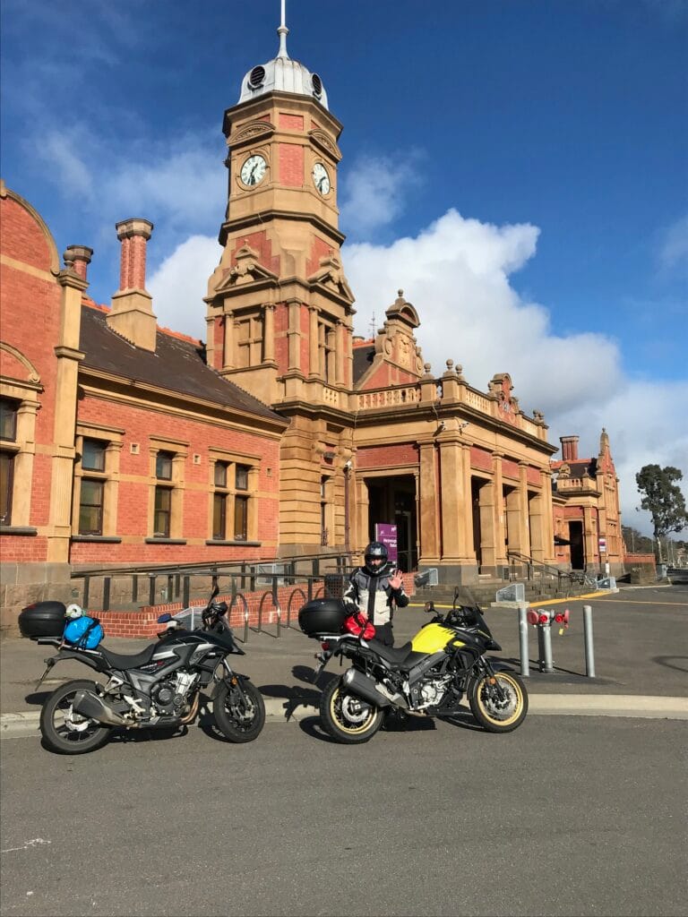
Day 1 – Home → Great Western
Route: Home → Kyneton → Castlemaine → Maryborough → Avoca → Ararat → Great Western
Distance: ~270 km
Diary
We awoke ready to leave Melbourne and make our way northwest toward Great Western, debating whether to take the more direct M8 / A8 Western Highway or the slower, scenic Pyrenees Highway through Castlemaine, Maryborough, and Avoca. The Pyrenees route promised more variety — smaller towns, rolling countryside, and a chance to pass through places we hadn’t explored before — so that’s the way we went.
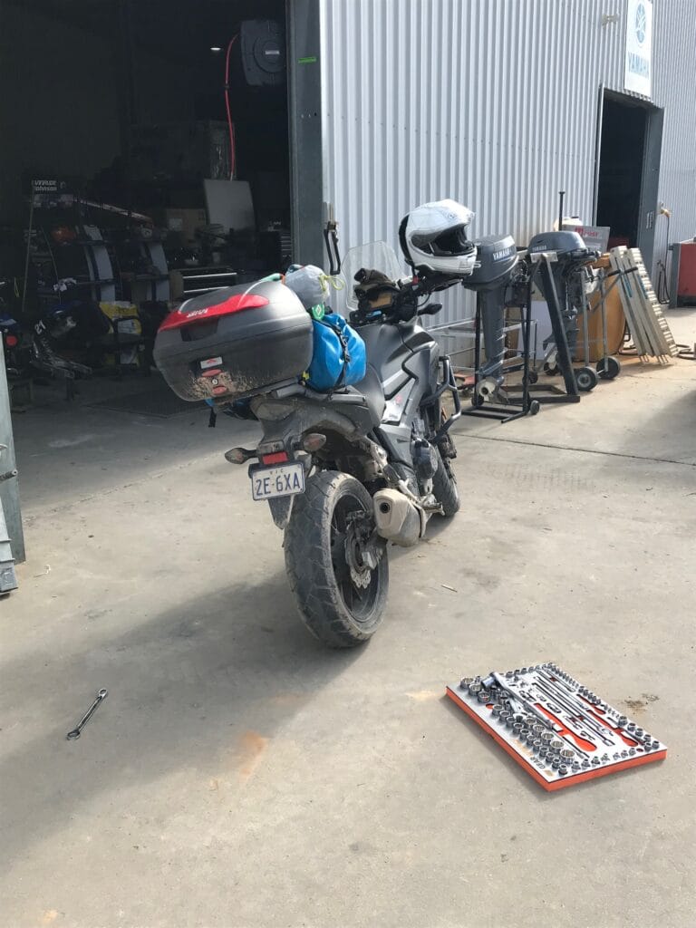
Bags packed, gear on, bikes prepped — or so we thought. The moment the bike was rolled forward, something felt off. The rear wheel sagged; a quick glance confirmed the worst — a puncture. Motivation dropped instantly, replaced by the practical focus of getting it fixed before we could even start the ride. With the tyre re-inflated using a hand pump, we decided to ride our luck and nurse it toward a proper repair.
By 9 a.m. we were at Pablo’s Tyres in Glen Waverley, an unexpected southeast detour that added nearly a hundred kilometres before we’d even truly begun heading west. Tyre replaced, coffee in hand, spirits lifted, and we were back home by mid-morning to repack and reset for the real start.
This time we took to the M79 Calder Highway, cutting across to Castlemaine, where we stopped for a late lunch at Saff’s Café. The ride beyond Castlemaine was a relaxed and enjoyable run through Maryborough and Avoca, each town sitting quietly under the soft light of a midwinter afternoon. The Pyrenees Highway delivered exactly what we’d hoped for — broad open farmland, easy sweeping bends, and very little traffic.
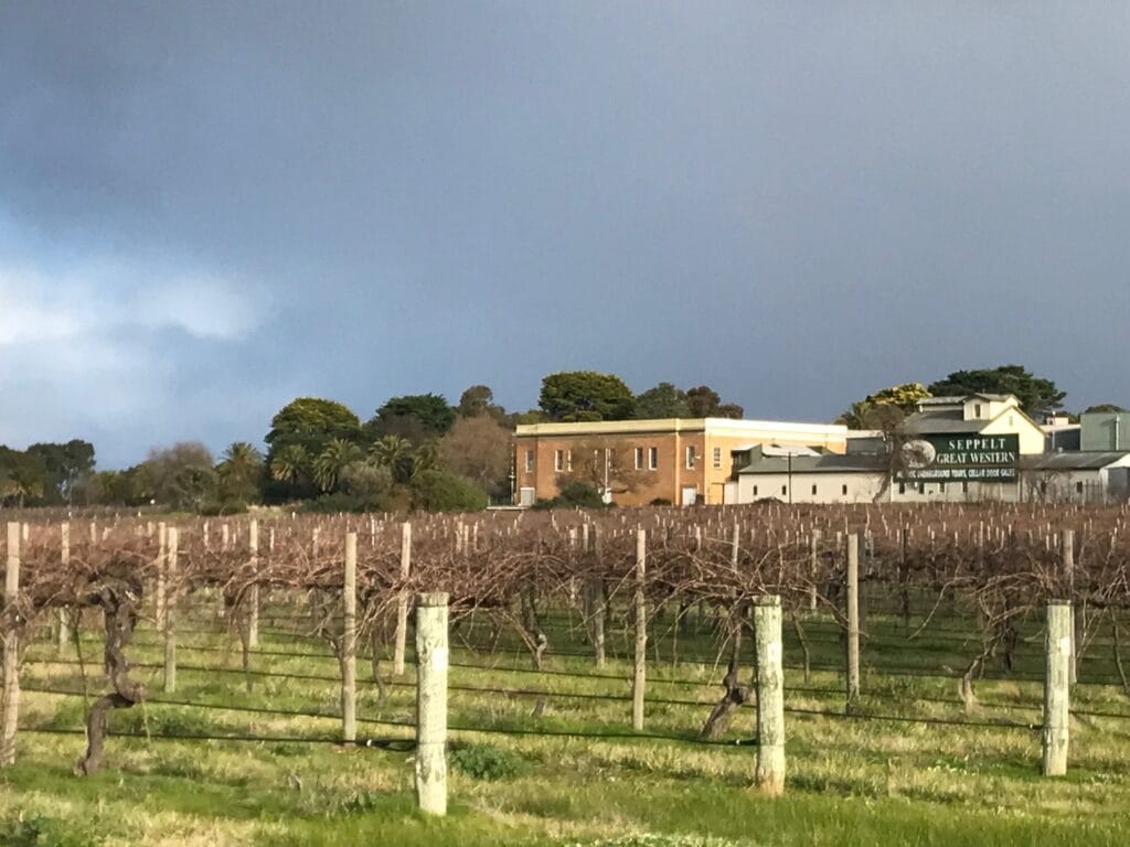
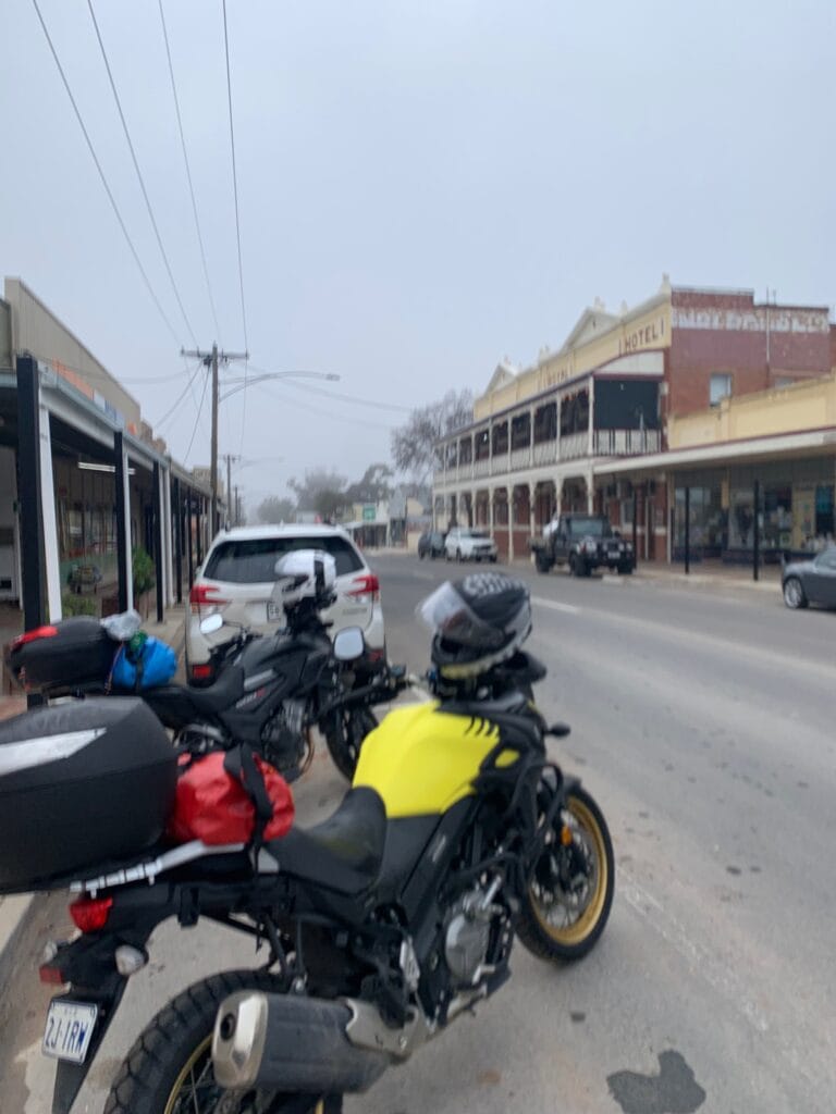
By late afternoon we rolled into Great Western, checked into the Great Western Hotel, and rode out to visit one of the region’s historic wineries — Seppelt’s. Known for its Méthode Champenoise (is that ok with our French followers 🙂 sparkling wines and century-old underground cellars, it was the perfect first-day wind down. A tasting or two later, we returned to the pub for dinner and our first overnight stay of the trip.
A delayed start perhaps, but the day ended just as we’d hoped — good roads, good wine, and a warm bed to finish it off.
Accommodation, Drinks and Meals
Accommodation: Great Western Hotel
Lunch: Saff’s Café, Castlemaine
Afternoon Drinks: Seppelt’s Winery, Great Western
Dinner: Great Western Hotel (surrounded by the local football team celebrating post-match)
Highlights
Riding on a re-inflated tyre to reach Glen Waverley for repairs
Smooth, scenic run through the Pyrenees Highway towns – a great inland highway!
Relaxed afternoon tasting at Seppelt’s Winery

Day 2 – Great Western → Sea Lake
Route: Great Western → Deep Lead → Glenorchy → Rupanyup → Murtoa → Warracknabeal → Sheep Hills → Brim → Beulah → Hopetoun → Sea Lake
Distance: ~245 km
Day two dawned overcast and cold, though the skies stayed mercifully clear. Today’s plan was simple but special — make our way north toward Sea Lake, and along the way, follow the Silo Art Trail that had inspired the trip in the first place.
We left Great Western and headed north up the A8, hoping to find breakfast in Stawell, but discovered that even bakeries sleep in on a Sunday — doors still closed before 10 a.m. Undeterred, we pressed on, turning through the back roads of Deep Lead until we joined the B210, heading toward Rupanyup.
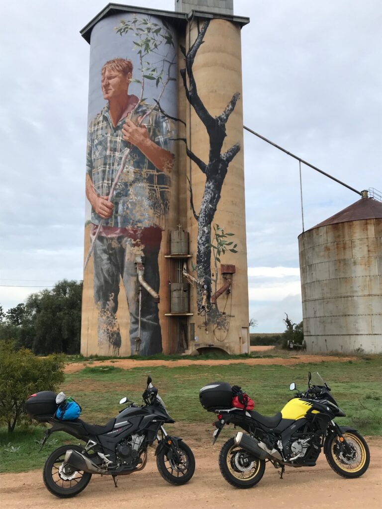
Rupanyup offered both food and art — a warming breakfast at The Blacksmith’s Café, and the first of many silo murals we’d come to admire on this leg of the journey. From there, we rode north toward Murtoa, where we detoured off the B240 to visit the Murtoa Stick Shed, an enormous timber cathedral of grain storage once built for wartime reserves. The sheer size and craftsmanship of the structure were remarkable — and right next door, another beautifully painted silo, marking our second of the day.
Continuing north through the Wimmera plains, we stopped at Sheep Hills for another mural, the brilliant colours standing out against the blue sky, and rolled through Warracknabeal toward Brim, where the now-iconic Brim silos have become the unofficial symbol of the entire trail. The small towns came and went, each linked by railway lines and silent grain elevators that told the story of a busier agricultural past.
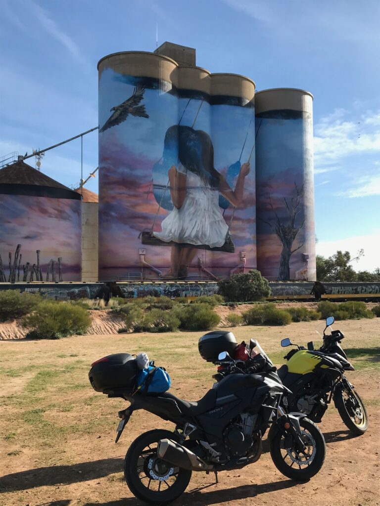
By mid-afternoon, we were back on the B200, continuing through Beulah for a quick coffee and a rest stop, before turning north through Hopetoun and finally east to Sea Lake, our stop for the night. The last stretch into town was quiet and reflective — the long flat roads, open sky, and endless silos giving the day a rhythm all its own.
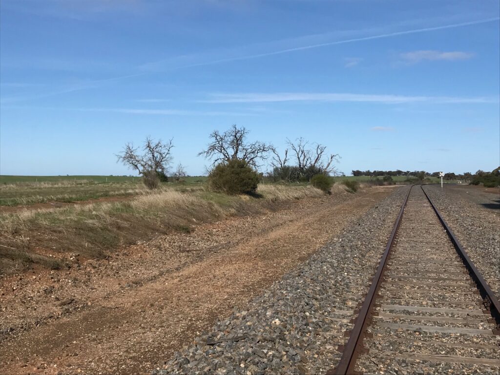
Dinner and accommodation were at the Royal Hotel, Sea Lake, where conversation quickly turned to the region’s past railways — after a day spent constantly crossing tracks, it was clear how much of rural Victoria was once connected by train. Over a beer, we watched a group of eight fellow motorcyclists roll in — a selection of big BMW GSs, a Honda Africa Twin, and a few KTM adventure bikes — all caked in Murray mud and dusted from the trail. They were seasoned riders, coming in from the Western District and heading next toward the High Country. Shared stories, mutual respect, and a laugh or two wrapped up what had been a full and rewarding day.
Accommodation, Drinks and Meals
Accomodation: Royal Hotel, Sea Lake
Breakfast: The Blacksmith’s Café, Rupanyup
Coffee Stop: Beulah
Dinner: Royal Hotel, Sea Lake
Highlights
Visiting the historic Murtoa Stick Shed and multiple silo art sites
Wimmera backroads and winter riding through the Silo Art Trail
Evening with fellow adventure riders at the Royal Hotel


Day 3 – Sea Lake → Murray-Sunset National Park (Lake Crosby Campground)
Route: Sea Lake → Lascelles → Patchewollock → Walpeup → Underbool → Murray-Sunset National Park (Pink Lakes / Lake Becking)
Distance: ~164 km
Heading west on the Sea Lake–Lascelles Road and easing into the familiar rhythm of the Silo Art Trail once again. The first stop was Lascelles, home to another striking mural, before continuing north to join the B222 through Speed and turning west toward Patchewollock.
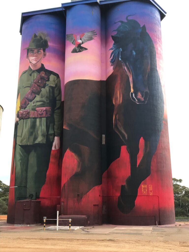
Patchewollock greeted us with another fine piece of silo art, inspired by the ANZACS and the charm of small-town hospitality. A quick stop at the local café turned into one of those memorable travel moments — being served by a young local girl between studying for her final year of secondary school. She explained how students in the district are collected by bus each morning and travel all the way to Ouyen for school — not exactly a short commute. It was a simple exchange, but one that reminded us how remote and resilient life is out here.
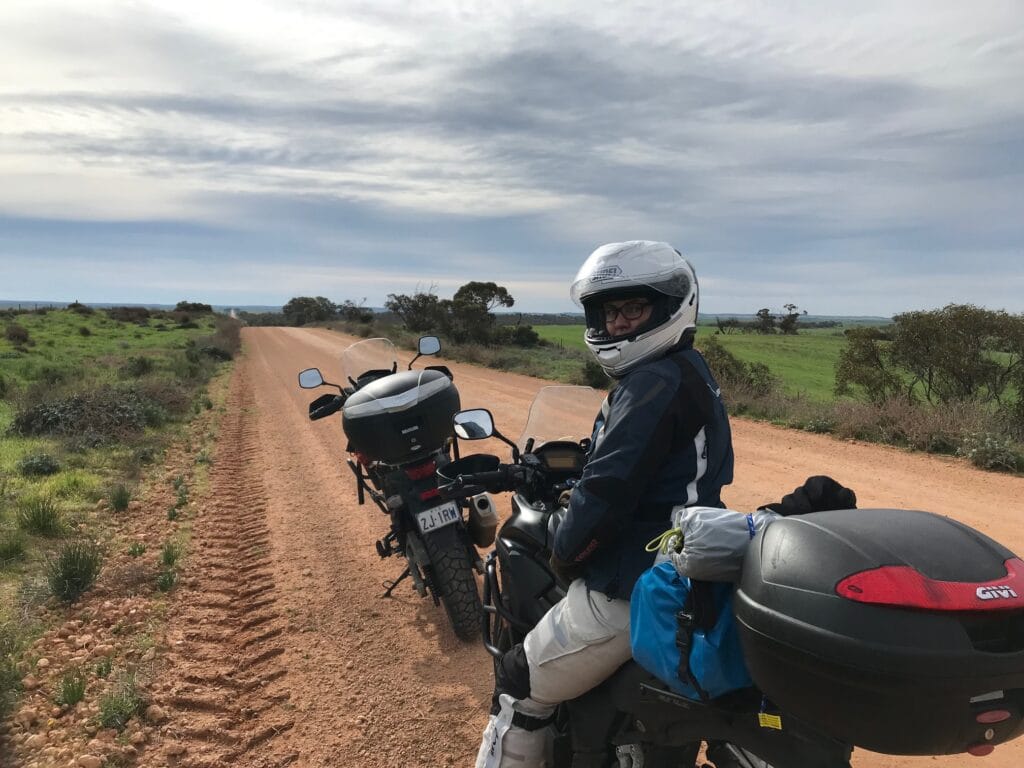
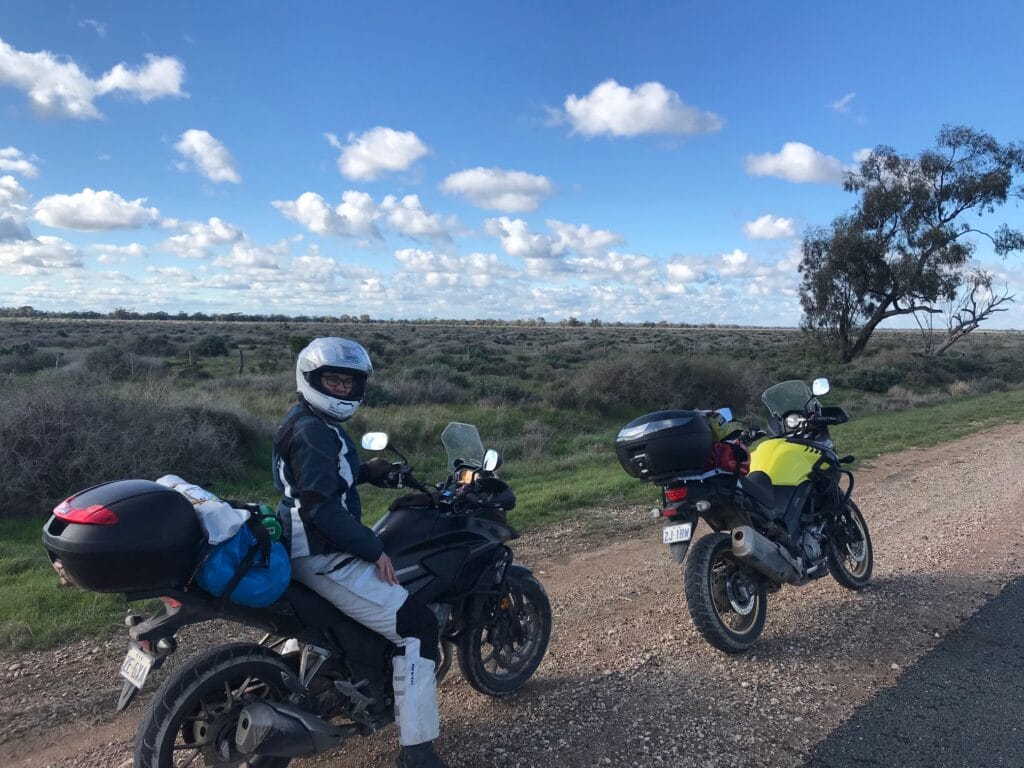
Leaving Patchewollock behind, we continued north, sharing the road with a steady flow of grain trucks and service vehicles, the lifeblood of the Mallee in motion. Turning onto the C247, we reached Walpeup, checked off another silo, and then turned left onto the Mallee Highway, heading west through Underbool. From there, we pointed the bikes onto the dirt roads leading into Murray-Sunset National Park.
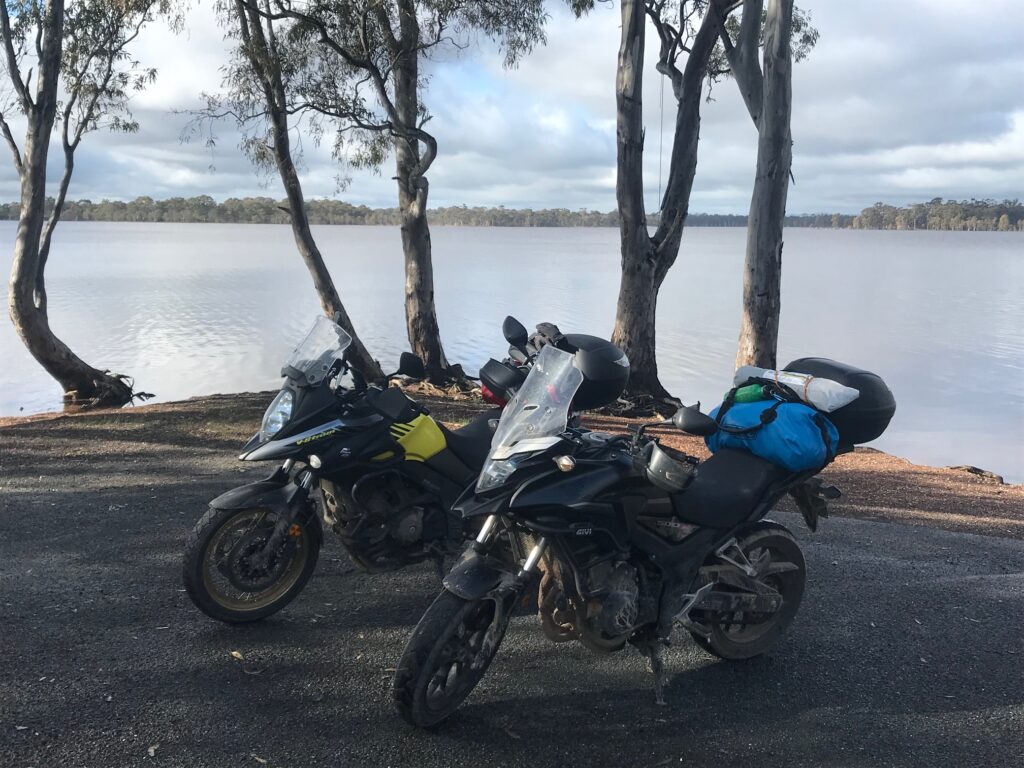
Conditions were perfect — dry, firm, and grippy underfoot — as we rode down the Pink Lakes Road, a scenic stretch through saltbush and mallee scrub. We looped around Lake Crosby and Lake Becking following some of the sandy tracks . The lakes shimmered softly under the afternoon light, the landscape painted in pastel pinks and greys — unmistakably Murray-Sunset.
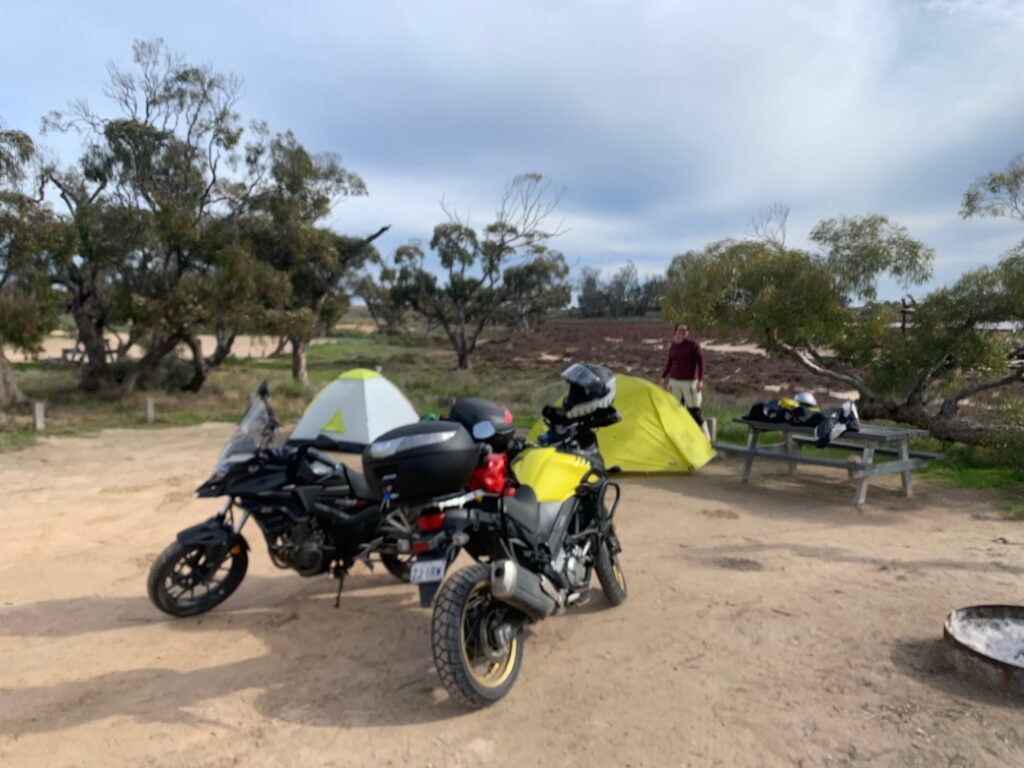
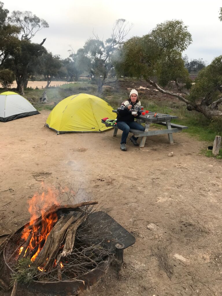
By late afternoon we reached the Lake Crosby Campground, pitched our tents, and gathered firewood for the evening. As darkness fell, the silence of the desert settled in — just the crackle of the fire, a canopy of stars above, and the faint scent of salt on the night air.
Dinner was self-catered, an Italian-inspired rice stew of salami, tomato, and vegetables, cooked over the camp stove beside the fire — simple, hearty, and perfect after a day of dirt roads and big skies.
Accommodation, Drinks and Meals
Accommodation: Camping, Lake Becking Campground – Murray-Sunset National Park
Brunch : Café, Patchewollock
Dinner: Self-catered Italian-inspired rice stew (salami, tomato & vegetables)
Highlights
Exploring silo art at Lascelles, Patchewollock, and Walpeup
Riding the dry dirt tracks through Murray-Sunset National Park
Peaceful night camping beside the Pink Lakes under a clear winter sky
Day 4 – Murray-Sunset → Mildura
Route: Murray-Sunset National Park (Lake Crosby) → Underbool → Ouyen → Red Cliffs → Mildura
Distance: ~180 km
Overnight rain — steady, persistent, and loud — kept us awake for most of the night in our tents at Lake Crosby. As we listened to the drops hitting the flysheet, thoughts turned to the clay road we’d ridden in on, now likely slick and unpredictable after hours of rain. Morning light confirmed it: the track out of Murray-Sunset National Park had turned into a patchy, slippery challenge. We inched our way back toward the Mallee Highway (B12), taking it slow and cautious, every corner a reminder that out here, the clay doesn’t forgive impatience.
Once safely back on sealed road, we turned east toward Ouyen, grateful for traction again, and pulled into the Ouyen Mallee Bakery for a much-needed breakfast — hot coffee, fresh pastries, and a chance to dry off and regroup. From there, the ride continued north on the A79, an easy, open run through Red Cliffs and on to Mildura.
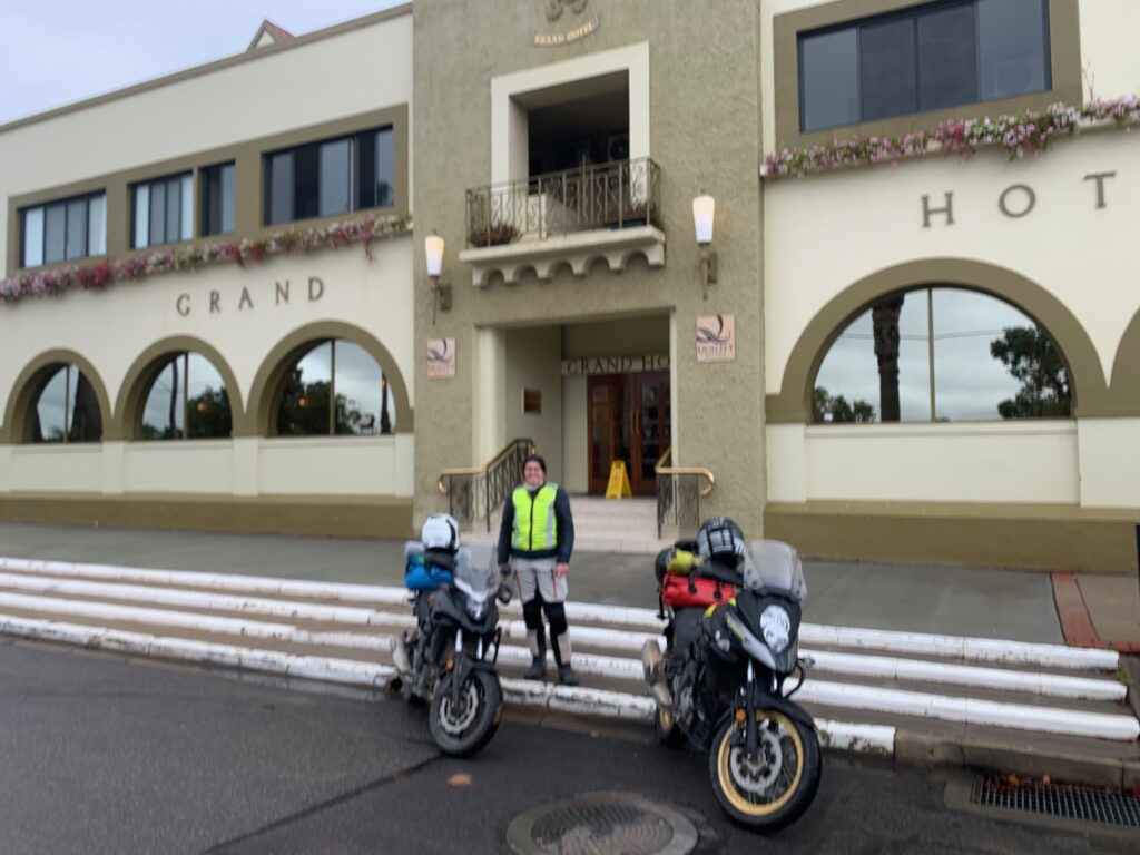
The plan had been to camp again on the Murray, but with the weather still unsettled and the gear damp, we decided on comfort over canvas, checking into the Mildura Grand Hotel — grand by both name and presence. The hotel dates back to the pioneering days when the Murray River was the main artery of inland trade, carrying wool, grain, and goods up and down between settlements.
By evening, with clothes hung to dry and a change into civvies complete, it was time for one of the trip’s anticipated highlights — dinner at Stefano’s. The restaurant, beautifully set beneath the Grand Hotel, offered a polished menu and elegant atmosphere. The dishes were exquisitely prepared — especially the seafood pastas — though perhaps a touch too ocean-heavy for our tastes. The sardine-rich pasta in particular wasn’t quite our thing, but it was still a meal worth savouring and an experience long remembered.
As the night wound down, it was easy to see why this region is often called “the food bowl of our country.” From the vineyards and orchards surrounding Mildura to the broad sweep of the Murray that nourishes it all, this is where much of Australia’s produce begins its journey.
Accommodation, Drinks and Meals
Accommodation: Mildura Grand Hotel
Breakfast: Ouyen Mallee Bakery
Drinks: Local pub, Mildura
Dinner: Stefano’s Restaurant, Mildura
Highlights
Navigating slippery clay roads out of Murray-Sunset after overnight rain
Settling into the heritage Mildura Grand Hotel
Dining at the iconic Stefano’s in the heart of Sunraysia
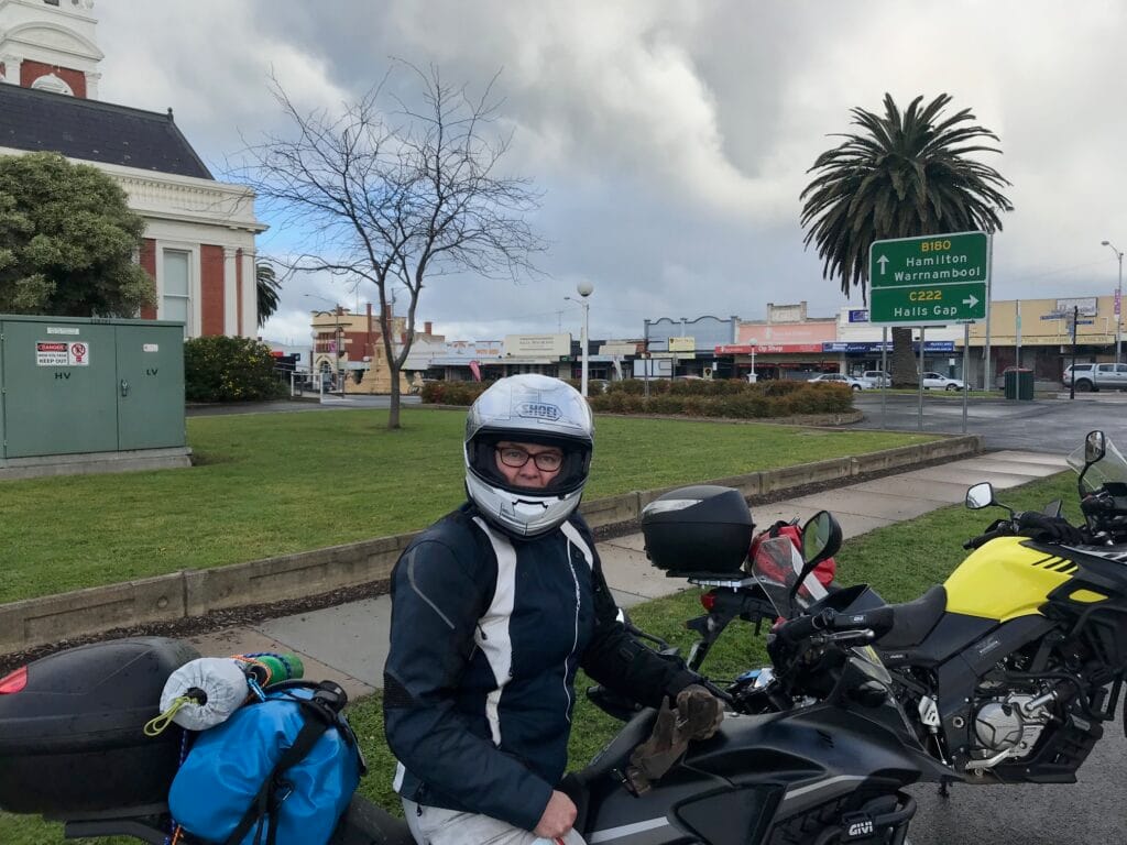
Day 5 – Mildura → Barham
Route: Mildura → Gol Gol (NSW) → Euston → Robinvale → Boundary Bend → Swan Hill → Noorong → Tullakool → Barham
Distance: ~210 km
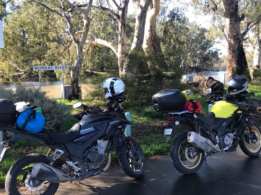
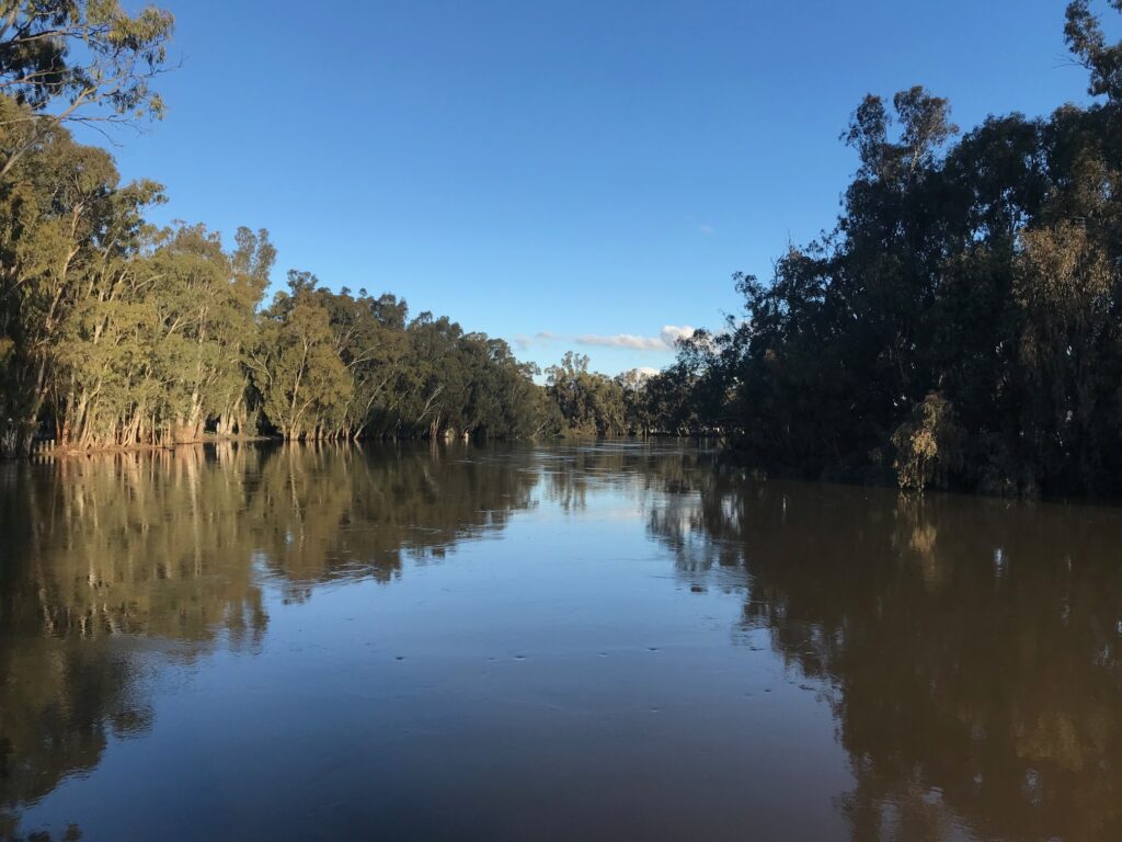
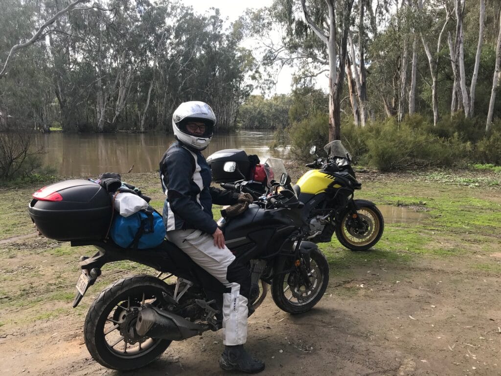
The plan is to follow the Murray River upstream for as much of the day as possible. We weren’t sure exactly how far we’d get — Swan Hill was in mind, as was Barham — depending on weather, road conditions, and how the tracks fared after recent rains.
Riding out of Mildura, we crossed the river into New South Wales and joined the Sturt Highway, following it east until Euston, where we picked up the Murray Valley Highway (B400) and crossed back over the Murray into Robinvale. Breakfast was at Nooy’s Coffee Shop, a friendly stop where we lingered over coffee and pastries while watching a steady stream of buses arriving, full of seasonal workers heading to the surrounding orchards and farms. The scale of agriculture here is immense — endless rows of citrus, vines, and fruit trees. It’s easy to understand why this region is called the fruit bowl of Australia.
From Robinvale, we continued south along the Murray Valley Highway, easily one of the most enjoyable stretches of road we’ve ridden. The highway runs close to the river, framed by wide paddocks and bursts of colour from melon patches and citrus groves. We passed roadside stalls and the odd watermelon or cantaloupe growing wild outside fencelines — a curious sight, considering we were still less than 500 kilometres from Melbourne.
Further south, the Murray widens near Boundary Bend, where the Murrumbidgee River meets it, before we pressed on toward Swan Hill. We arrived around lunchtime and explored briefly, but the town didn’t quite entice us to stop for the night. With the afternoon still young, we decided to continue. Crossing the river again into New South Wales, we took Noorong Road, aiming to cross into Victoria again at Murrabit across an the Gonn Crossing Historic Bridge.
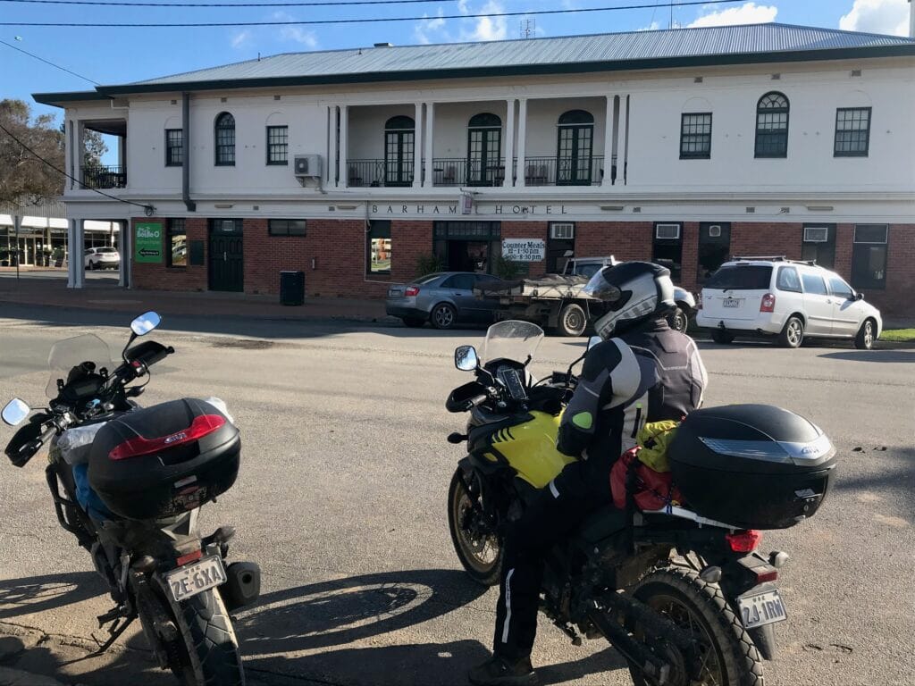
At the junction, however, a sign told the story — “Road Closed – Flood Damage.” Recent rains had washed out the route, forcing another on-the-fly replan. We continued along Noorong Road until reaching Tullakool, then turned south on Moulamein Rd, eventually rolling into Barham by mid-afternoon. We checked into the Barham Bridge Motor Inn, just a short walk from the Barham Hotel, where we enjoyed a relaxed beer in the late afternoon sun before moving across to the Royal Hotel for dinner. It had been a full, scenic day of river roads, border crossings, and the quiet charm of country towns — a reminder of how life and landscape both follow the flow of the Murray
Accommodation, Drinks and Meals
Accommodation: Barham Bridge Motor Inn
Breakfast: Nooy’s Coffee Shop, Robinvale
Drinks: Barham Hotel
Dinner: Royal Hotel, Barham
Highlights
Scenic ride along the Murray Valley Highway through fruit-growing country
Discovering the road closure at Wetuppa and needing to re-route via Noorong and Tullakool – navigation batteries had died, weren’t sure how far we needed to ride 0 but we were getting tied!
Afternoon beers and a relaxed evening in Barham

Day 6 – Barham → Echuca
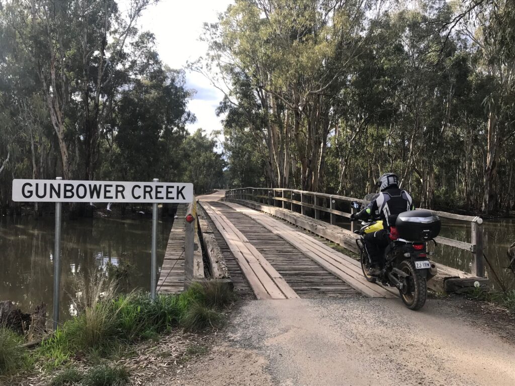
Route: Barham → Koondrook → Gunbower National Park (River Track) → Cohuna → Leitchville → Echuca
Distance: ~110 km (closer to 200 after adventures and backtrack!)
Leaving Barham at a decent hour, we crossed the Murray River into Koondrook for breakfast before setting out on what we hoped would be an adventurous ride through the Gunbower National Park, aiming to reach Echuca via the river tracks.
The morning started promisingly. We followed the River Track, riding between the Murray River and Gunbower Creek, keeping as close to the river as possible. Early on, the track was firm and easy to follow, winding through stands of red gum and over gentle rises. But it quickly became clear that the recent rains had taken their toll — sections of the track were soft, rutted, and washed out in parts. As relatively inexperienced off-road riders, and with tyres not quite suited to the wet clay and sand, progress slowed. After nearly an hour of negotiating puddles and slick surfaces near the Gray Mills site, we decided discretion was the better part of valour and turned back toward the main track
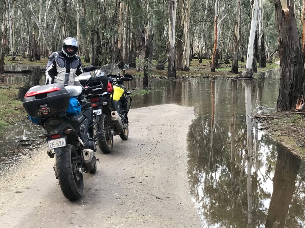
It was during that retreat that we hit our first real mechanical hiccup of the trip — Janette’s chain slipped off her bike, bringing her to a quick stop. Rolling back to help, we saw the chain had loosened enough to simply guide back onto the cogs. After carefully refitting it, we rode slowly out to firmer ground, making our way back toward Koondrook.
Back in town, we found Molin Motorcycle & Marine, whose friendly team not only helped us tighten and adjust the chain but also gave us a quick 101 in on-the-road maintenance, a much-appreciated bit of bush-side education. With bikes fixed and confidence restored, we rejoined the sealed roads, taking the C265 through Cohuna and Leitchville, before following the Murray Valley Highway into Echuca.
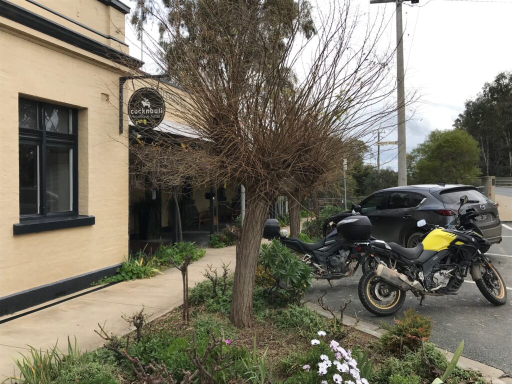
We checked into the CocknBull Boutique Hotel, a lovely spot nestled between the Campaspe River and the Murray, perfect for a relaxed end to the day. Dinner was at the American Hotel Echuca, where good food, local beer, and the easy hum of a busy pub marked a fitting close to a day that had been part adventure, part lesson, and all character.
Accommodation, Drinks and Meals
Accommodation: CocknBull Boutique Hotel, Echuca
Breakfast: Koondrook (local café)
Drinks: American Hotel, Echuca
Dinner: American Hotel, Echuca
Highlights
Attempting the River Track through Gunbower National Park
Quick roadside chain repair and help from Molin Motorcycle & Marine, Koondrook
Finishing the day riverside at the CocknBull Hotel in Echuca
Day 7 – Echuca → Home
Route: Echuca → Nanneella → Rochester → Elmore → Barnadown → Axedale → Lake Eppalock → Redesdale → Kyneton → Hanging Rock → Romsey → Home
Distance: ~300 km
Day seven began without a firm plan. We debated whether to find a stop halfway between Echuca and Melbourne, but with only 300 kilometres to cover, it soon became clear we could make it home comfortably in a single day. The loose idea was to follow the Campaspe River as closely as possible for as long as we could.
Leaving Echuca, we took the C351, turning off toward Nanneella and then Rochester, where we stopped for a quick refuel. From there we followed Burnewang Road, which runs close to the winding Campaspe, passing quiet farmland and red-gum flats that shadow the river’s course.
Near Elmore, we left the highway and switched onto the Elmore–Barnadown Road, continuing to hug the Campaspe’s edge. At Barnadown, we crossed a historic timber bridge beside the Barnadown Steamside Reserve Camping Ground, a reminder of earlier journeys along this same corridor of water. The route then carried us onto the Epsom–Barnadown Road and south along the Axedale–Goornong Road toward Axedale.
Axedale felt familiar — we’ve passed through many times, both on motorcycles and bicycles while riding the Heathcote Rail Trail. The Axedale Tavern, always a tempting stop, marked our transition back into known territory. Continuing south, we skirted Lake Eppalock, looped through Redesdale, and followed the C326 to Kyneton for lunch at a long-time favourite — the Country Cob Bakery.
After lunch we took the back roads home, tracing the Old Calder Highway through Carlshrue and Cadello, passing Hanging Rock, then east through Romsey, and finally turning south toward home.
It was a smooth, steady finish to the trip — no dramas, no mechanicals, just an easy winter ride through the familiar landscapes of central Victoria. A great seven-day journey, finished a day earlier than expected, but rich with experiences — from silo art and salt lakes to Murray mud, Sunraysia produce, and riverside roads all the way home.
Accommodation, Drinks and Meals
Accommodation: Home
Lunch: Country Cob Bakery, Kyneton
Highlights
Following the Campaspe River through central Victoria’s back roads
Crossing the historic bridge at Barnadown Steamside Reserve
Returning home after seven days and 1,300 kilometres of riding
Summary & Reflection
Seven days, just over 1,300 kilometres, and a journey that covered the length of Western Victoria and the Murray River — from the Pyrenees to the Mallee, from the Pink Lakes to the citrus fields of Sunraysia.
This trip had everything that makes motorcycle touring so memorable: unhurried roads, crisp winter air, and that mix of unpredictability that turns a plan into an adventure. From a flat tyre in Melbourne before we’d even begun, to navigating slippery clay in Murray-Sunset and Janette’s chain mishap deep in Gunbower, it was a ride defined as much by its challenges as by its rewards.
The highlights were plentiful — discovering the artistry and pride of the Silo Art Trail, camping under the stars beside the Pink Lakes, the indulgence of Stefano’s in Mildura, and the simple joy of crossing back and forth across the Murray, tracing its bends through small, timeless towns.
More than anything, it was a reminder of how close true adventure sits to home — long stretches of quiet highway, small-town bakeries, the warmth of a country pub fire, and the steady rhythm of two bikes rolling through the heart of regional Victoria.
Another great ride in the books — one that connected the silos, the sunsets, and the rivers that make up the quiet soul of the state’s west.
Leave a Reply